Photo: @hatchetthejeep
It may seem obvious to drive, run, walk, hike or ride in the Eastern Sierra. But do you know how much land there is to cover and how many ways there are to do it?
Here’s an overview of the region to give you a sense of how much adventure awaits you in and around Bishop.
WHERE
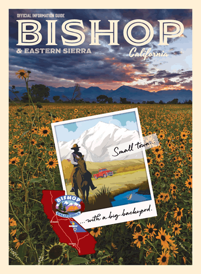
The Eastern Sierra
Broadly speaking it is a region of eastern California that covers a vast area on the east side of the Sierra Nevada mountain range. It is a sparsely populated, high desert region that spreads across two counties, incorporates only a handful of towns, and has lots and lots of open and accessible terrain. The topography and geography of the region encompasses the deep Owens Valley, the tall and rugged Sierra Nevada to the west, the gentle giants of the White and Inyo mountains to the east, and the magnificent Mono Basin on the northern plateau. US Highway 395 is the main thoroughfare that takes travelers through this beautiful region that stretches from Lone Pine in the south to Bridgeport in the north.
Bishop is located pretty much right in the middle of the Eastern Sierra at the northern end of the Owens Valley in Inyo County.
Inyo County and The Owens Valley
Inyo County has a total land area of about 10,200 square miles and a population of just over 18,500 persons (according to Census 2010). All, but about 1,000 Inyo County residents, live in the Owens Valley, which covers an area of about 3,330 square miles. Even so it remains one of the least populated regions in the country with a population density of 5.25 persons per square mile. Ranked by population density it falls between lowest ranked state, Alaska, with just 1.3 people per square mile, and the wide-open spaces of Wyoming that has an average of 6 people per square mile. All that means … there’s a lot of space to explore in the Owens Valley.
The Owens Valley is considered one of the deepest valleys in the United States. It’s about 100 miles long by 6 to 18 miles wide. The Owens River is a verdant, riparian area that weaves its way along the valley floor, which sits at about 4,000 feet above sea level (ASL). The open fields of the valley and foothills are covered in wildflowers every spring and the canyons higher up are bathed in fall colors every autumn. The mountains rise suddenly and dramatically on both sides with peaks reaching over 14,000 feet ASL.
Sierra Nevada
This mountain range is long (400 miles north to south), wide (70 miles east to west), tall (numerous peaks above 10,000 feet and some over 14,000 feet) and immensely rugged. It boasts the highest peak in the contiguous United States, Mt. Whitney, at 14,505 feet above sea level. Climbing this mountain is an adventure that people come from all over the world to accomplish. And two of the world’s greatest hiking trails, the Pacific Crest and John Muir trails, are easily accessed from the Eastern Sierra. The range is wild and craggy, and conditions can be harsh at times. It requires experience and planning to venture into the heart of the wilderness. But the foothills and outer edges of the range provide opportunities for all kinds of exploration.

View of the Sierra Nevada from the White Mountains
White and Inyo Mountains
These gentle giants to our east cover about 130 miles together from north to south. The narrow tip of the Whites rises to just over 13,000 feet at Boundary Peak like the prow of a ship sailing north. A little south of that and just northeast of Bishop is White Mountain Peak. At 14,252 feet, it is the highest peak in Mono County, the third highest peak in California after Mt. Whitney and Mt. Williamson, and the 14th most topographically prominent peak in the contiguous United States.
Further south the range expands to about 20 miles wide where it meets its counterpart, the Inyo Mountains. These two ranges form part of one giant fault block separated by a narrow gap through which State Route 168 runs, just east of the community of Big Pine. From this road it’s an easy drive to visit the planet’s oldest living things, the Ancient Bristlecone Pines, which live at 10,000 feet near White Mountain Peak.
The highest peak in the Inyos is Waucoba Mountain at 11,128 feet above sea level. From there the range narrows and descends to the high desert floor that sits at 4,800 feet. It is at this point that travelers have access, along State Route 190, to the lowest point in the contiguous United States, Badwater Basin (at 282 feet below sea level) in Death Valley.
We have a lot of significant stuff here.
This is the eastside. The other side of California. The wild side of California.
WHAT
Whatever moves you – and we mean that literally – there’s a place for it here.
On Four Wheels
There are excellent roads, with light traffic and magnificent views, for a family road trip. Take an afternoon drive up Bishop Creek Canyon and visit the sparkling blue lakes and alpine forests. There are wonderful campgrounds, streams for fishing, lakes for swimming, boating, and paddling, cafés and resorts for fine food and drink, and trailhead access to explore more on foot. Go for a drive up to the Ancient Bristlecone Pine forest and learn about the history of these trees and what they’re teaching us about the history of our planet. The Sierra View Overlook on White Mountain Road is an awesome vista over the valley and across to the Sierra Nevada.
A longer trip loops around the tablelands or up past Mono Lake. From Bishop head north to Benton on US Highway 6. Then take SR 120 west and cut across the Benton Crossing road to Crowley Lake, or stay on 120 to loop past Mono Lake. Head back to Bishop south on US 395. There are all kinds of great sights to see along the way.
Got a 4 wheel drive off-highway vehicle? Bring it!
A legal system of roads and trails for motorized vehicles was designated here in 2009 following many years of inventory and analysis. Now an extensive network of 2,200 miles of off highway vehicle (OHV) trails and roads provides access through almost one million acres of the Inyo National Forest. In less than 30 minutes’ drive from Bishop there are many excellent routes that will take you up into the mountains where the air is cool and the scenery spectacular. The rugged terrain is a superb test for driver and vehicle.
Get the low down on the high up Coyote Flat 4×4 track for a really rugged OHV adventure. Or take it up to Papoose Flat for a little rock crawling and a look at a landscape that looks like a moonscape. Both these routes will take you to overlooks where you’ll have a bird’s eye view of the Owens Valley below – one from the west and one from the east.
On Two Wheels
Of these legal OHV routes most are double-track, native surface roads, but at the base of the White Mountains, 5 miles east of the center of Bishop, is an exceptional off-road motorcycling and all-terrain vehicle (ATV) area. Whereas most of the larger network requires that drivers keep their vehicles on designated roads, the Poleta Open Area, is approved for cross-country and open motorized vehicle travel. In addition to this system, many of these routes link to adjacent routes managed by the Bureau of Land Management (BLM).
The Eastside is a fantastic area for a motorcycle road trip. There are long stretches of quiet roads with sweeping vistas for easy cruising, and many twisting, turning mountain roads for a nimble sport bike, tourer, dual sport or cruiser. The road surface on these routes is excellent and the curves will keep your mind focused and your adrenalin flowing.
Is a bicycle your favorite two-wheeler? We have roads and trails for you!

Mountain Biking on Lower Rock Creek trail in Fall.
Road cycling on the Eastside is second to none. We think so. You can ride easy or train hard for hundreds of miles along roads that carry a very low volume of traffic. Practice your hill climbing or downhill cornering, go flat out sprinting or find your rhythm for the long haul. We have roads on lower, level ground where it’s warm in winter or up at altitude where it’s cool and green in summer. There really is no end to the roads you can ride. Join our local cycle club, Eastside Velo Cycling Club, and participate in some of the best road bike rides around.
And we have mountains. So we have mountain biking. Some of the best trails in the country. You can spend as little as a couple of hours or as long as … well, a lifetime … and experience mountain biking that is fun and family-friendly, and challenging and thrilling. There’s always somewhere to ride a bike down a sweeping, technical trail or out across a high desert landscape, where there’s always one thing that will surely take your breath away – the view!
On Foot
Hike, run, walk, ski, snowboard or snowshoe. Not all at the same time of course, but pick your season and move yourself through these mountains, over meadows, across streams, and down canyons on foot. In fact, you can move yourself over boulders and up cliff faces with hands and fingers too. Bouldering and rock climbing is world class and the options are almost limitless.

Hiking in the Sierra Nevada. Summer. Wildflowers. Dogs. Love!
Many trails are multi-use but the higher up you go the more suited they are for foot travel. Once you’re into the wilderness, where vehicular travel is prohibited, you’ll be in wild, wonderful territory where you will be moved – even when you’re standing still.
Lots of great trailheads are easily accessible by car. Within a 20-minute drive from Bishop you can be standing at a trailhead garbed and geared for a run, hike, walk, boulder circuit or snow tour.
On Horseback
Roads, tracks and trails, even in the wilderness, are open to horseback riding. There’s muleback too. Load your horse trailer or book a mule pack trip and experience the Eastern Sierra the way it was – way back when. It’s all still here just like it was then. You just need to get in the saddle and let the beast of burden carry your body forward and thoughts back to history.
One of the loveliest areas for an equestrian campout is up in the High Sierra at the aptly named Horseshoe Meadow Equestrian Campground. This is where you can bring your own equines, beat the heat of summer, and experience a high-altitude camp-and-ride experience that is unequalled.
WHEN
This land is a land of changes. The landscape goes from low to high and from arid to alpine. The temperatures fluctuate with the time of day and the changing of the seasons. Water flows relentlessly down the mountains and the floral carpet and leafy canopy change colors as the seasons change. Sometimes the wind blows and always the snow falls in winter.
Choose your mode, choose your season and choose your region. Summertime it’s best to go high and wintertime is best down low. Timing in spring and fall is somewhat unpredictable, but no matter when you visit or what you want to do … somewhere nearby, there’s a road or track or trail or route that’s doable.
HOW
We encourage everyone, and especially folks with disabilities, to come and see what you can do in the Eastern Sierra. Here’s a blog from earlier this year that has tons of great information on wheelchair accessible places in our area.
Please treat our big backyard as nicely as you’d treat yours. Pack out everything you pack in and, if you can, take an extra trash bag with you and pick up and pack out any littler left behind by others. Please stay on designated trails and don’t park on top of bushes. Remember this fun phrase and teach it to your kids, “Don’t crush the brush.”
Come in, call, or email us at the Bishop Visitor Center and ask about the experiences and adventures you can have in our big backyard. We really do have a vast and most exquisite backyard. There is so much land where you can play and explore and it’s best to visit often and try it all.
Read about Bishop by Air and Bishop by the Water too.
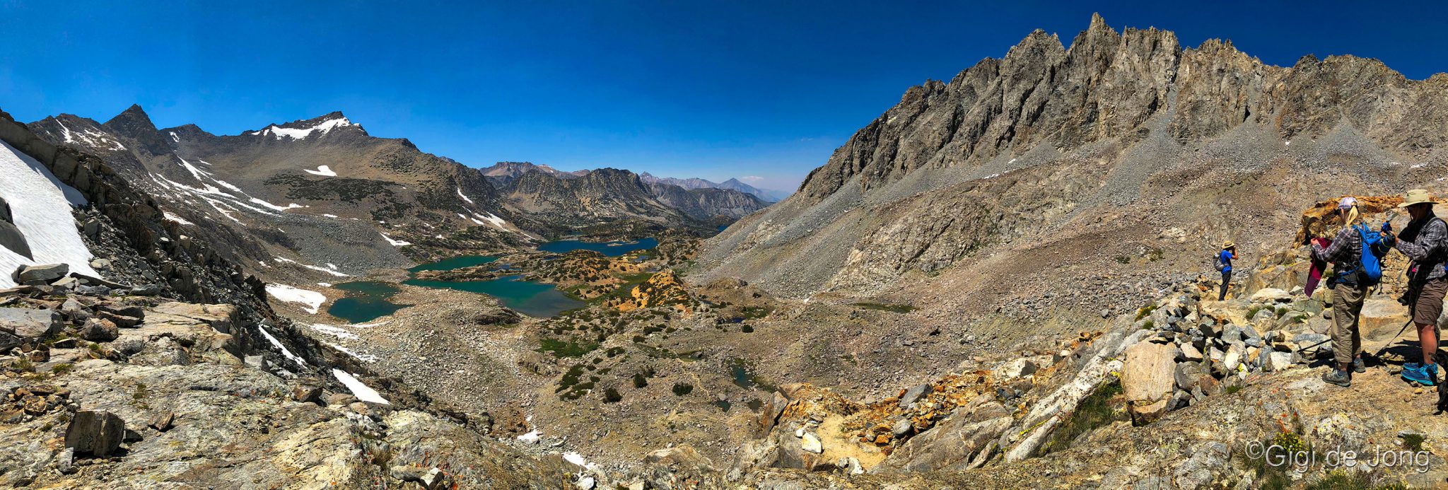
Looking down from near the top of Bishop Pass trail.