Road Trip US Highway 395 to Bishop – the small town with the big backyard
Oddities of nature and the stuff of human ingenuity and absurdity exist here in the Eastern Sierra just as they do the world over. The fascinating history of these weird and wonderful things is as incredible as the objects and attractions themselves. We find ourselves looking at these mysterious manmade and naturally occurring phenomena and wondering, “When? How? Why?”
The Eastern Sierra is often referred to as “the other side of California,” and these places might also make it “the weird side of California.” Pick your path along US Highway 395, from Los Angeles to Bishop and little beyond, where you will see some of the most curious, grotesque, mysterious and awe-inspiring features of nature and feats of humankind.
Even Great in Winter
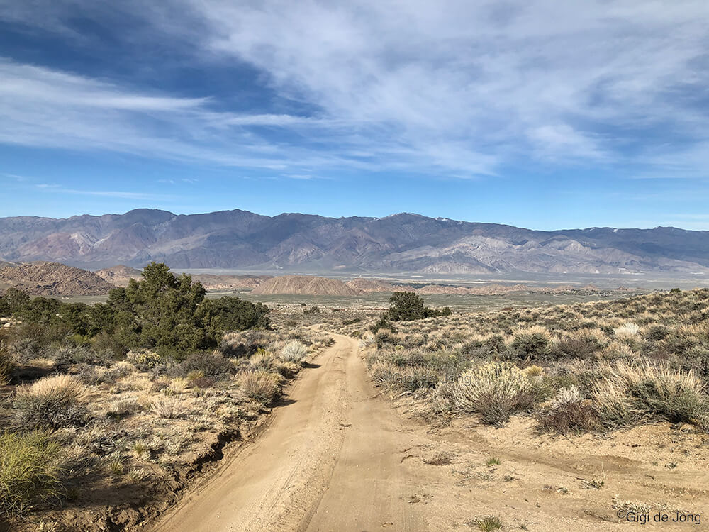
While the Sierra Nevada and White Mountains are blanketed in snow during winter, traveling to Bishop from southern California on Highway 395 is generally straightforward. The road follows the valley floor, which sits in the high desert, making winter driving not only possible but enjoyable.
If you are coming from farther away, Bishop’s winter air service makes travel even easier. You can fly directly into the area, rent a car, and start your Highway 395 adventure without missing a beat.
The Story of US Highway 395
US Highway 395 stretches 632 miles from Hesperia, California, to New Pine Creek at the Oregon state line. It begins at the junction with I-15 in Hesperia and passes through the Mojave Desert, the driest desert in North America.
The highway then enters the Owens Valley, which sits 4,500 feet above sea level. It is flanked by two mountain ranges. To the west, the Sierra Nevada offers scenic outdoor adventures, including Bishop Creek Canyon. To the east, the White and Inyo Mountains are home to the oldest living organisms on Earth, the Ancient Bristlecone Pines.
Between these ranges, Owens Valley is considered the deepest valley in the United States. Peaks on both sides rise above 14,000 feet.
Just beyond Bishop the road begins to climb alongside the Sierra Nevada, with a steep rise over Sherwin summit. Beyond Mono Lake it reaches its highest point at 8,138 feet in altitude at Conway Summit in Mono County. The road passes four summits on its journey northward then at Topaz Lake it dips into Nevada for 87 miles. After one final summit pass, Simee Dimeh Summit, the road exits the mountains and follows the receding escarpment of the Sierra and into the urban areas of Carson City, Reno and Sparks.
Returning to California US Highway 395 runs through Sierra, Lassen and Modoc Counties, serving the towns of Susanville, Ravendale, Termo, Madeline and Likely. At New Pine Creek, CA alongside the eastern shore of Goose Lake. Here it enters Oregon and continues its journey north for another 673 miles to the Canadian border. The entire length of US Highway 395 is 1,305 miles.
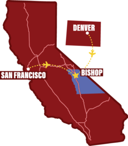
Hotspot map of US-395 Road Trip
Click on the map to download and print for reference about this road trip.

Pick Your Path
We begin our road trip from the northern edge of the Los Angeles basin.
From the start of US-395 in Hesperia, it’s a mere 88 miles to our first weird attraction. From the western side of the basin where I-5 meets CA-14, in the San Fernando pass, it’s only 109 miles to the first stop on our wonderful journey. CA‑14 soon meets up with US-395, and it is here in the vast expanse of the Mojave Desert where your journey of discovery really begins.
Some of these attractions require 4-wheel drive and high-clearance vehicles and good OHV driving skills. Some also include a bit of hiking to access the feature. Others have easy access on paved roads, with services at or nearby the attraction, such as: food, restrooms, gas, lodging, and visitor information where you can learn more details about the feature.
Review the map above and choose the ones that really fascinate you and your group. Read the description and see an image of each of these wondrous features below. Make sure you have the right vehicle, gear, and enough time for your intended destinations. Then pick your path!
Best of all—next time you can pick a completely different path and explore more.
Burro Schmidt Tunnel
Location: 163 miles south of Bishop off the Redrock Randsburg Rd near Garlock.

One man, two donkeys, a few hand tools, a wheelbarrow, and some explosives. With these, William “Burro” Schmidt spent more than 33 years digging a tunnel nearly half a mile long through solid rock in Copper Mountain, deep in the remote Mojave Desert of California. He never fully explained his project, only saying it was a “short cut.”
Schmidt had moved to California from Rhode Island for his health and staked a mining claim in the El Paso Range of the Mojave Desert. At the time, transporting ore from his claim to the smelter in Mojave meant navigating a perilous mountain trail. Schmidt reportedly said he would never haul his ore “down that back trail” with his two burros.
He became obsessed with digging the tunnel and largely ignored mining, even after discovering rich veins of gold, silver, copper, and iron during the excavation. The tunnel, however, emerged on a high ridge well above the desert floor. Today it is called the “short cut to nowhere,” as Schmidt never transported a single ounce of ore through it.
The tunnel remains intact. Schmidt had no formal training, yet he learned quickly from trial and error. The skills he gained, often through mishaps and injuries, resulted in a feat of precise and remarkable engineering.
Today, the tunnel, Schmidt’s cabin, and the surrounding land are managed by the Bureau of Land Management. Visitors can reach the site by road, walk through the tunnel, and enjoy commanding views of Saltdale on the other side.
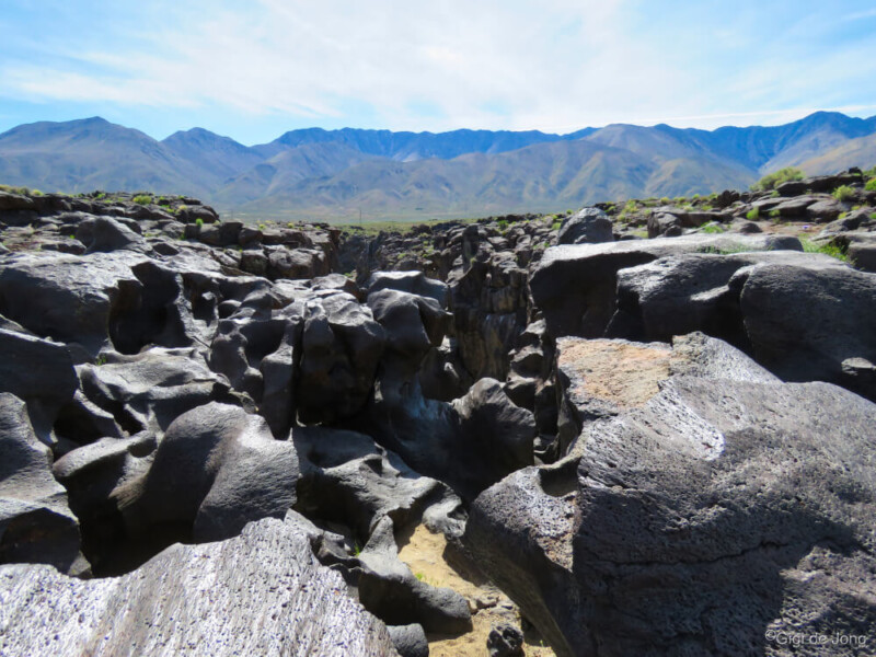
Fossil Falls
Location: 104 miles south of Bishop near Little Lake
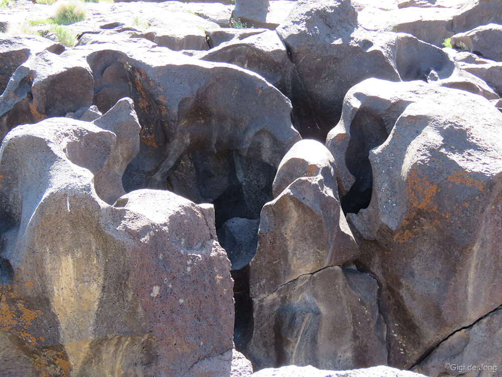
This geological wonder is a magnificent example of the forces of nature that shape our world. Technically it’s not a fossil and water no longer falls here in any abundance. This surreal canyon of basaltic black lava rock is now a natural work of art beautifully sculpted by eons of rushing water from a prehistoric age.
The chasm is almost unnoticeable in the flat lands of the valley floor until you get quite near to it, then it unfurls below you in folds of glossy, black rock that is both beautiful and strange. The rock is smooth and shiny and distinctly different from the surrounding landscape. It is stark evidence of a time when the valley was wetter, and of the inevitability of change.
Early inhabitants lived along the banks of this ancient river, where artifacts and rock art indicate a viable hunter-gatherer culture existed here some 10,000 to 20,000 years ago.
A trip to Fossil Falls is less than a mile off Highway 395 where a few minutes, a couple of hours, or an overnight camping trip will expand your view and understanding of this remarkable valley.
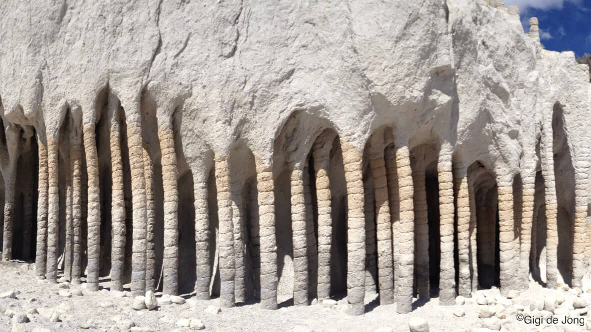
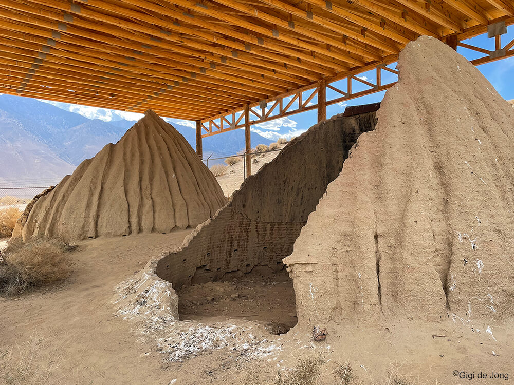
Charcoal Kilns
Location: 73 miles south of Bishop adjacent to the Owens Dry Lake
This is another testament to human ingenuity. It may not seem as outlandish as some of the others on this list, but it remains truly remarkable.
High in the Inyo Mountains of the Eastern Sierra, Cerro Gordo thrived as a silver and lead mine. In just ten years, from the 1860s to the 1870s, miners shipped about $20 million worth of silver and lead bullion from Cerro Gordo. It holds the distinction of being the most successful silver and lead mine in California history.
Soon after the mine opened, workers stripped the nearby mountains of lumber. Smelters urgently needed quality fuel, so miners built charcoal kilns to convert wood into charcoal. This charcoal was essential for smelting and purifying the precious metals into ingots.
The logistics of Cerro Gordo were challenging but manageable. Miners built kilns along the lake shores and Cottonwood Creek, where wood and water were plentiful. Good fireclay was also present. Unlike most kilns of the era, made from brick or stone, these kilns used clay bricks and plaster.
Cottonwood trees were cut, ‘cooked,’ and transported across the lake on steamboats to the town of Keeler. From there, horses and mules hauled the charcoal up the mountain to the smelters at Cerro Gordo. The valuable bullion was brought back down the mountain and ferried across the lake on the same steamboats, the Bessie Brady and Mollie Stevens, to Cartago for shipment onward to Los Angeles.
The Cottonwood Charcoal Kilns: A Window Into History
Where Highway 395 runs west of the old shoreline of the now dry Owens Lake, is a dirt road leading to the historical landmark that is the Cottonwood Charcoal Kilns. These 25-foot wide structures are an eerie reminder of an economic and environmental era that is now vastly different in the region.
Tuttle Creek Ashram
Location: 63 miles south of Bishop, near Whitney Portal (and 1.6 miles of rough 4×4 track and a fairly strenuous 3.5 mile roundtrip hike up into Tuttle Creek Canyon)
The mountains have long been spiritual destinations for those seeking solitude and enlightenment. Many have climbed lofty peaks to feel closer to the heavens or to view the world from an almost otherworldly perspective.
Buddhist monasteries perch high in the mountains of China. Temples dot the foothills and ice-covered peaks of the Himalayas. In the United States, the Sierra Nevada offers one such spiritual destination.
The Tuttle Creek Ashram sits high in the mountains above Lone Pine, at 8,000 feet above sea level. In 1930, Franklin Wolff and his wife Sherifa—both philosophers, mystics, and writers—began building a 2,000-square-foot stone structure. Its design forms a balanced cross, symbolizing the principles of equilibrium.
Over the years, the ashram has faced vandalism, near abandonment, and even a near-demolition. It has since been recognized as historically significant and nominated for the National Register of Historic Places. Today, it is managed by the US Forest Service.
The ashram’s location was carefully chosen near Mt. Whitney, the highest point in the contiguous United States. The couple believed a country’s spiritual center could be found near its highest elevation.
Coyote Teeth Dentures
Location: 42 miles south of Bishop at the Eastern California Museum in Independence

What would you do if you were living a meager life in the early 1900s in a remote mountain community and had lost all your teeth? Perhaps you’d count your pennies and go see a local dentist. Perhaps the closest dentist is in a town far away and you can’t afford the time or expense.
A gruesome artifact, now on display in the Eastern California Museum in Independence, seems to tell the story of a man who, in about 1930, found himself in this predicament. What he did is not just grotesque, but rather ironic as well.
He fashioned a set of dentures from the teeth of a dead coyote!
He made the now famous Coyote Dentures by melting celluloid from toothbrush handles, molding the mixture to the shape of his gums, then pressing the yellowed coyote teeth into the cast.
Perhaps he wasn’t poor just miserly, but he definitely was macabre.
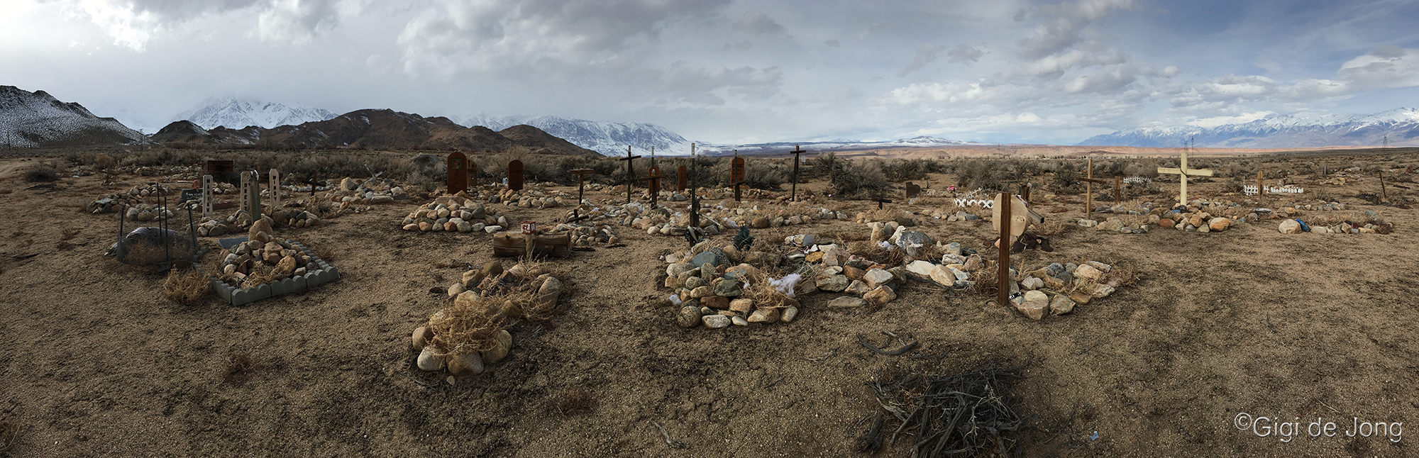
Two-Headed Lamb
Location: 6 miles north of Bishop on US Highway 6 at Laws Railroad Museum
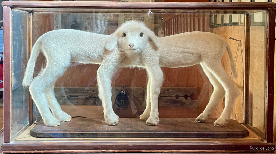
The birth of Siamese twins to farm animals is not exceptionally rare, but it is always rather shocking.
Sometime around 1940, on a local farm northwest of Bishop, Siamese twin lambs were born. The conjoined twins were born joined at the neck and, although they are known as “the two-headed lamb” or “the two-faced lamb,” they each actually have a complete body too.
According to the daughter of Clifford Jones, who lived on the farm since a child, the lambs lived for a short time and after their death he stuffed the lambs for posterity. They are now on display at Laws Railroad Museum along with a multitude of other intriguing artifacts of the weird and wild west.
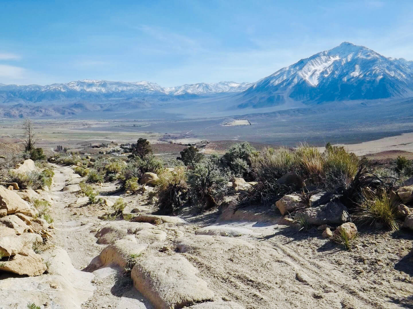
Gravity Hill
Location: 7 miles west of Bishop on Bishop Creek Rd, just off West Highway 168 (West Line St.)