FAQ
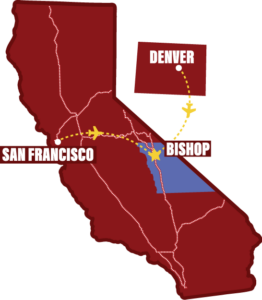
Bishop is located along U.S. Highway 395 in the heart of the Eastern Sierra. It’s 268-miles from Los Angeles, about a 4.5-hour drive, and 200-miles from Reno, about 3.5-hours, along this scenic highway. The drive from San Francisco is about 6-hours in summer, about 290-miles, and possibly 7-hours in winter due to snow closures. From Las Vegas, 266-miles, it’s about a 4-hour drive.
Coordinates of Bishop, CA: 37.3614° N, 118.3952° W
United Airlines commercial service offers seasonal flights from San Francisco and Denver.
Bishop Airport (BIH) is located 2 miles east of downtown Bishop.
The area enjoys good recreational weather year-round. The climate in Bishop is dry, averaging about five inches of precipitation per year. We do have lots of water in lakes and streams thanks to runoff from the High Sierra snowpack. Bishop is one of the sunniest locations in the west and enjoys four distinct seasons. While summer days are quite warm on the valley floor, the evenings cool off nicely. Winter days are sunny and mild.
The Eastern Sierra Tour is a free road trip! It’s the top 10 must-see spots linked together to create an epic road trip through the Eastern Sierra. (Some stops do have entrance fees.) It is a linear route, spanning over 555-miles, from Death Valley at 282-feet below sea level to the towering peaks of Tioga Pass at 9,943-feet above sea level. It’s the highest, lowest, hottest, oldest, saltiest, rockiest, earliest, purest, strangest, loneliest and wildest 555-mile road trip in America.
Find out more information about the Eastern Sierra Tour here.
There are many, many camping opportunities in and around the Bishop area. The area offers campsites on public lands administered by the U.S. Forest Service and the BLM. Private and Inyo County campgrounds are also available.
Tioga Pass (SR-120) across the Sierra Nevada from US-395 into Yosemite National Park closes each year due to the tremendous snow accumulation the area receives each winter and spring. The highway on average closes in late October and remains closed through late spring and sometimes even into early summer.
Fall colors in the Eastern Sierra offer visitors a two-month window each fall to enjoy the diversity of stunning colors. The foliage begins to change colors in early September at the higher elevations and lasts through late October in the lower elevations in Bishop. Our Fall Color Guide has complete visitor information on where leaf peepers should go!
Also visit californiafallcolor.com for more information, pictures, and a calendar guide to when colors are changing throughout California.
The Eastern High Sierra offers some of the best Trout fishing in the West. From the high mountain lakes of Bishop Creek to the gently flowing Lower Owens River, Bishop offers a very special opportunity for all level of anglers. Our page on fishing the Bishop area has more details and locations including fishing reports and more!
The Bishop area offers a comfortable variety of lodging for visitors to the area. If you are looking for a good, clean economically priced room, or rooms to spread out among well-appointed surroundings, we have the right place for you.
Bishop is the perfect midway base to explore these two famous National Parks. Although seemingly worlds apart in geography, ecology and climate, they are only about 300-miles of driving distance apart, and Bishop is about halfway between the two. Visit the Bishop Information Center in downtown Bishop, at 218 S. Main St., where our friendly, knowledgeable hosts can provide maps and literature about the parks and help you plan a trip to each of these great parks. Death Valley is best during late fall, winter, and early spring—summer in the park is very hot. Yosemite is best during late spring, summer, and early fall—in winter Tioga Pass into Yosemite is closed. A multi-day road trip from one to the other is possible in spring or fall.
Look at this blog post about Bishop being halfway between these parks.
Be sure to check road conditions and weather before traveling.
Vast public lands immediately surrounding the Bishop area offer some of the best off-highway opportunities in the West with major trails like Coyote Flat, Silver Canyon and Sand Canyon leading to hidden lakes, streams, campsites and beautiful scenery. Whether you are in your 4×4 truck, Jeep, SUV or on an ATV or motorcycle, the important thing is to stay on existing dirt roads and trails and not to drive or ride cross country. Stop in the Bishop Information Center, 218 S. Main St. and chat with our friendly, knowledgeable hosts.
Download a copy of this guide, Backroad Tours in the Eastern Sierra, here.
The Buttermilks, Happy and Sad Boulders, Druid Stones, Pollen Grains and many other world-class bouldering opportunities exist for all skill levels. For more information on bouldering in Bishop, follow this link to your gateway to bouldering adventure.
We’ve created a big library of interactive maps that tell the stories about Bishop, our big backyard, and all the wonderful things there are to see and do here. Explore our collections that cover the Seasons, Experiences, Itineraries, and Road Trips. You can browse the entire library here, and check back often as we keep creating and adding StoryMaps.
Come into the Bishop Information Center in downtown Bishop at 218 S. Main St., adjacent to the lovely Bishop City Park. Our hosts have years of experience and a wealth of information—way more than we can convey on this page. And we have shelves full of books, brochures, maps and more to inspire you. Come share your Eastern Sierra dreams and desires and we’ll help you pick your perfect path.
 Flip through the pages now of the Bishop Visitor Guide!
Useful Information
Here is some important information and frequently asked questions for when you are preparing for your trip.
Emergency Number
911 is the US Emergency Number and must be used ONLY in an emergency.
Hospitals
Northern Inyo Hospital is and the Bishop Chamber of Commerce has listings of all medical, dental, vision and pharmacy locations here.
Yosemite
Is the road (Tioga Pass SR-120) open to Yosemite? Do you currently need a reservation to visit/drive through?
Camping
Click here for complete campground information and details.
Accessibility
Learn more about visiting and accessibility here.
Tourist Office
The Bishop Information Center is located at 218 S. Main St..
See Bishop Live Now
Check out the webcams and road conditions page for what’s happening now.
Recreate Responsibly
Some great advice for all outdoor enthusiasts. If you want, sign Bishop’s Big Backyard Pledge.
Death Valley
Is the road to Death Valley open? Check the Park’s Alerts & Conditions page.
Transportation
Public Transportation is offered by ESTA. Car Rentals are EXTREMELY limited. Be sure to make reservations in advance.
Road Information
911 is the US Emergency Number and must be used ONLY in an emergency.
Travelers Guide
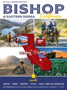
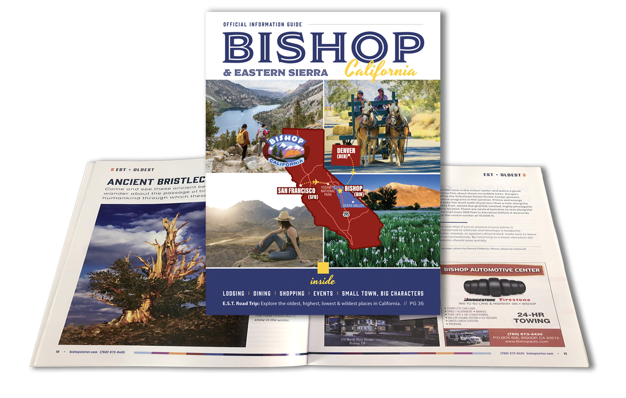
We offer a digital brochure and printed Bishop Information Guide.