Chocolate Peak

Distance / Elevation: 7 miles / 2000 feet / Clockwise Lollipop
Start GPS Coordinates: 37°10’09.2″N 118°33’57.7″W
Directions to Trailhead: Take 168 W Line Street from Bishop. After 15 miles, turn left onto South Lake Road. Follow this for 7 miles to reach a large parking lot and the trailhead at the end of the road. There are toilet facilities at the trailhead.
Difficulty: Medium. The trail has steady, but mostly runnable gain through the Chocolate Lakes. It is a bit steeper and rockier for the out and back up to the summit.
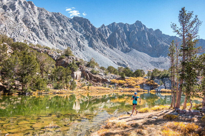
Views: The lakes really steal the show. South Lake to start, and then Bull, Chocolate, Ruwau, and Long Lakes along the loop. Chocolate Peak itself is a sight with its unusual chocolatey-brown color surrounded by the more typical gray granite. From the top you’ve got a fantastic view of Cloudripper, Picture Puzzle, Mount Goode, Hurd Peak, and down on all those lakes.
At the South Lake Trailhead, you’ve already gained some elevation and access to the Sierra. It’s a special thing to be able to reach a peak in a short run in the Sierra, and even more so to loop the peak too. Many peak bags require much longer approaches and usually are run out and back.
Starting on the popular Bishop Pass Trail, you’ll follow along the main flow of hikers, runners, and fishermen through yellow aspen. Take the left fork sign posted for Chocolate Lakes about 2 miles in. First you’ll reach Bull Lake where Chocolate Peak rises into view, and recognize its chocolatey brown point. Passing around the north side of the lake, your next aims are the Chocolate Lakes. Now halfway around Chocolate Peak, on the saddle before descending towards the large, glistening Ruwau Lake below, you can cut right, following use-trail and occasional cairns to the top of Chocolate Peak.
Enjoy the view and eat a piece of chocolate that you’ve packed along as a treat while you skim through and sign the summit register. It’s full of excitement from many hikers as their first Sierra summit.
Retrace your way down from the peak back to the trail that loops around the peak, and skip down a few steps to meet Long Lake. Running the length of Long Lake, you’ll meet the split you took to Bull Lake, 5.25 miles into the run. Now you know the way back to the start, and it is even more fun downhill. To learn more, visit @sierratrailruns
Photos by PatitucciPhoto
Written by:
Dan Patitucci
PatitucciPhoto is a team of three photographers and athletes, Dan & Janine Patitucci, and Kim Strom. Their commercial & editorial work has appeared around the world for countless ad campaigns, magazine stories, and communication for the outdoor industry’s leading brands. In 2021, along with Hjördis Rickert, the four produced Sierra Trail Runs : A Guide to the Eastside, a guidebook and online resource to trail running in the Eastern Sierra. You can follow them at @sierratrailruns

