A Motor Tour Guide of Round Valley CA
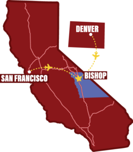
I had the distinct pleasure of doing a motor tour with Joe Pollini of the Bishop Visitor Information Center a couple of weeks ago. We started in Bishop, at the Visitor Center next to Bishop City Park, made our way up West Line Street to Buttermilk Road, then backtracked a bit to Ed Powers Road and out to Round Valley. We included just a couple of brief side trips up Pine Creek Canyon and on the Owens River Gorge Road before heading back to town on the highway.
This is a tour you can easily do in a morning or an afternoon. We recommend stopping by one of our friendly coffee houses for you favorite beverage before heading out on this pleasant loop, and it never hurts to throw a pair of sturdy shoes in the car in case you decide to explore a little more on foot.
From Battlegrounds to Boulders: Exploring Bishop’s Wild West
From U.S. 395 (Main Street) in Bishop, head west on Line Street. As you leave the main part of town, you’ll spot Manor Market on your left, followed shortly by Cerro Coso Community College, also on the left. Just past the college, keep an eye out for a large mosaic historical landmark on the same side.
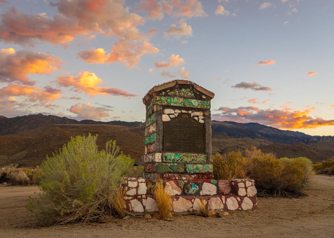
This monument marks the Bishop Creek Battleground, a site of conflict between the region’s original inhabitants, the Paiute and Shoshone tribes, and early settlers. From here, you can look back across the valley and the city of Bishop. To the west, you will see the road climbing toward Bishop Creek Canyon and the towering Sierra Nevada mountains.
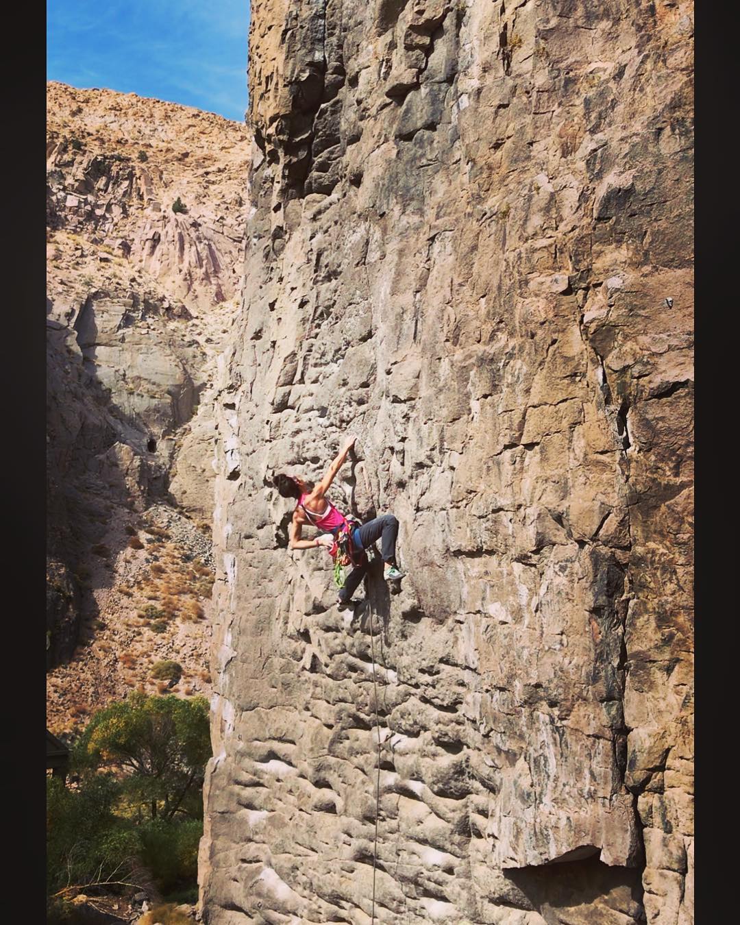
Continue heading west and keep an eye out for Buttermilk Road on your right. This is the gateway to Buttermilk Country, a legendary spot known for world class bouldering and its vast outdoor playground. Turn onto the road, pull over safely, and take a moment to soak in the stunning views.
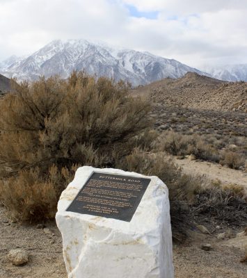
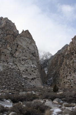
Facing the Sierra, Basin Mountain will be to your left, Mt. Tom to your right, and just behind Basin sits Mt. Humphreys. You’ll also have a clear view of Horton Canyon, a place you may want to return to in summer for the hike to Horton Lakes.
At the base of the mountains, roughly due north of your vantage point, lie the Tungsten Hills. Now a favorite spot for horseback riding, trail running, mountain biking, and off-road vehicles, the hills were once home to thriving tungsten mines from 1910 to 1915.
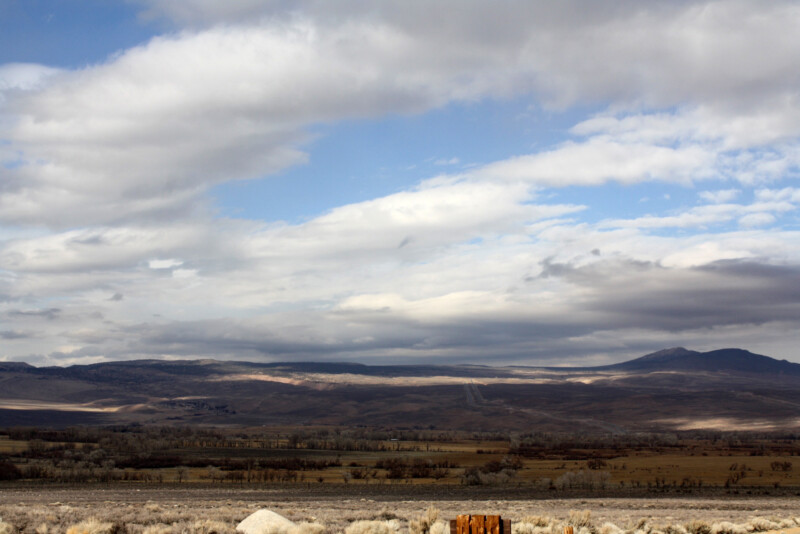
Look northeast and you’ll see the Volcanic Tablelands and the striking Chalk Bluffs. These formations are made of Bishop Tuff, the result of a massive volcanic eruption around 760,000 years ago when the Long Valley Caldera exploded, reshaping the landscape.
Sawmill Road: A Journey Through Time and Terrain
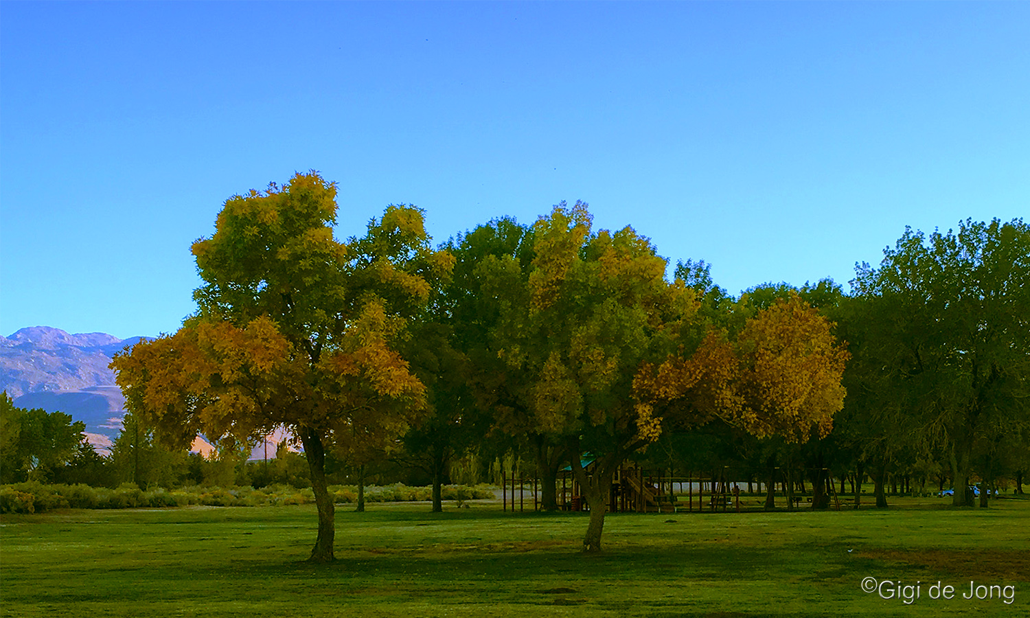
When you’re ready, head back east on Line Street to Ed Powers Road and turn left. Follow Ed Powers almost all the way to U.S. 395, then turn left onto Millpond Road. Continue past the Millpond Equestrian Center and Millpond Recreation Area, then make another left onto Sawmill Road. The road is named after the old sawmill that once supplied lumber to the nearby mines. That sawmill used to sit where the Millpond Recreation Area is now.
As Sawmill Road winds through Round Valley, keep your eyes peeled. This area is a great place to spot Mule Deer in the winter when the herd migrates down from the mountains. We recommend making a stop at Horton Creek Campground. Step out of the car, take in the views, and keep an eye out for deer and other wildlife.
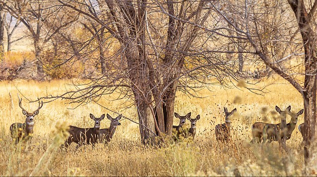
Horton Creek is a popular summer camping spot for climbers thanks to its proximity to both the Buttermilk Boulders and the Owens River Gorge, two world class climbing destinations.
Back on Sawmill Road, you’ll pass Arcularius Ranch and one of the last remaining old corn cribs in the area. With a bit of luck, you might see deer grazing alongside cattle or spot wintering mules and horses in the pastures.
Pine Creek: Mining Roots and Mountain Views
When you reach Pine Creek Road, consider taking a scenic side trip up the canyon. Before venturing down it be sure to check road conditions first, especially after recent snowstorms.
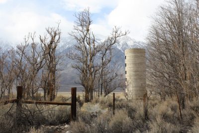
As you head up, you’ll pass the small community of Rovana, originally built to house miners and their families during the days when the Pine Creek Mine was still active. For a fascinating look back in time, check out the Eastern California Museum’s video on the region’s tungsten mining history.
Farther west, keep an eye out for the Pine Canyon Crags, a climbing area visible on the right. You’ll need to pull off the road and hike a short distance to reach it, but it’s well worth the effort.
From here, you can either turn around and follow our route back, or continue up the road to take in more of the dramatic canyon scenery and catch a glimpse of the now-closed mine (please note, it is off-limits to visitors).
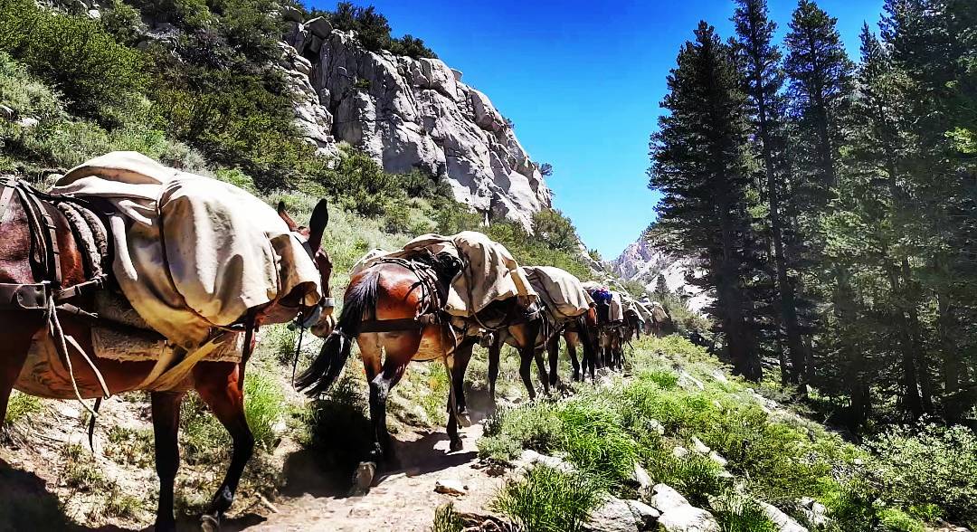
In the summer months, you’ll also find the Pine Creek Pack Station near the end of the road, which offers pack trips into the rugged wilderness above.
Into the Gorge: A Scenic Sierra Detour
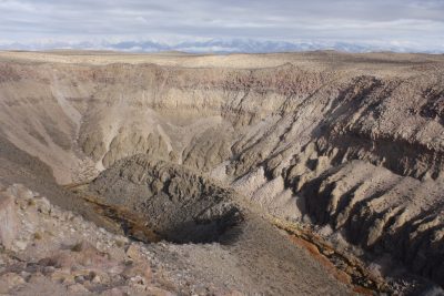
If you’re following our route, we headed east on Pine Creek Road, crossed over U.S. 395, and continued onto Gorge Road. At the “T,” we turned left (north) and followed the graded dirt road, keeping an eye on the massive pipe that carries water from the Sierra to Los Angeles. Just after the pipe disappears underground, look for a road on the right. Take that turn for a short distance to a parking area overlooking the Owens River Gorge. You’ll definitely want to spend some time exploring. Check out this short video of Joe sharing insights about the hike and the area.
Cruising Bishop: Scenic Drives and Off Road Adventures
This is just a small taste of the incredible motor touring adventures waiting for you around Bishop. Whether it is your first visit or your hundredth, we recommend starting with the Bishop’s Big Loop Auto Tour, a local favorite that showcases the area’s best scenery.
Looking for more inspiration? Check out our article on Fun OHV Adventures Near Bishop for off road excitement. Prefer to stick to the pavement? Do not miss 5 Classic Sierra Drives Every Visitor Should Do.
And if you are exploring in the colder months, be sure to read Gigi De Jong’s OHV and Auto Touring Guide for Winter. It is packed with seasonal tips and routes that shine when the snow flies.
Written by:
Vickie Taton
Since taking a chance summer job in 1980, I've lived in and loved the eastern Sierra. Sometimes home is a place you've never been before, and that is how I felt driving north into Inyo and Mono Counties so many years ago. It really doesn't matter the activity; fishing, hiking, skiing, riding my horse or mountain biking, I love the clean air, the cobalt blue sky, the constantly changing weather. Welcome! I'm happy to share a little piece of this place with you.