Must Do Trail Runs in the Eastern Sierra
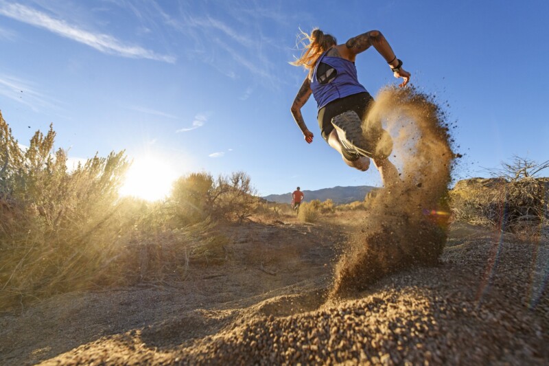
Trail and mountain running aren’t new, but they’re gaining serious momentum as more people seek ways to connect with nature while chasing their fitness goals. Running on trails—away from traffic, noise, and poor air quality—isn’t just healthier, it’s also more peaceful, challenging, and rewarding. And when it comes to trail running nirvana, Bishop delivers. From high desert loops to shaded runs through conifer forests, here are some of the best trail runs in the Eastern Sierra that deserve a spot on your must-do list.
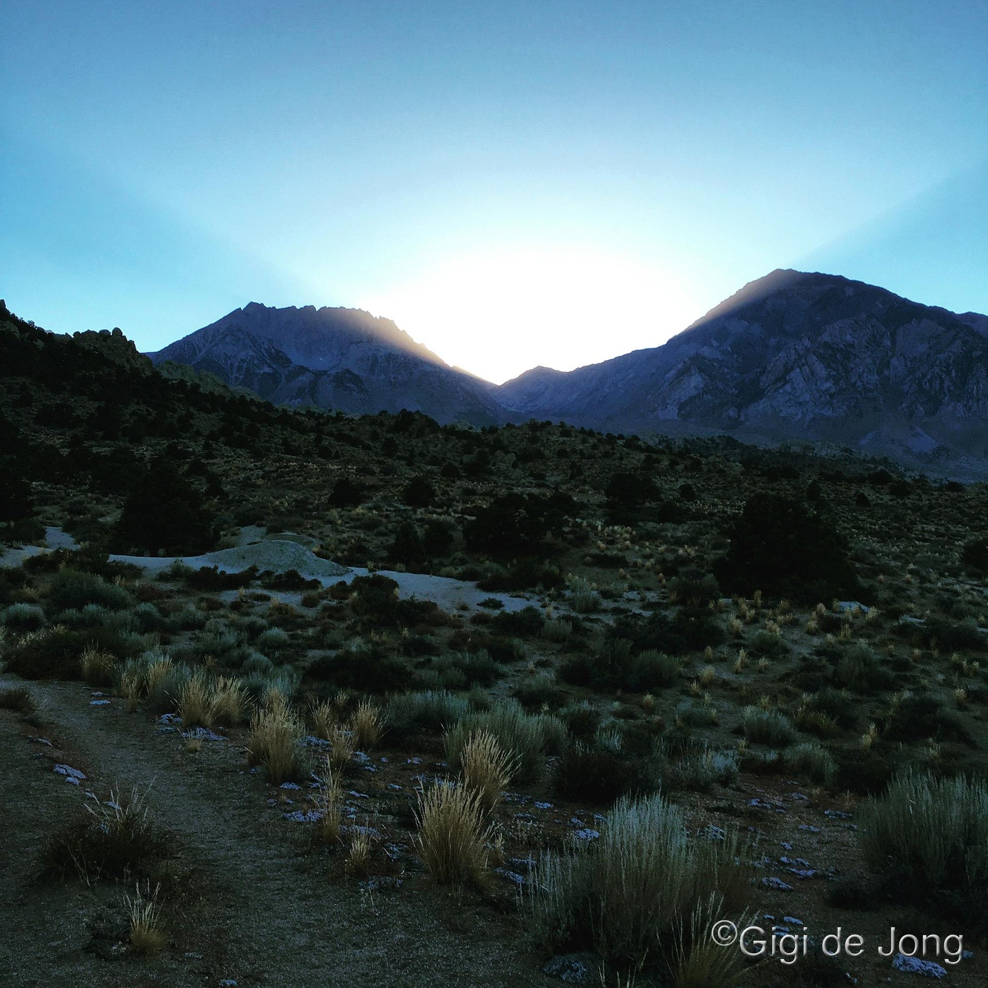
Winter is a Great Time for Trail Running in Bishop
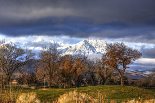
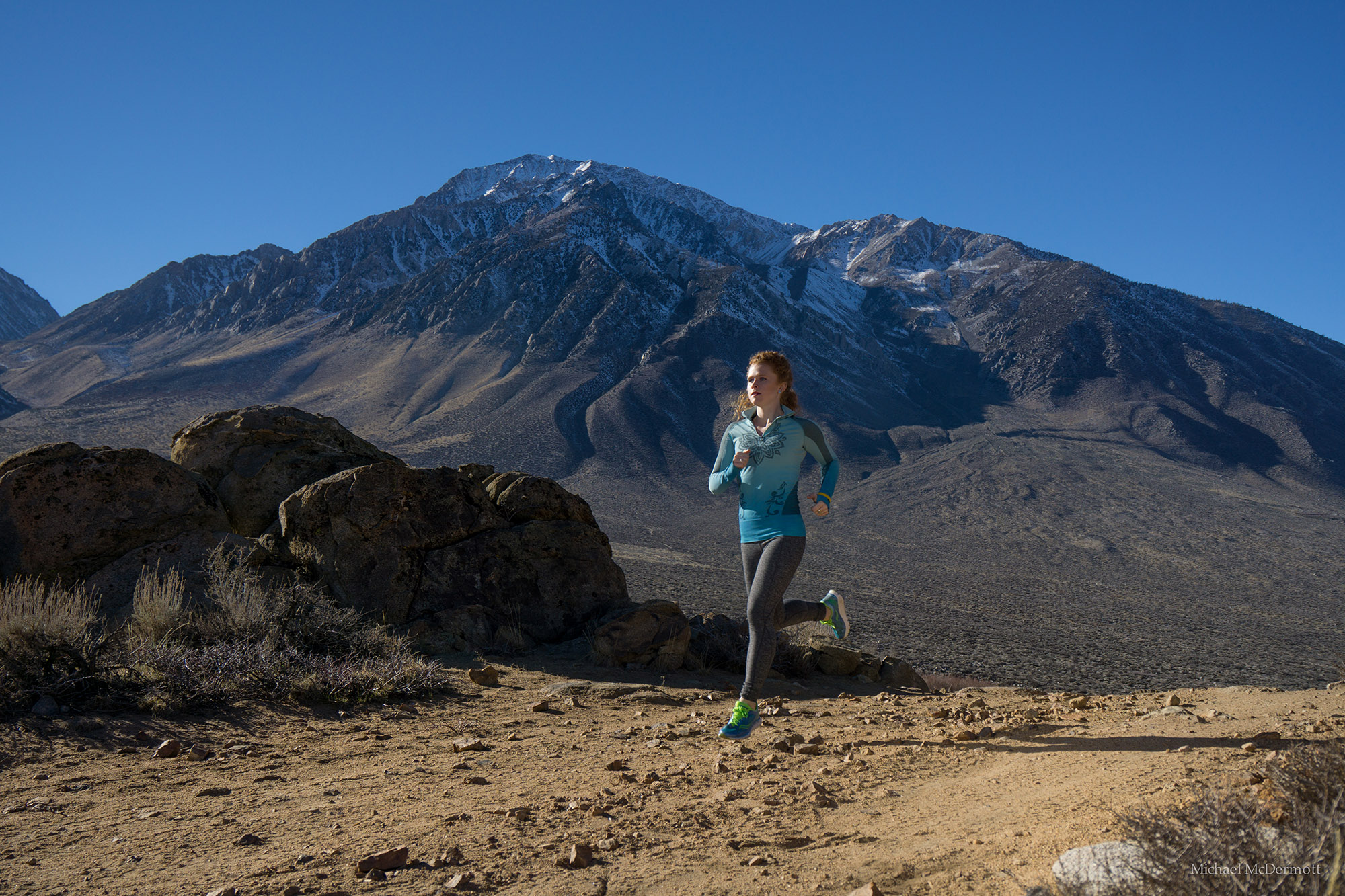
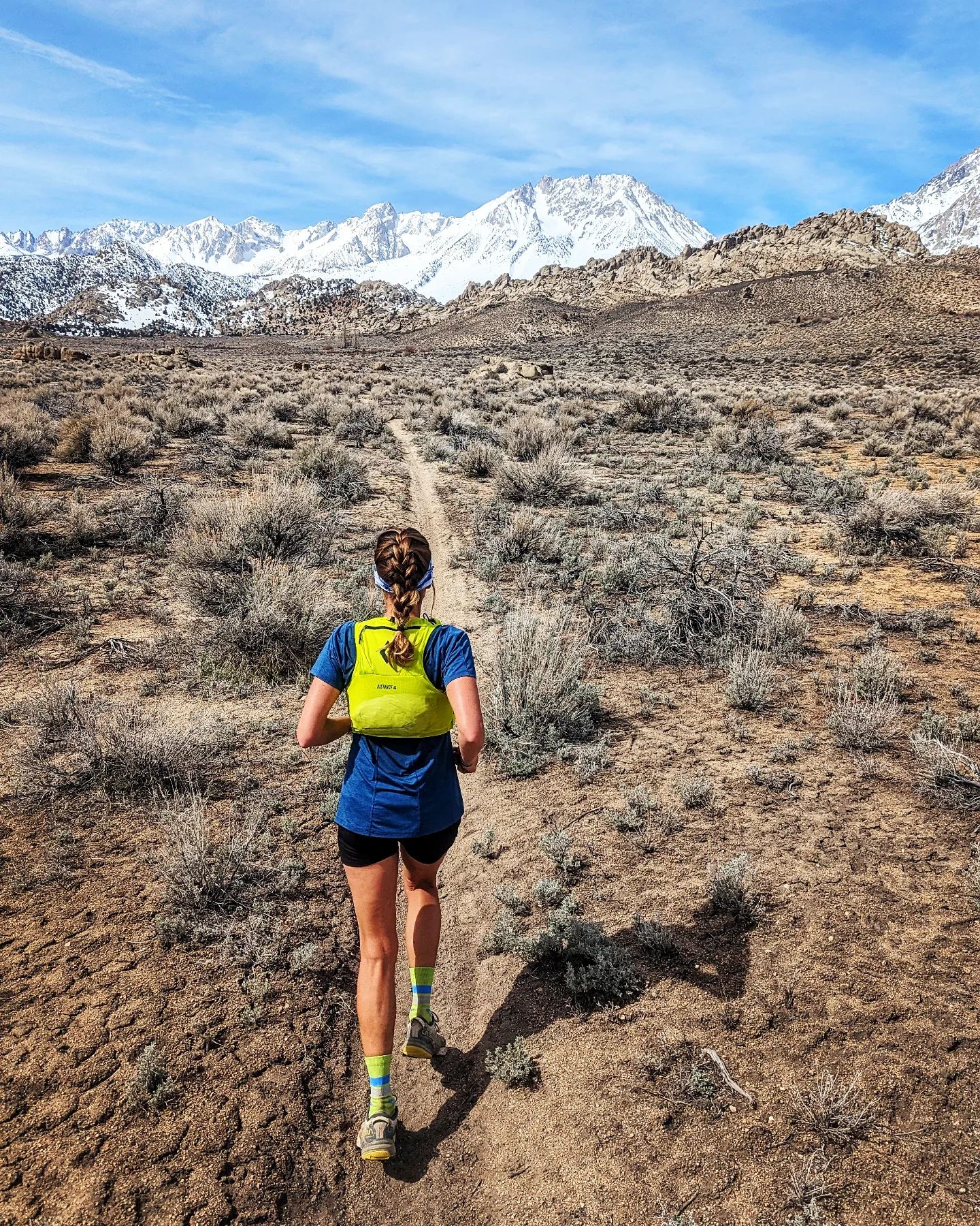
Bishop offers a vast array of trail running and mountain running options all year and winter is no obstacle for the great trail running here. It is, in fact, one of the best times of year to run in Bishop. The trails and running zones that are close to this beautiful mountain town are easily accessible and yet feel remote due to the pristine landscape in which it sits.
Within the broad expanse of the Owens River Valley floor, the rocky hills of the valley, the foothills of the Sierra Nevada and the escarpment of the Tablelands is an area of almost 400 square miles that has innumerable single- and dual-track trails that add up to why Bishop has been named one of the top trail towns in America!
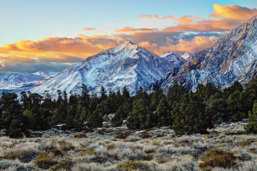
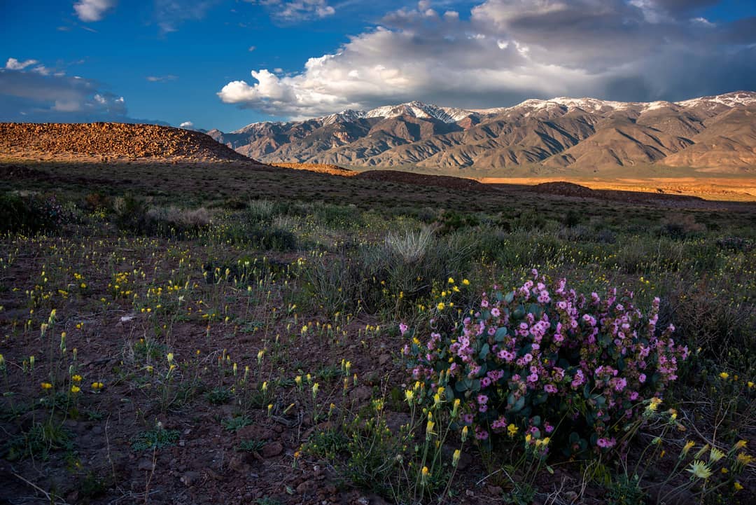
Buttermilk Country
Known as a destination for world-class bouldering and with its early history of mining and ranching there are numerous roads and trails that thread their way through and around these spectacular rocks. Trail running here provides the opportunity to link these trails together for a variety of results. Runners could aim for distance and minimal technical challenge or higher levels of difficulty depending on training requirements or personal satisfaction. These trails have varying surfaces, inclines, obstacles and a few stream crossings – which may be icy in winter.
At 6,400’, the Buttermilk area covers 325 acres of high desert meadow, unimpeded views of the Sierra Nevada and is surrounded by the Inyo National Forest. The junction of Buttermilk Rd on State Route 168 is just 8 miles from Bishop.
Tungsten Hills
Get the scoop on the Tungsten City Running Loop
Named for the tungsten that was mined here until the late 1940s the Tungsten Hills are composed primarily of granite and quartz diorite. It’s a favorite place for rock hounding and crystals of red garnet can still be found here. However, if you’re on a mission to run, the seemingly endless roads and trails (including a loop) here will keep your attention focused on the task. If you’re a seasoned trail runner the only thing that will leave you breathless here … is the view!
There are a number of good access points with the closest to town being the Tungsten City Rd at just a little over 6 miles from the Bishop Visitor Center. The Millpond Recreation Area is also a great place to start and end your Tungsten trail run as it offers well maintained amenities, such as: ample parking, restrooms, picnic areas, and a playground. If you’re visiting with a group of friends or family that include non-runners this is the venue for you.
Volcanic Tablelands
Get the scoop on the Volcanic Tableland Loop
If you feel the need to stretch your eyes and your legs the Tablelands will provide sweeping vistas and long, undulating roads for a rhythmic run. Of the routes available some skirt the protected wetlands of Fish Slough, or wander through indigenous alkali meadow that comprises much of this plateau and the valley floor below the escarpment. Others curve in and around the rock formations that are sculpted in the Bishop Tuff from which this plateau is created.
Formed as a result of a massive volcanic eruption a mere 760,000 years ago, very recent in geological time, the Volcanic Tablelands rise dramatically less than 5 miles north of Bishop. This area offers a variety of fairly flat high desert running on graded dirt roads and well-worn trails with few obstacles.
Owens River Floodplain
The Owens River floodplain is a runner’s paradise, full of life and variety. The river winds for 40 miles between Pleasant Valley and Tinemaha Reservoirs, with trails and tracks following its path for countless more. In just the 2.5-mile stretch between East Line Street and Warm Springs Road, you’ll find a network of trails crossing grassy meadows, soft sand, packed gravel, muddy washes, and even sand dunes.
There isn’t much elevation change, but the ever-shifting terrain will keep things interesting. Wildlife is everywhere—birds and animals thrive here—and you might spot anglers casting from the banks or wading in the river, even in winter.

Running Around Town
Before you head for the hills take a quick run around town and visit the local retailers and pop into the Bishop Visitor Center at 218 S. Main St. The folks you can chat with here are knowledgeable and experienced about our area and all the great activities we do here.
You’ll find the running enthusiasts at Sage to Summit at 312 N. Main Street and the store is stocked with all the gear you might need for trail and mountain running. Eastside Sports has ‘equipment and clothing for all your mountain adventures’ and books galore on these subjects.
Get maps, get gear, get advice and, most of all, get prepared. Dress in layers as weather can change quickly in this mountainous, high-desert region. If you’re running alone always tell someone where you plan to go and when you plan to return.
Run Around Bishop … you’ll be so glad you did.
Local Resources
Click here for information about the Winter 5K Race Series. All proceeds benefit Inyo County Search & Rescue
Here is a list of more local trail runs.
Written by:
Gigi de Jong
Gigi is “crazy mad in love with Bishop.” Since moving here in 2006 she has made it her mission to participate in as many of the outdoor activities as possible. She learned to snowboard, improved upon her very average climbing skills, took long hikes, has driven up and down innumerable mountain roads and 4x4 tracks, cycled and occasionally tumbled down mountain bike trails, taken to the roads on a bicycle or motorcycle – sometimes for fun and sometimes to commute, and successfully completed her first attempt at a triathlon. She spent 10 months touring the western US and Canada on a bicycle and after 4,000 plus miles returned to Bishop – for the beauty of the place and the spirit of the community. “My soul belongs here,” she says.