Fall Colors in Bishop’s Big Backyard
Welcome! This fall color guide will help you discover and monitor elusive and overlooked fall colors in the Eastern Sierra quickly and easily. Many visitors read the information below and tell us they benefit greatly from it. Like other fall leaf peepers, you can benefit as well.
Basically, botanical experts will tell you that fall colors are difficult to predict any given year. Much depends on how low temperatures drop in the high country. Aspens have a biological clock geared toward day length and nighttime temperature. Typically, with the weather getting warmer, it seems that fall colors in the high country now begin in early September, maybe a bit earlier. Generally, the first week or two of October is a good bet to come up for high country colors but there are no guarantees with nature.
Also, fall colors are not necessarily uniform in the Eastern Sierra. For example, fall colors may be at or close to peak color at one geographic location while another spot elsewhere may be just beginning to change color. For example, a place like Rock Creek Lake may have brilliant peak color while South lake is just beginning to turn color. Commit yourself to consistently check the information below and you will find beautiful photogenic fall color.
Typically, the trees lose their leaves later in October as color moves down into the valley extending the fall colors season into November. But a late summer burst can extend high country foliage longer. Wind plays a role as well in how fast the leaves drop.
Many fall leaf peepers read the fall color blog posts published on our website and find the area’s best color locations after reading them. These posts will enhance your experience greatly.
Most importantly, we recommend you monitor the progression of fall colors from the beginning of September on the many websites that provide updated reports for our area. Then when color looks good at locations you desire to visit, drive up to the area immediately before the color ends. Experienced fall foliage guests follow californiafallcolor.com, our current color report below, and Mono County fall color guide, all of which give you real time fall colors information so you can come up when the colors are best.
We recommend you stop at the Bishop Visitor Center when you come to town to pick up a complimentary fall color guide in print and treasure map. It can save you some time since we attempt to keep up with fall colors as they change. We are located at 690 N. Main, in the A-frame building across from Carl’s Junior Drive In. When you are here, take a few minutes to look at an awesome new book entitled California Fall Color. We have read it and it is outstanding! It guides you to the fall color locations along Highway 395, Yosemite, and around South Lake Tahoe. Fall color enthusiasts love this book. We have a display copy available for guests to review.
“The longest fall color show in North America,” ~ californiafallcolor.com
>> Download the map to your phone & enjoy an on the go Color Guide to Fall

Take a full screen, interactive, virtual Fall Colors StoryMap tour here
Wow!!! Let’s plan a Fall Colors Trip.
Follow the virtual tour, study the places, and plan a trip to Bishop and the Eastern Sierra. Call us: (760) 873-8405, or email us: and let us help you plan a Fall Colors adventure. We look forward to meeting you!
And don’t forget to check out all our great lodging options.
Please follow us on social media:
Facebook | TikTok| YouTube | Instagram
Check out the latest blog posts on BishopVisitor.com!


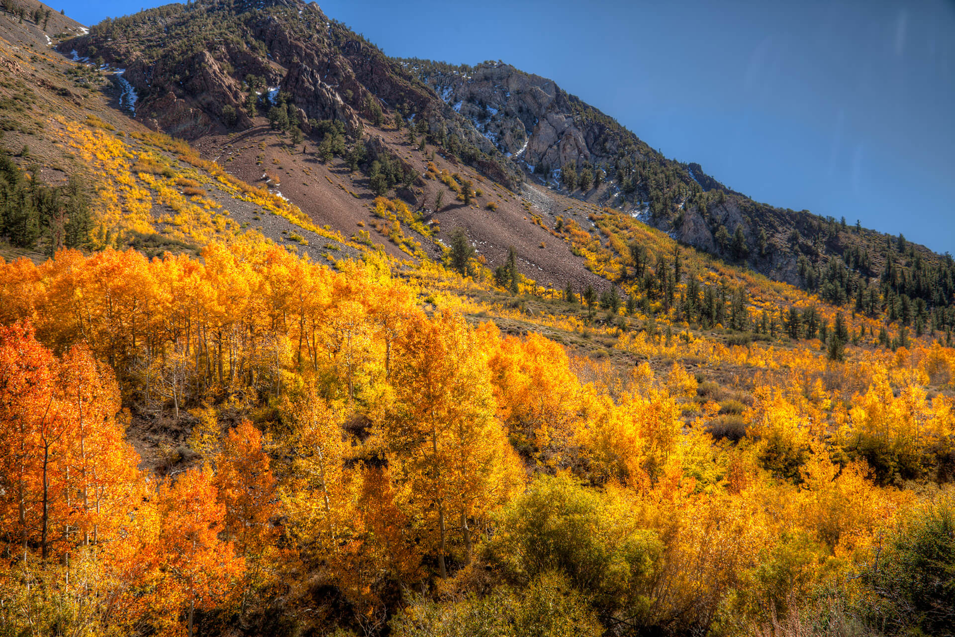
South Lake Road above Mountain Glen campground near peak. Photo: Gigi de Jong
Color Report
For updated color reports of what’s turning where visit californiafallcolor.com.
Color Guide
- Just Starting (0-10%)
- Patchy (10-50-%)
- Near Peak (50-75%)
- Peak (75-100%)
- Past Peak
Everything you always wanted to know about Fall
Click on each toggle bar below for details on what, where, how, why and more.
What & Why

Bishop Creek South Fork. Photo: David Wolfe
Historically, fall was the season of the harvest, when farmers gathered crops to put in storage for the winter season. Festivals and celebrations often marked the harvest as a testament to the commitment and strength of those working the land and in gratitude to mother nature. Autumn was the season to celebrate achievement.
Autumn is now more commonly referred to as fall. It is characterized by the splendid visual display that precipitates the falling of the leaves from the trees. No matter how often we witness it, it is always remarkable for its beauty and significance to the passage of time.
When the air cools and summer turns to autumn the leaves begin to change color and an abundance of yellow, orange, red, russet and gold is presented in the forests near Bishop.
Why do leaves change color?
Leaves are the food producing parts of plants and the process by which they do this is called photosynthesis – meaning, “to put together with light.” The catalyst required for photosynthesis in all plants is the chemical chlorophyll. It is a green pigment most abundant in leaf cells.
In the presence of chlorophyll, the plant uses sunlight (or artificial light) to synthesize carbon dioxide and water to produce sugars. The sugars produced through photosynthesis are the food source for the plant that sustain it and allow it to grow.
During the summer growing season leaves appear green because of the high concentration of chlorophyll, which masks the other pigments also present within the leaf. As the hours of daylight decrease the production of chlorophyll slows and eventually stops. The other colors, predominantly yellow and orange, begin to emerge.
Plants produce far more food than they need to survive and the overabundance of sugars in the leaf are an additional factor that contributes to the color change. A good growing season in summer and the right balance and of light and temperature during autumn will result in the reds emerging with greater intensity.
Golden Aspens
What trees grow and change color in the Eastern Sierra?
The principal players in this spectacular display of color are aspen, willow, and cottonwood trees. The mountain alder, a shrub belonging to the birch family, participates too. In a very few stands where it occurs, the California black oak adds a rich color to the palette.
When & Where

Cardinal Village near peak. Photo: Gigi de Jong
When does it happen and how long does it take?
The color change can begin a few days to a week or more before the autumnal equinox, on or about September 22nd each year. Weather plays a large role throughout the year. The amount of sunlight and water and the temperature levels during the growing and slowing season are major factors that affect the hues, rate of change, intensity, and duration of color that occur during autumn.
When is the best time to visit?
From mid-September to well into November.
Fall is long in the Eastern Sierra. The topography of the region provides a slow shift into winter that starts first at the higher elevations and descends slowly over the open plains of the Owens Valley below. Temperatures cool quicker at the higher elevations and sunlight is further reduced as shadows are cast when the sun drops behind the crest of the Sierra Nevada earlier each day. The cooling begins in September as daytime temperatures decrease significantly up high, while summer still seems ever-present in the valley.
The color change begins high too – first in the canyons and alongside lakes and streams in the mountains high above Bishop. Then it flows down into the Owens Valley many weeks later as the nights grow shorter and temperatures colder.

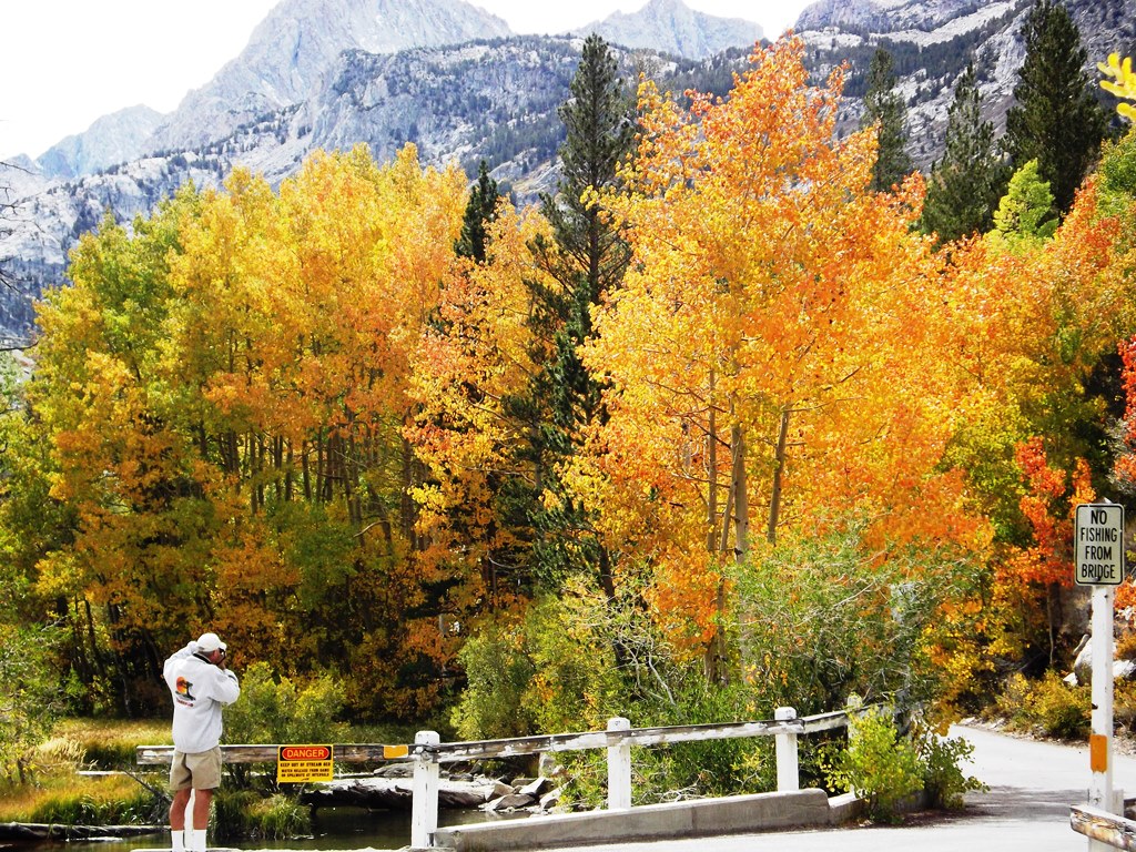
Fall Colors in Bishop Creek Canyon. Photo: @alexfitchphoto
Where is the best place to see fall colors?
Bishop Creek Canyon is one of the most beautiful places in the state, if not the country, to witness this magnificent display. A short drive west from Bishop on State Route 168 (W. Line Street) will take you up into the canyon where there are innumerable places to see the changing colors of the forest.
The entire canyon comprises three forks of Bishop Creek – north, middle and south fork. A large lake marks the head of each fork, North Lake on north fork; Lake Sabrina on middle fork; and South Lake on south fork, with numerous other smaller lakes along the creeks.
The road winds up through the groves of aspen and willow with ever changing views as you drive. Exploration on foot from any of the turnouts and trailheads will take you deep into the explosion of color.
Who & How
Fall photographer near Lake Sabrina
Fall color spotting is accessible and magical for folks of all ages and abilities. Good paved roads wind up into the mountains of the Eastern Sierra, where deciduous trees line the roadway and large groves spread out along the mountainside. Trails add an opportunity to get up close and personal with the foliage of the forests. Some are easy and others require a little more time and effort, but all are greatly rewarding.
A few tips when driving in the area during this season:
- Drivers of all types of vehicles should use low gears when descending down the mountain. Use brakes intermittently. All road users must obey speed limits and posted signage, as well as mandated vehicle and driver regulations.
- Stay in your lane at all times as there are many blind corners. Be aware of slow-moving vehicles, pedestrians, cyclists, and animals – especially during sunrise and sunset when the latter are often on the roadway.
- Always use an obvious turnout when stopping and pull completely off the roadway
- Attempt to stop or park in a space that is out of the line of photography for yourself and other photographers.
Some things to think about when hiking here:
- Dress in layers, carry plenty of water and snacks, wear sunscreen and a hat, and take insect repellent – especially during sunset hours.
- Please always stay on trails where designated and do not cut switchbacks. If some cross-country is necessary (hiking where no trail exists) please don’t crush the brush.
- Uphill hikers have right of way.
- Pack out everything you pack in.
- Tell someone where you are going and when you expect to be back.
Links & Things
Monitor the progression of fall colors on these great websites to plan your fall color trip perfectly:
http://www.californiafallcolor.com/
https://www.monocounty.org/things-to-do/fall-colors/
Download our fall color guide which has tons of info and may answer many of your questions:
https://bishopvisitor.com/wp-content/uploads/2017/09/FallColorMap2017.pdf
Take a look at this informative video about fall colors:
Before you decide to take a drive up to North Lake, take a look at this video to see if this experience is for you.
Request a FREE Bishop Information Guide
Get a Guide. Get Inspired!
Read and study these pages, download the brochures and maps, and plan a trip to Bishop and the Eastern Sierra. Call us: (760) 873-8405, or email us: and let us help you choose your future adventure. We look forward to meeting you then!
And don’t forget to check out all our great lodging options.
Please follow us on social media:
Facebook | TikTok| YouTube | Instagram
Check out the latest blog posts on BishopVisitor.com!

#VISITBISHOP GUEST EXPERIENCES
Be sure to add #VISITBISHOP and #RECREATERESPONSIBLY to your Eastern Sierra Fall Color treasure hunts so we can find them!!