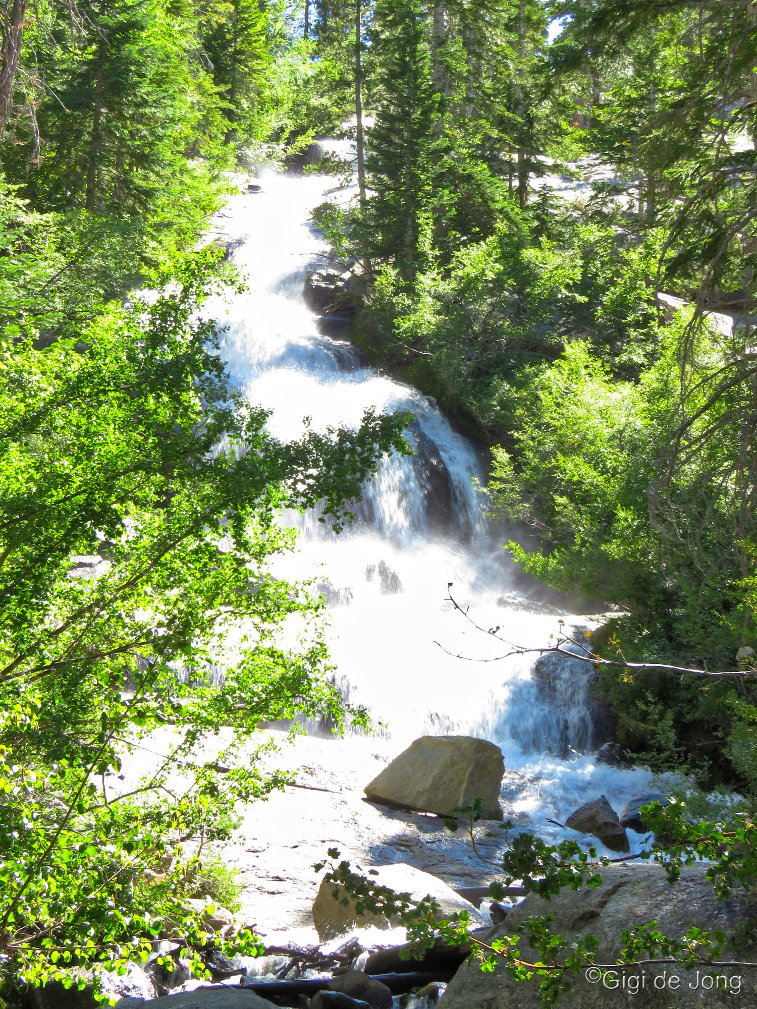
Lone Pine Creek Waterfall, Whitney Portal.
Spring in the high desert of Bishop’s big backyard is simply magical. Waterfalls cascade down mountain ravines, wildflowers bloom in the desert, roads and trails open up at higher elevations, days are warm and sunny, nights are cool and refreshing, and the world is rejuvenated. Soon freshwater fishing season opens and the lakes and streams at higher elevations beckon anglers from all over. The season is notoriously unpredictable and yet it is famously fun.

When it’s chilly up high we play in the valleys; OR when it’s hot in the lowlands we head for highlands. Spring means there’s something for everyone.
Here are some details about the great adventures, activities, and sights to be found in the spring in and around Bishop.
- Waterfalls
- Wildflowers
- Fishing
- Hiking
- Trail Running
- Biking
- Climbing
- Motor Touring
- Natural History Sites
- Museums & Cultural Sites
- Events
Waterfalls

First Falls on Big Pine Creek
The Sierra Nevada is a mighty mountain range in central and eastern California that runs for 400 miles, north-to-south, and about 70 miles, east-to-west. It rises to well over 9,000 ft along its crest and has over 120 peaks above 13,000 ft. This immense range is the ‘water trap’ for California. About 20 to 80 inches of precipitation falls annually, most of it in fall, winter, and spring, and generally in the form of snow above 6,000 feet. During the Pleistocene epoch glaciers that receded only a little less than 12,000 years ago created a glacial staircase of over 2,000 connected lakes. On the steep Eastern Sierra escarpment these connections produce countless waterfalls and cascades.
For an extensive list of waterfalls in the Eastern Sierra visit our Waterfalls Guide here. Three great falls to see in Spring are First Falls along Big Pine Creek, Cardinal Falls in Bishop Creek Canyon, and Darwin Falls in Death Valley National Park.
First Falls, Big Pine Creek

First Falls, Big Pine Creek.
These falls are located along Big Pine Creek about 10 miles west of Big Pine. The hike to First Falls is an easy quarter-mile hike with less than 200 feet of elevation gain. The trail crosses an impressive cascade over a wide, sturdy wooden bridge. It’s a popular photo spot with all the elements for great people and nature pics.
From US-395 in Big Pine turn west on W. Crocker Ave. Follow the road, which becomes Glacier Lodge Rd, for 10.5 miles to where it ends at the trailhead parking area. It’s a gorgeous drive and there are vault toilets available at the parking area. There is no view of the falls from the trailhead, so take the short ¼-mile hike to get right up to the First Falls.
Cardinal Falls
Cardinal Mine Falls roadside view.
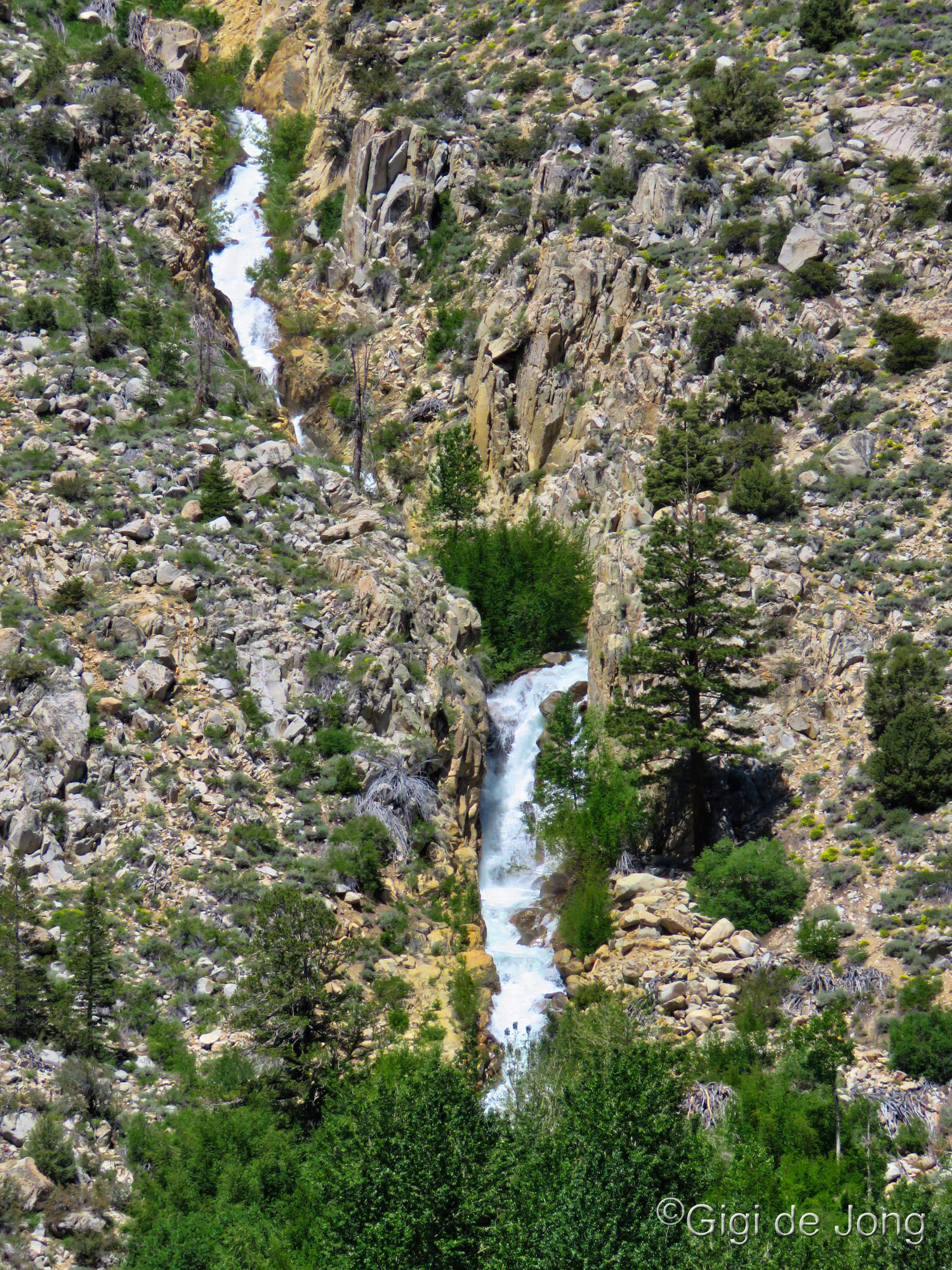
Cardinal Falls cascades down a narrow chute from the rim of North Lake, which sits in a hanging valley above Cardinal Village Resort. It falls into the deep valley below, where the village and the old Cardinal Mine site are located, then cuts down the canyon into Bishop. The cascade is fullest in spring when the winter snow melt runs from North Lake over the rim into this chute.
Drive 17-miles from Bishop along US-168 west (W. Line St.) toward Lake Sabrina to the village of Aspendell. The falls can be seen from a distance along the road beyond Aspendell or up close following a short, but strenuous and technical hike from the resort in the valley below. The long view of the falls is a stunning vista of canyons and crags, and forests and streams. The close-up view of the falls delivers the power of the cascade on all the senses—sight, sound, and vibration. Take care here as the rocks may be slippery.
Darwin Falls
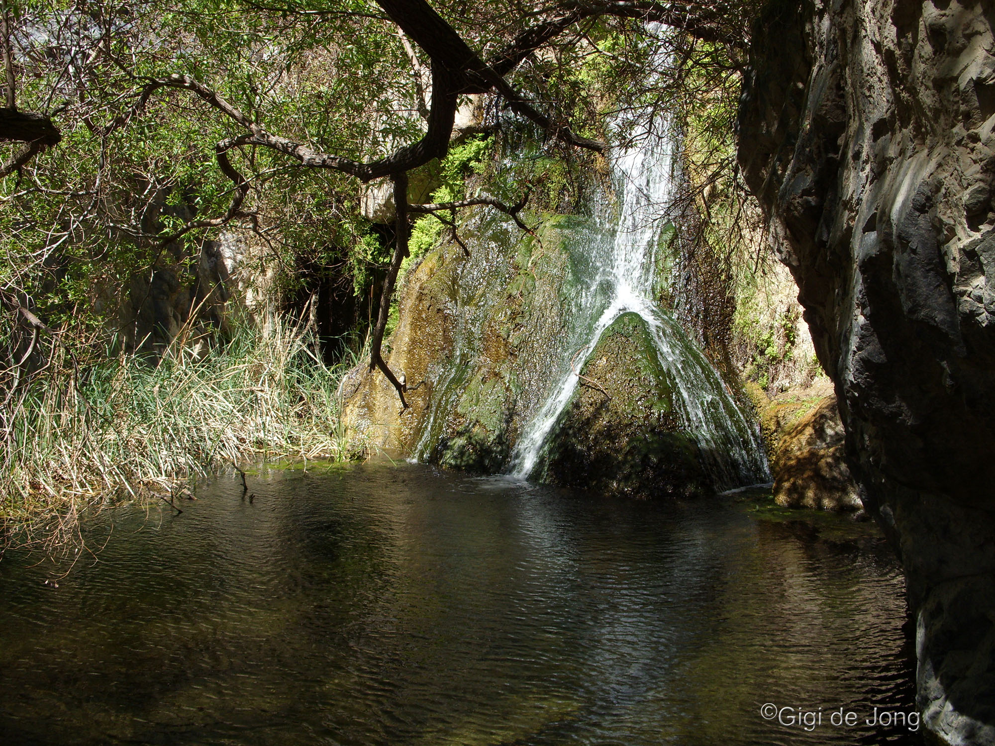
Darwin Falls, Death Valley. Photo: Gigi de Jong
Darwin Falls, in Death Valley National Park about 50 miles east of Lone Pine, is a surprising oasis in this vast, dry country. It’s best to visit this area during the cooler months—winter and early spring. It is a series of falls and cascades on Darwin Creek, which is one of only four perennial streams in all of Death Valley NP. The lower fall is visible after a hike of about one mile, with a little over 500 feet of elevation gain.
From US-395 turn east onto CA-136 just south of Lone Pine. Follow the road, which becomes CA‑190, for 49.1-miles. At the bottom of a winding grade below Father Crowley Vista Point turn right onto an unmarked dirt road, known as the Old Toll Rd. Stay on this road for 2.4 miles until you reach the trailhead parking lot. The hike is relatively easy with the first .7-miles being fairly flat and exposed with little to no tree cover. The final ¼-mile is in the treed, riparian area where the trail climbs about 500 feet. Even in spring it can be a hot, dry hike so cover up and take plenty of water.
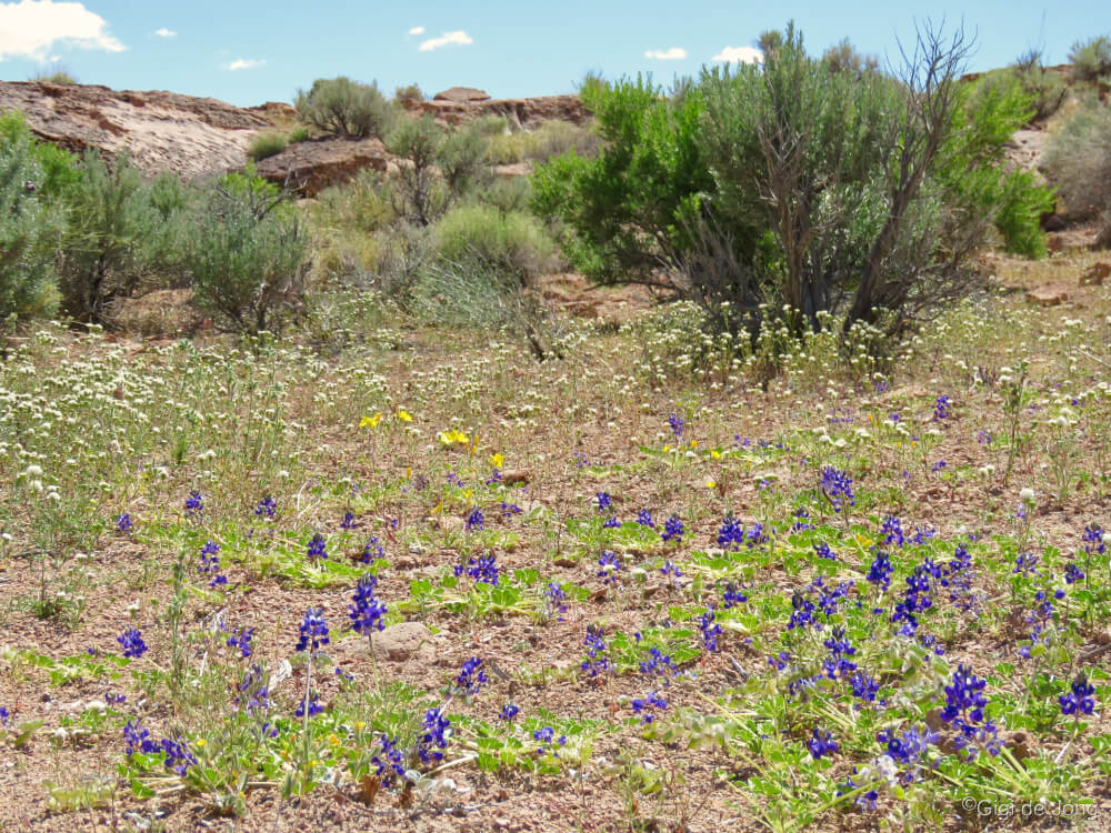
Wildflowers

Wild Iris bloom near Bishop
Inyo County is a large, sparsely populated, high desert region that incorporates only a handful of towns. It has lots and lots of protected, public land, a huge National Park, and a massive elevation change from 282-feet below sea level (Badwater Basin–the lowest point on the north American continent) and 14,505-feet above sea level (Mt. Whitney–the highest point in the lower 48 states) that are only 85‑miles apart as the crow flies. This unique topography allows for a long and abundant growing season. It is also the intersection of three major biotic provinces—the Mojave, Great Basin, and Sierra Nevada–with the result that this region has a wide variety of vegetation communities. Thousands of species occur here and many are unique to the Eastern Sierra.
Spring flowers begin early (as early as February 1st) in the low elevation regions in Death Valley National Park and continue well into late Summer at the upper elevations of the Sierra Nevada Mountains. The region is also known for the “super bloom” that happens periodically in the deserts of the southwest; conditions must be just right for that to occur. Wildflowers bloom here every year and it can be a blossoming experience for the whole family in Spring.
Have a look at our Wildflower guide here for more details about these, Death Valley, Fossil Falls, Division Creek, and Fish Slough, plus many others in the entire Eastern Sierra region.
Death Valley
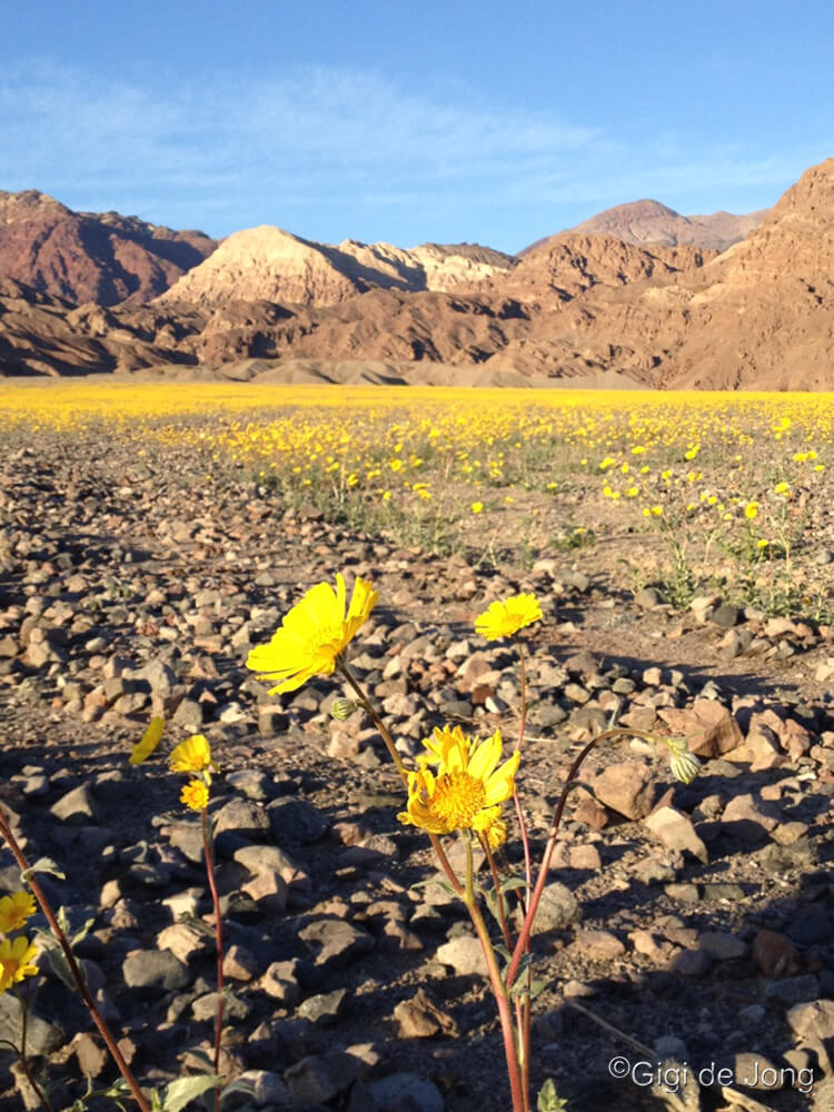
Death Valley superbloom.
Despite its macabre name, Death Valley does, in fact, sustain a large variety of life. The sheer size and diversity of its terrain creates opportunity for plants, animals and insects to survive and thrive in a seemingly hostile environment. This parched-looking earth hosts a multitude of seeds that lie dormant, ready for the perfect conditions to bloom and reseed the soil. Desert flowers are mostly small and fine, but a few species present a bold face to the world. This is a great resource for ‘what’s blooming now’ to give you current reports on flower sightings.
Fossil Falls

Wildflower at Fossil Falls.
Fossil Falls is a fantastic site to visit any time of year, but it’s especially lovely in Spring when the wildflowers bloom. Water does not fall in any abundance here anymore and technically these are not fossils; it is a canyon of basaltic black lava rock sculpted by eons of rushing water from a prehistoric age. It is a magnificent example of the forces of nature that shape our world. During wildflower season the counterpoint of hard, black rock and soft, colorful petals is a reminder of a time past and life renewed.
From US Highway 395, 45-miles south of Lone Pine, turn east on Cinder Road and follow the signs to Fossil Falls a mere 1.4-miles off Highway 395. The chasm is almost unnoticeable in the flat lands of the valley floor until you get quite near to it, then it unfurls below you in folds of glossy, black rock that are both beautiful and strange. The surrounding landscape delivers an expansive view of magnificent wildflowers in early Spring.
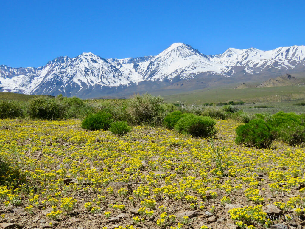
Division Creek

Lupins abound at Division Creek.
Division Creek tumbles down from the Sierra Nevada about 35-miles south of Bishop. A little under 3-miles directly east of US-395 is an unassuming landmark located along Division Creek. It is Division Creek Powerhouse, the first power plant built by the agency that was to become the Los Angeles Department of Water and Power (LADWP). The original structure built in 1908 burned down and Unit 2 was built at the same site and continues to be operational. West and above the powerhouse the creek runs full most of the year and in Spring it presents a magnificent display of bush lupin and other thirsty desert flowers.
From Bishop drive south on US-395 for 30-miles and turn right onto Goodale Rd. About 200-feet along turn left onto Tinemaha Rd (Old Hwy 395) and drive for 2.2-miles. Turn right onto Upper Division Creek Rd, which is a dirt road from this intersection. Continue for 1.6-miles until you see the powerhouse structure on your left. Park in a clearing and please don’t crush the brush! Walk along the road and alongside creek, where possible, for the best views of these large blossoming bushes.
Fish Slough
Delicate wildflowers along Fish Slough
Less than 10-miles north of Bishop is a riparian wetland, one of the richest wetland floras in the Great Basin. With over 125 plant species, including eight rare species, Fish Slough will be an extravagant find for flower enthusiasts. The diversity of species will deliver a greater variety of color and size. Blossoms of cream, yellow and magenta will carpet the slopes bordering the slough. Timing is everything and, like most desert flowers, blossoms are generally small and fine.
This is a protected area designated as an Area of Critical Environmental Concern (ACEC). It can be accessed via Five Bridges Rd 2.5 miles north of Bishop on US Highway 6. Wildflowers can be seen from the comfort of a vehicle, but viewing is best done on foot. Please tread very carefully.
Fishing
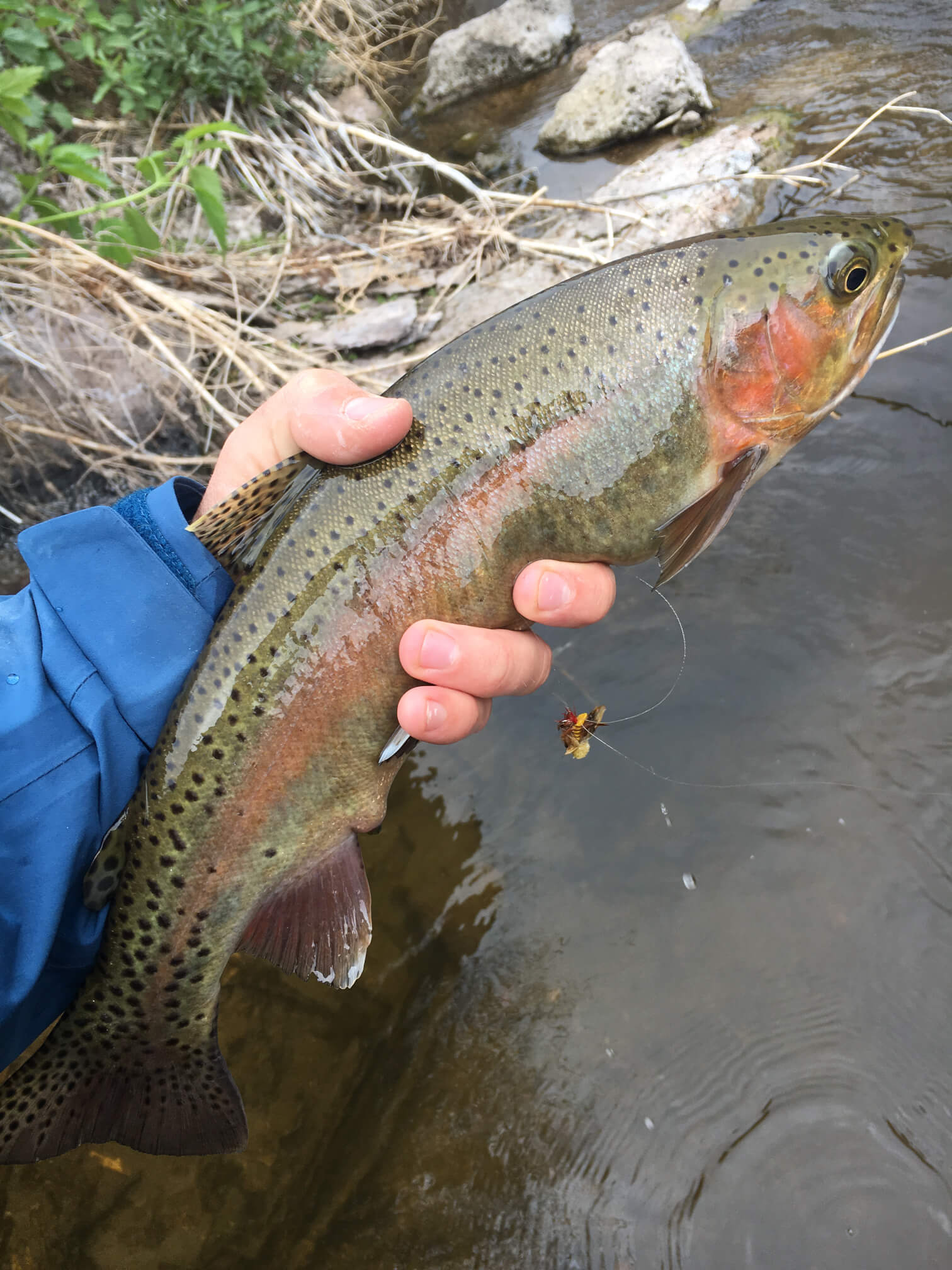
Fantastic fishing in Bishop
Fishmas happens in Spring! It’s the last Saturday in April every year and it’s the biggest, happiest fishing holiday on every angler’s calendar. This is the day that freshwater fishing season opens; every creek, pond, and lake is open for fishing.
The Eastern Sierra has been a prime fishing destination for more than 100-years. There are so many great places to fish that it’s impossible to list them all. Pleasant Valley Reservoir is open for fishing all year; early spring is a delightful time to fish here. These two super seasonal destinations, Intake II and Lake Sabrina, are located high up in Bishop Creek Canyon and are spectacular seasonal springtime fishing lakes. They are fun for the whole family and perfect for anglers, from beginner to experienced.
Fishing can be a solitary pastime and a lively group activity; it is also a highly competitive sport. The Blake Jones Trout Derby is an Eastern Sierra tradition and one of California’s largest single-day trout derbies. It has grown since it began almost 55-years ago and it now offers over $10K in cash & prizes.
Find out more about this event and other great fishing in the Eastern Sierra here.
Intake II

Sweet spot at Intake Two
After freshwater fishing season opens at the end of April, fishing in Intake Two is pretty much a perfect outing. This beautifully maintained reservoir has all the rustic amenities an avid angler could want or need. Paved road access, plenty of parking, a wheelchair accessible fishing pier, a trail all the way around the lake, vault toilets, picnic benches, trees, and regular seasonal fish planting of catchable rainbow trout.
The drive west on CA‑168 (W. Line St.) from Bishop takes 20 minutes to the reservoir nestled in Bishop Creek Canyon at an elevation of just over 8,000 feet. The lake is usually accessible all year, depending on the snowpack, but fishing is only allowed during sport fishing season and licenses are required. Make sure to check out all rules and regs here. Licenses can be purchased in many Bishop stores. The California Department of Fish and Wildlife (CDFW) offers two Free Fishing Days a year. Check it out. Get started.
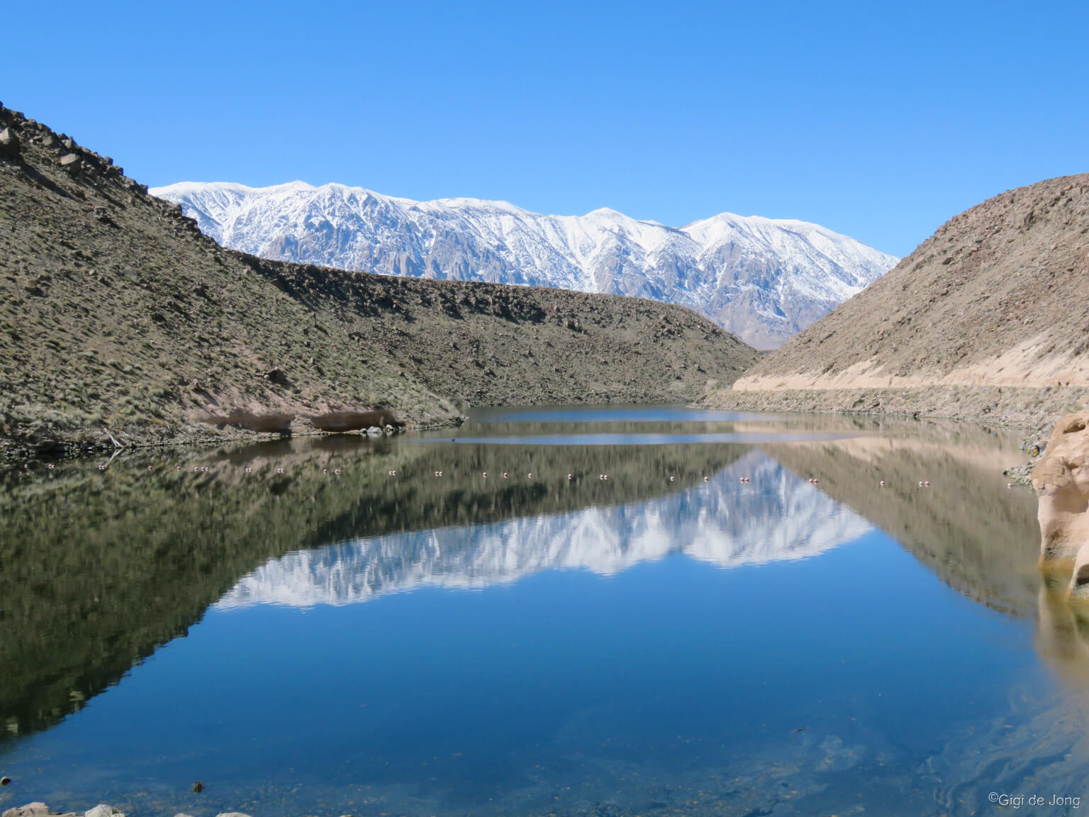
Lake Sabrina

Lake Sabrina Boat Landing
Lake Sabrina, pronounced Suh-BRY-nuh (no-one knows why – it just is,) is a gorgeous, blue lake that sits at just over 9,000 feet above sea level. The stark granite peaks of the Sierra Nevada, rise above the alpine forest that surrounds the lake. The lake level fluctuates seasonally and annually and spring is when the winter snowmelt begins to fill the lake for some of the best boating and fishing in the area. A quaint café and a beautiful boat landing with fish-cleaning station alongside the dam make this an easily accessible lake for safe, family-fun fishing.
From the junction of US 395 (Main St.) and W. Line St. (SR-168 W.) head west on W. Line St. for 19 miles, a 25-minute drive. Park in the turnaround at the road’s terminus or continue around to the overflow parking just few feet back down on the left. Access to Lake Sabrina is open from late spring to late fall and fishing is legal during sportfishing season from late-April to mid-November.
Pleasant Valley Reservoir
View from the dam at Pleasant Valley Reservoir
This deep body of water that weaves down the narrow mouth of the Owens Gorge Canyon is a year-round fishing destination. Spring is especially lovely here as wildflowers begin to bloom in the tablelands above the canyon. It’s also the time for the annual Blake Jones Trout Derby held here for over 50-years. For more information and to register visit our Fishing page here.
To reach the reservoir from downtown Bishop, drive north on US-395 N for 6.5-miles. Turn right onto Pleasant Valley Dam Rd. and drive for 2.4-miles until the road ends at the base of the dam. Park in the turnouts alongside the roadway and walk through the pedestrian gate and up the ramp to the right of the dam. There are access points for fishing along the entire length of the reservoir, with some requiring a little bit of scrambling. At 1.6-miles from the vehicle parking area is a ramp that provides easy access for small craft and float tubes.
Hiking
Take a walk on the wildflower side.
Inyo County is the second-largest county in California; it is also the county with the second-lowest population density in California. Add to that—a staggering 99% of land in Inyo County is public lands. That means…lots and lots of space to hike!
The Eastern Sierra is a pristine and diverse landscape of deserts and sand dunes, huge mountains and alpine forests, meandering rivers and tumbling waterfalls, spectacular sunsets, spring wildflowers and fabulous fall colors. It ranks as one of the most photographed regions in the USA.
While much of the high Sierra is inaccessible in winter and early spring due to snowpack, many wonderful lakeside trails, rocky ridge lines, and alpine canyons open for spring hiking—sometimes early in the season. Here are three very different trails that offer great hiking opportunities: the Druid Stones above Bishop on Coyote Ridge, Lower Rock Creek that tumbles down the Sherwin plateau, and Convict Lake loop trail that circumnavigates a lovely alpine lake with some sections accessible for wheelchairs.
Druid Stones
View of Bishop from the Druid Trail
Getting to the Druid Stones is definitely an uplifting experience. The ‘Druids’ are a large collection of impressive monzonite boulders that are well-liked by climbers, but not often frequented because of (by climbers’ standards) the long and steep ascent. The hike climbs about 1,700 feet in a little under 2-miles and delivers a bird’s eye view of Bishop and the Owens Valley below. The hike follows a fairly obvious trail from the base of the Coyote Ridge just off Bir Road, about 5-miles southwest from the center of Bishop. There are a few fairly steep sections, so wear your good shoes, or bring hiking poles for balance.
Follow W. Line St. (State Route 168) west from the center of Bishop to the traffic light at Barlow Rd. Turn left (south) and travel until you pass beyond the developed neighborhood and you reach a fork in the road. Take the right-hand fork, Bir Rd., and drive slowly for 1.7 miles. Turn left onto a dirt road toward the trailhead parking at the base of the hill. Park in a suitable clearing off the main road or dirt road and please do not crush the brush.
Lower Rock Creek

Hike Lower Rock Creek with your pup.
Lower Rock Creek trail weaves among tall Jeffrey pines and thick groves of aspen trees as it follows Rock Creek from the top of the Sherwin Plateau down the narrow canyon for about 8‑miles one-way. It is regarded as one of the best mountain bike trails in the region, but it also gives hikers the chance to experience the remoteness of a narrow canyon trail without having to hike into the high country. The trail is divided into three sections and it can be hiked up or downhill from any of the four access points.
Take an out-and-back hike as far you like from the lower trailhead at Paradise. To get there from downtown Bishop drive about 10-miles north on US-395 (N. Main St.) to the junction of Pine Creek Rd. and turn left. In less than 500-feet turn right onto Old Sherwin Grade Rd. Follow the road for 5-miles. At the sharp left hand turn where the road begins a climb through the settlement of Paradise, turn right into the parking lot for the lower trailhead. Follow the pedestrian signs for the trail. A vault toilet is available for use here.
Convict Lake loop (accessible)
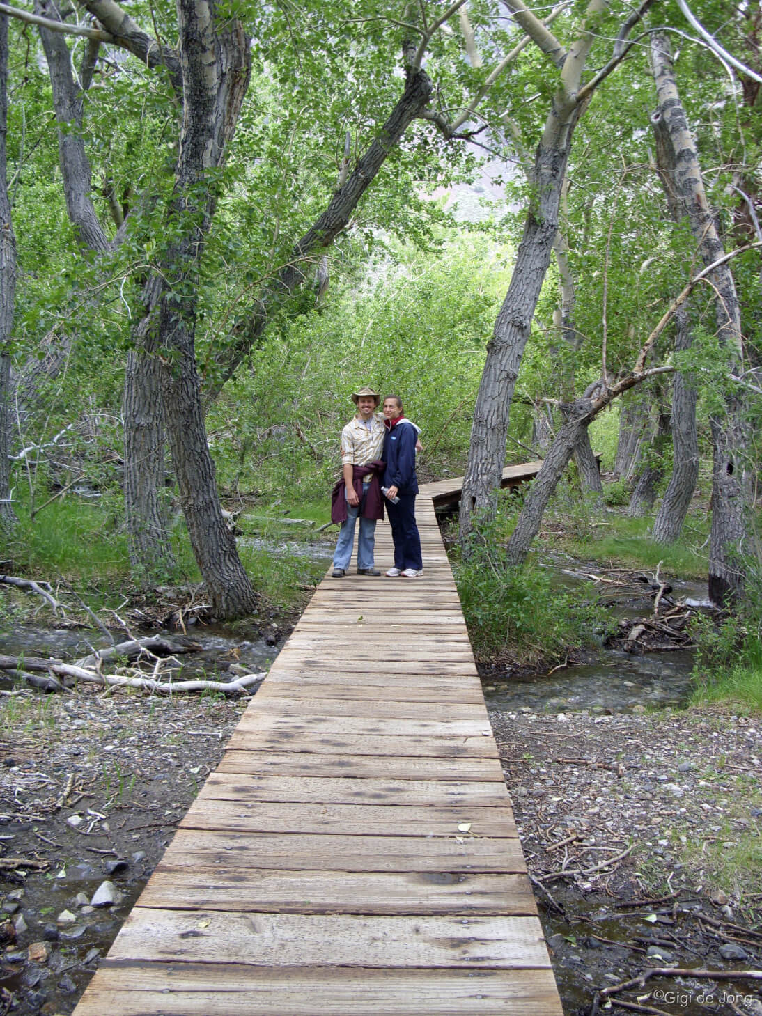
The boardwalk at Convict Lake
Convict Lake is often a prime natural skating destination in winter, so it may be late spring before its trail is clear of snow and ice for easy hiking. Once it is, is it magnificent. A 3-mile, mixed surface trail loops around the lake. A paved section along the eastern side of the lakeshore is wheelchair accessible with a fishing pier built over the water. A wooden boardwalk crosses where the creek it enters the lake and weaves through the aspen groves at the southern end of the lake. Dirt track makes up most of the loop along the water’s edge. The trail provides magnificent views of the lake, towering mountains, and forests in this glacial valley.
Situated 36-miles north of Bishop on US Highway 395 the drive is also well worth the trip. Just beyond Benton Crossing Rd. and opposite Mammoth Airport turn left onto Convict Lake Rd. and park at the Marina or the turnaround at the trailhead.
Trail Running
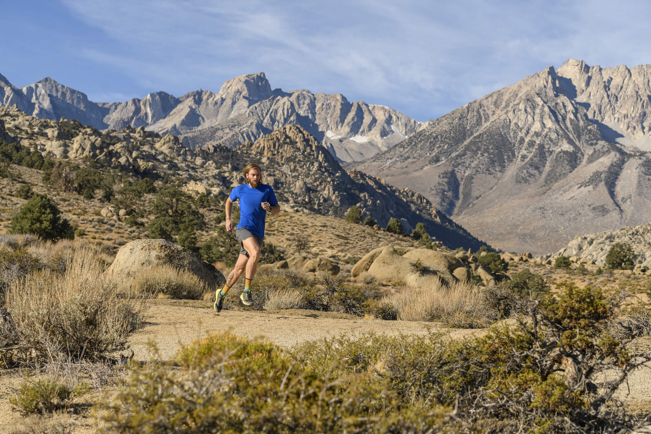
Endless variety for trail running in Bishop. Photo: fmarmsater
Bishop offers a vast array of trail running and mountain running options all year and spring is a magical time for great trail running here. It is, in fact, one of the best times of year to run in Bishop. The trails and running zones that are close to this beautiful mountain town are easily accessible and yet feel remote due to the pristine landscape in which it sits. Bishop has been named one of the top trail‑running towns in America!
Buttermilk Country is known as a destination for world-class bouldering and is fast becoming a world-renown trail-running destination. With its early history of mining and ranching there are numerous roads and trails that thread their way between the magnificent boulders here. Trails can be linked for a variety of results. Runners could aim for distance and minimal technical challenge or higher levels of difficulty depending on training requirements or personal satisfaction. These trails have varying surfaces, inclines, obstacles and a few stream crossings. Here are two trail recommendations in the ‘Buttermilks’—McGee Creek and Buttermilk-Tungsten Loop.
Buttermilk Country

Buttermilk Country Trail Running. Photo: Mike McDermott
At 6,400’, the Buttermilk area covers 325 acres of high desert meadow, unimpeded views of the Sierra Nevada and is surrounded by the Inyo National Forest. Two good springtime trail runs start from the same point at 1.8-miles along Buttermilk Rd. McGee Creek trail is a short loop on the south side of Buttermilk Country. The Buttermilk-Tungsten Loop trail is almost 12-miles of undulating dual- and single-track with almost 2,000-feet of elevation change.
Getting to the starting point for these two trails, drive about 7-miles west on CA-168 (W. Line St.) from downtown Bishop. Turn right onto Buttermilk Rd. and follow this wide, graded dirt road for 1.8-miles. Just beyond Starlite Rd. on the left, turn left into an obvious, wide clearing and park. McGee Creek trail follows the track to the left and Buttermilk-Tungsten loop begins along Buttermilk Rd. for the first 1.7-miles.
Be aware that all the trails in this area are multi-use trails and you may encounter hikers, bikers, dirt-bikers, pack animals, and vehicles on the dual-track road sections.
McGee Creek

McGee Creek trail run
McGee Creek tumbles down from Longley Lake below Mt. Humphreys. This run loops around a small wetland at the lower end of the creek with a short spur up toward Grouse Mountain. It is a little over 5-miles long with about 850-feet of elevation change. The beauty of this run is that it’s quiet and has a few fun obstacles along the way. A steep, sandy embankment of about 40-feet, a creek crossing that may be flowing but usually shallow, with last mile on Buttermilk Rd. to return to your vehicle.
Buttermilk-Tungsten loop

Buttermilk Tungsten trail running. Photo: Mike McDermott
This trail delivers a commanding view of the Sierra Nevada to the west and the White Mountains to the east. It also drops down into sandy washes and rolls along single-track trails that weave around the rocky outcrops of these hills. Begin the run along Buttermilk Rd. going west for 1.7‑miles. Just beyond the climbers’ parking area turn right and run up the hill for 1/4-mile. The trail drops down the west side of the Buttermilks and 2-miles along, just as it starts to climb, look for a single-track heading sharply off to the left. The trail rolls around the rocks for 4-miles then joins up with the hard-packed dirt of Tungsten City Rd. At mile 8 turn right onto a well-used old mine road and keep on a southerly tack as you traverse the hillsides. There are many tracks and trails in this area, so be sure to plot your exact route.
Biking
Miles and miles of beautiful biking roads. Photo: Mike McDermott
Biking in Bishop is fantastic all year. As the seasons change the best biking destinations are elevated to another level. Spring biking moves from the valley floor, which is best for winter biking, to the midlands range which includes foothills, canyons, and the escarpment. As the season warms up, the opportunity to climb the winding canyon roads or run the downhills trails also goes up.
There are seemingly endless roads to ride and trails to bike all with spectacular scenery, easy access, and light use. Here are two super spring rides for a fun morning or afternoon of biking Bishop. Try road bike Pine Creek Canyon and mountain bike the historic Wagon Wheel trail. Take a look at our road biking page here and our mountain biking page here for lots more information, with maps and descriptions, about biking in Bishop.
Pine Creek Canyon – road bike
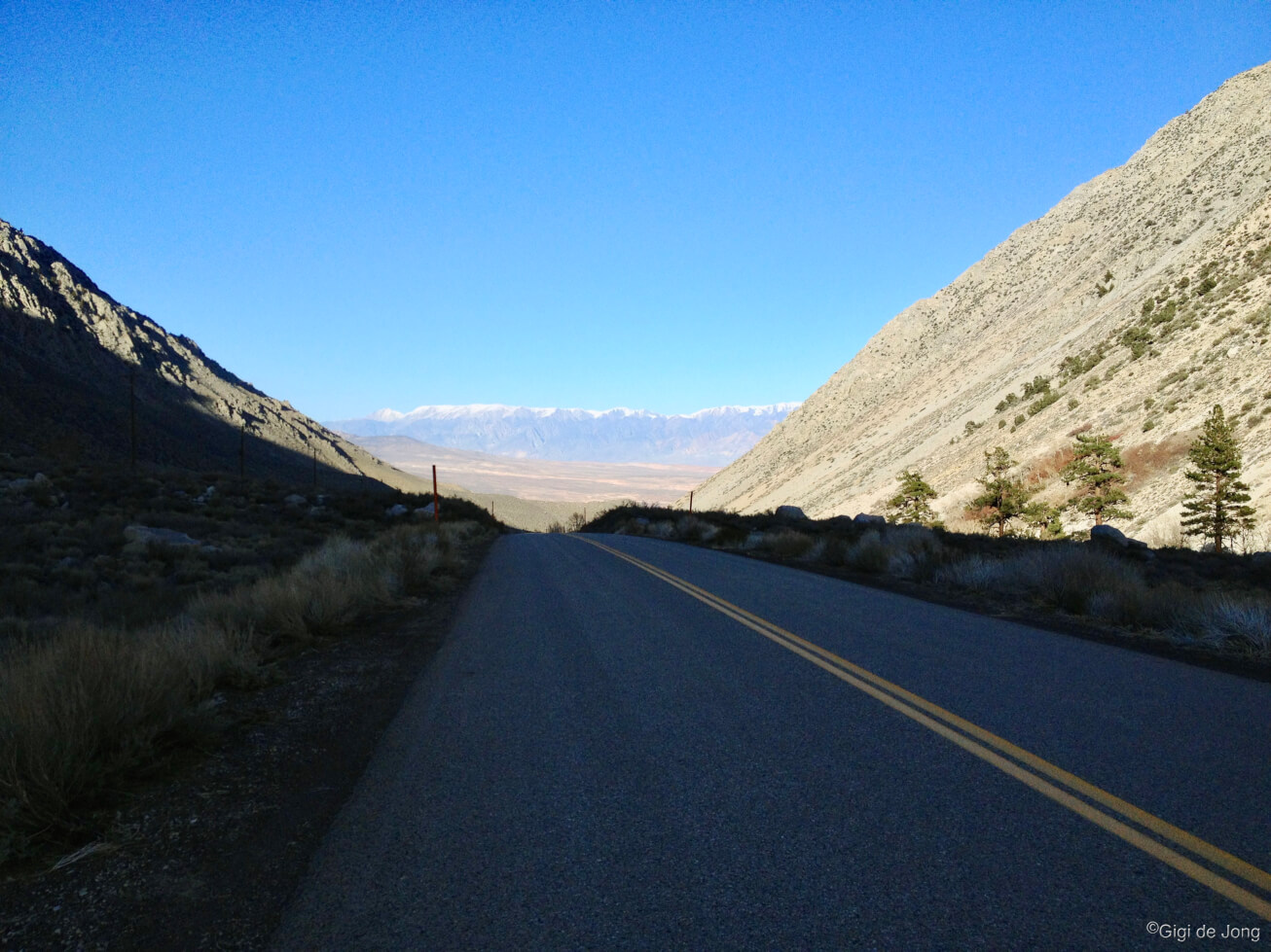
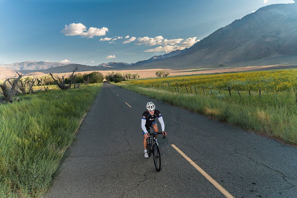
Cool and quiet late afternoon on Pine Creek Rd.
Pine Creek canyon is a spectacular example of a deep glacial canyon. The canyon walls rise high and steeply on either side and the mouth is bordered by glacial moraines. Cycling this canyon in spring will elevate your spirit and your body. The sky is deep blue above the towering walls of the canyon. The sound of the burbling creek flowing below is quiet and soothing. Late afternoon in early spring is best when the canyon warms a little as the day progresses. An early morning in late spring will be invigorating and possibly infused by the sweet smell of spring wildflowers.
From Bishop head north on US-395 for 10.3-miles to the junction of Pine Creek Rd. Turn left and follow the road for 9.5-mies to its end at the Pine Creek Trailhead. For a detailed description of this ride follow this link.
Wagon Wheel trail – mountain bike

Riding the Wagon Wheel trail
This trail runs along a bit of fascinating Owens Valley history. In 1870 James L.C. Sherwin made a rough road from Sherwin Meadows, which is now the settlement known as Swall Meadows, to haul lumber down to Round Valley. Some years later he built a toll road, the High Road, that connected Round Valley with the historic Mammoth City. For many years, huge mule-drawn wagon trains weighing many tons cut through the Bishop Tuff, which is the volcanic rock that forms this massive escarpment. Their passage left deep scars in the rock and this is now part of the current Wagon Wheel biking and hiking trail.
From Bishop drive 30-minutes to Sky Meadow Rd above Swall Meadows. Take US-395 North for about 10-miles, turn left at Pine Creek Rd. and immediately turn right onto Old Sherwin Grade Rd. Drive 8.7-miles then turn left onto Swall Meadows Rd. In ½-mile turn right onto Sky Meadow Rd. About 0.6-miles further turn into the large, obvious, dirt clearing and park. Get a detailed description and map of the ride here.
Climbing

Rock climbing in Bishop is world class. Photo: Jeff Deikis
Rock climbing, as with so many other great outdoor activities, is a year-round endeavor in our big backyard. The forces that shaped this marvelous landscape here created a deep, steep-sided gorge, a tall rocky scarp, a field of erratic boulders, and massive alpine cliffs; all within easy reach of a bustling, western town.
Spring is probably the most changeable season of the year. Temperatures fluctuate, windspeed varies, and precipitation is unpredictable. But, this makes for amazing climbing! When one location is not prime for climbing another is just perfect. Here are two superb spring climbing destinations. The Owens Gorge is a deep, steep-sided canyon about 10-miles long located northwest of Bishop. It is sheltered and when one wall is chilly and shaded the other is warm and sunny. Directly north of Bishop, at the southern edge of the 300-foot-high Volcanic Tablelands are numerous washes filled with perfect boulders.
Owens Gorge

Owens River Gorge has routes for everyone from beginners to more advanced climbers.
The Owens Gorge is California’s most concentrated sport climbing area, located just northwest of Bishop, and provides over 500 routes. It is a favorite destination for sport climbing for beginners and experienced climbers alike. There are two good routes to access the most popular stretches of wall and both involve a short hike–one by road, which is closed to vehicle traffic, and the other a steep scramble down a rocky gully with roughly built steps that is maintained by the local climbing community.
A drive of about 12-miles from Bishop north on US-395, then a further 5-miles along Gorge Rd. will get you to the parking areas for these trails.
Volcanic Tablelands
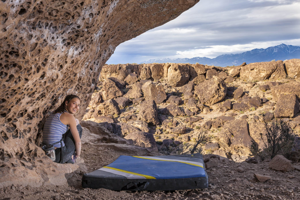
There are many varied problems to try out in the volcanic tablelands.
This large area was formed by a huge volcanic explosion 760,000 years ago and, thereafter, eons of rushing water and cutting winds have eroded washes into the tablelands at the edge of the 300-foot-high escarpment. Two washes, known as the Happy Boulders and Sad Boulders, have been sculpted, cracked, and pockmarked to provide an endless variety of bouldering opportunities. The Happy Boulders offer more warmth and shelter from the wind on a blustery day and the Sads can be perfect on hot days due the narrow, catacomb-like channel. A short, but fairly steep trail leads into each canyon and the views out across the valley toward the towering Sierra Nevada are awe-inspiring. Climbing on the tablelands offers physical climbing on positive holds, a perfect transition from gym climbing to the outdoors.
Getting here is a short 4-minute drive from the center of Bishop north on US-6 to the junction of 5 Bridges Rd. Turn left and follow the road for 2.5-miles as it curves westward to where the pavement ends at an intersection with multiple dirt roads. Turn left onto Chalk Bluff Rd. and drive for about 1.4-miles to the Sad Boulders and 0.8-miles further to the Happy Boulders. Parking is along the roadside and a vault toilet is available for use at the Happy Boulders parking area.
Motor Touring

Quiet and scenic motor touring around Bishop
Motor touring in the Eastern Sierra has something for every driver and every type of vehicle all year. Spring is wildflower season and this is a super special time to go for a drive; mornings are cool, afternoons are warm, upper elevation roads are clear of snow and ice, and traffic is light—even on the highways. These three tours will get you off the beaten path and open up a world of incredible sights.
Less than 5-miles from downtown Bishop, a drive along Fish Slough Rd. and Chidago Canyon Rd. will get you out onto good, graded dirt and give you a sense of adventure. Another adventurous drive will take into the back and beyond, to Eureka Valley, but you never have to leave the pavement—unless you want to and then you can go all the way in to see the Eureka Dunes. Both these drives can be done in a morning or afternoon from Bishop. A little further afield and a commitment to multiday motor touring is a trip through Death Valley National Park via Titus Canyon.
Fish Slough & Chidago Canyon

The Headless Miner of Chidago Canyon
Fish Slough is a protected riparian area and one of the richest wetland floras in the Great Basin with over 125 plant species, including eight rare species. Fish Slough Rd. runs north along the Volcanic Tableland that was formed by a massive volcanic eruption 760,000 years ago. This is a vast untamed plateau of rocky outcrops, water-gouged washes, and weather-beaten canyons. The White Mountains rise 10,000-feet to the east and the rugged Sierra Nevada rise even higher to the west. It’s a huge and impressive landscape with numerous natural and cultural sights.
Drive north from Bishop for about 2-miles and turn left onto 5 Bridges Rd. and continue for 2.5‑miles to a multi-road intersection at the base of the Tablelands. Turn right onto Fish Slough Rd. Cruise for 17-miles then turn left onto Chidago Canyon Rd. and slice through a narrow, shallow, steep‑sided gorge. As the gorge opens up 3-miles further stop and look for the ‘Headless Miner’ etched in the rock. The scenery is evocative of the old west and the hardships endured by the pioneers who first encountered this ancient landscape. Return along Chidago Canyon Rd. and south onto US-6 to keep the tour time short. A longer loop exists by continuing east and returning on Casa Diablo Rd., but this may need more preparation to pinpoint the route and establish the road condition. It is possible to get stuck and lost out here; ask a local to help you plan this loop.
Eureka Valley Dunes
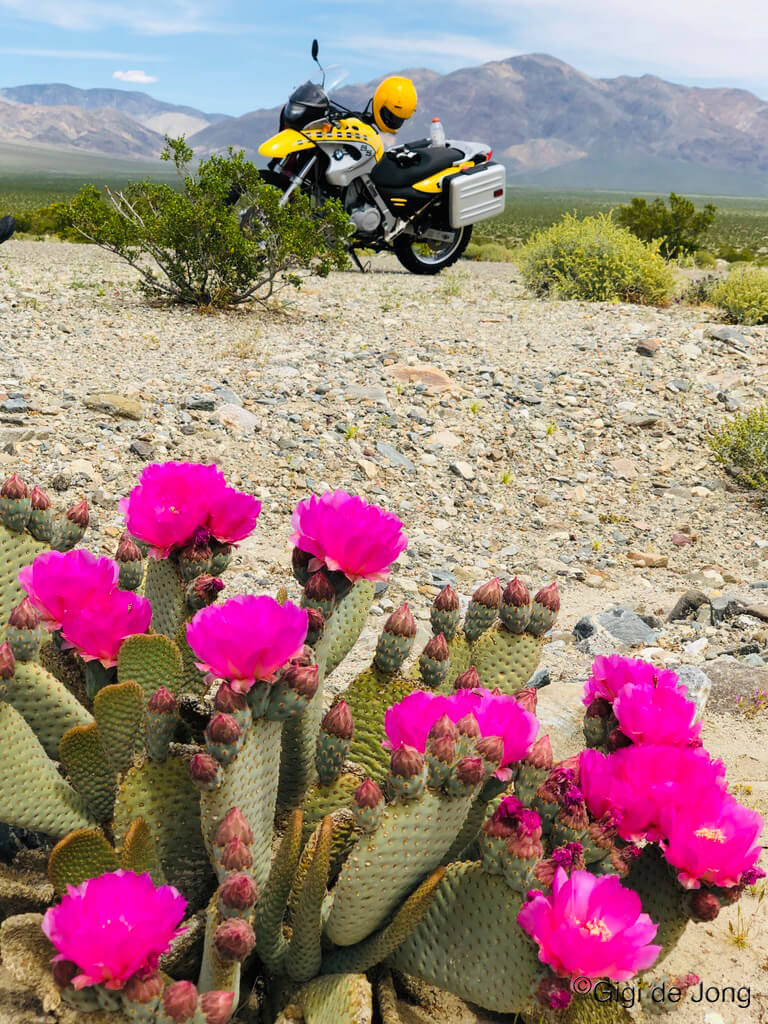
Moto tour to Eureka Valley in Spring
The Eureka Dunes are the tallest sand dunes in California, rising to about 680-feet from the valley floor. Situated in the northwest section of Death Valley National Park these dunes cover an area of about 3-miles long and 1-mile wide and lie in an enclosed basin at 3,000-feet above-sea-level (ASL), the Eureka Valley. This valley and the dunes are more easily accessed from Bishop than from any other route which all cross very rugged OHV terrain in the remote northern areas of the park.
This is a marvelous spring drive (on two wheels or four wheels) and clearly demonstrates the differences that occur with elevation change. Head south out of Bishop for 14-miles and turn left (east) onto CA-168 East. Drive for 2.3-miles and turn right onto Death Valley Rd. This paved road follows the contours of ancient washes that cut between the peaks of the White Mountains to the north and Inyo Mountains to the south. It also climbs to 7,600-feet before it drops to 3,400-feet where it enters Eureka Valley. The pavement ends 30-miles along and the Eureka Dunes can be seen in the distance. They appear small in the enormous landscape. To get up close and see how big they really are is best done as an overnight trip with a well-equipped vehicle capable of rough, dirt roads. Otherwise turn around at the pavement and head back to Bishop. This out-and-back tour is less than 3-hours’ drive time. Be aware that even in spring when daytime temperatures can be warm to hot, the nighttime temps may fall well below freezing.
Titus Canyon, Death Valley
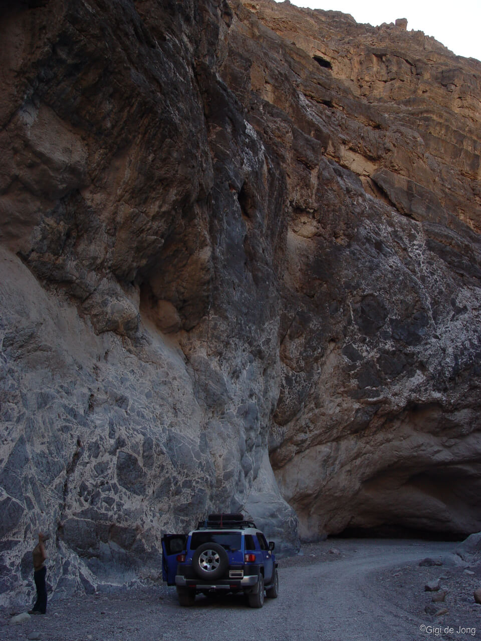
The narrows in Titus Canyon, Death Valley National Park
Spring may be the best time to visit Death Valley National Park and, if the conditions are good, take a drive through Titus Canyon to get there. This canyon has it all—a ghost town near the start point, wildlife, rare plants, colorful rock formations, and a deep and steep narrows just before the exit. It feels remote, wild, and ancient. But you’ll probably not be alone as it’s the park’s most popular backcountry road.
Any trip to Death Valley National Park should be well planned. It is huge and the amenities outside of Furnace Creek in the main valley are few and far between. It is one of the most awe‑inspiring places for motor touring on the planet. Titus Canyon is a one-way drive from east to west beginning just outside of Beatty, Nevada and ending at the northern end of Death Valley, about 35-miles north of Furnace Creek. A round trip from Bishop is certainly doable in a day with a total drive time of about 7-hours. But to really experience this epic tour, take your time and see the sights along the way and plan camping or lodging in the park.
Natural History Sites
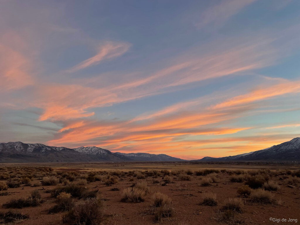
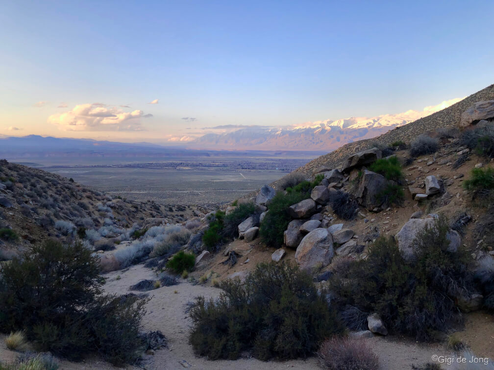
Wild and wonderful Owens Valley at sunset. No filter!
There are few places in the world where evidence of the natural history of a region is more obvious and interesting than in the Eastern Sierra. We’ve dedicated an entire page here to describe, map, and guide visitors to the many awe-inspiring sights of our very big backyard. Spring is a wonderful time to explore some of these unique features of our landscape. It’s a time when rejuvenation occurs and wildflowers bloom spontaneously and extensively in this high desert.
Early spring before the daytime temperatures begin to soar in the Owens Valley is a perfect time to visit a fascinating feature known as Fossil Falls. It’s also a great time to learn about the Owens Lake (now dry) and how it still supports a large variety of birdlife. A springtime auto tour along US-395 that cuts through the heart of the Eastern Sierra reveals the most striking natural feature of the region—the mighty Sierra Nevada. Within this range, just west of Lone Pine and gateway to Death Valley and the lowest point on the north American continent, is the highest point in the contiguous USA—Mt. Whitney. Late spring is fine time for drive to Whitney Portal to get as close as possible to this 14,505-foot giant in a vehicle.
Fossil Falls
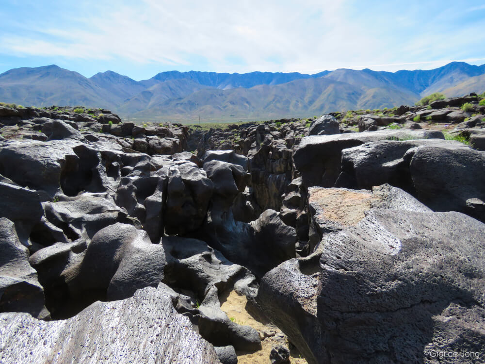
The chasm at Fossil Falls.
This geological wonder is a magnificent example of the forces of nature that shape our world. Technically it’s not a fossil and water no longer falls here in any abundance. This surreal canyon of basaltic black lava rock is now a natural work of art, beautifully sculpted by eons of rushing water from a prehistoric age. The chasm is almost unnoticeable in the flat lands of the valley floor from a distance. But up close it unfurls in folds of glossy, black rock that are both beautiful and strange. The rock is smooth and shiny and distinctly different from the surrounding landscape. It is stark evidence of a time when the valley was wetter and of the inevitability of change.
It is easily accessed from US Highway 395 just 5-miles south of Coso Junction along a one-mile dirt road and then a short walk of less than ¼-mile to the mouth of the crevasse. In spring it may also be surrounded by fields of wildflowers.
Owens (Dry) Lake

Me, myself, and I. Gull takes off over Owens Lake pond.
The Owens Valley, also known by its traditional name, Payahǖǖnadǖ – place of flowing water, was once a wet, flood plain where water flowed into and filled a large lake at the southern end of the valley. Much of the water that is produced by the runoff from the Sierra snowpack is diverted to Southern California today, but water still flows down the Owens River as it meanders its way down the valley. Along the way it seeps into the aquifer and terminates in large, maintained ponds in what is now the dry lakebed of the Owens Lake. These newly restored wetlands are home to a remarkable variety of resident and migratory birds.
The Owens Lake Trails Plaza, located 11-miles southeast of Lone Pine, is a recently dedicated art installation at the lake. It is a tribute to the history of the Owens Lake and its revitalization. This plaza captures the essence of the landscape and the likeness of its inhabitants–the myriad birds that now feed, nest, and migrate through the region. The interpretive signage pays tribute to the first people of this region and points to the landmarks that dominate the skyline. Detailed information on the development of this lovely plaza can be read and downloaded here. Getting to the plaza is a short drive from Lone Pine south on US-395. Turn left (east) onto CA-136 East toward Death Valley. Look for a sign at 8.1-miles along and take a slight right onto a dirt road and follow the road for about 1.5-miles to the plaza.
Mt. Whitney from Whitney Portal
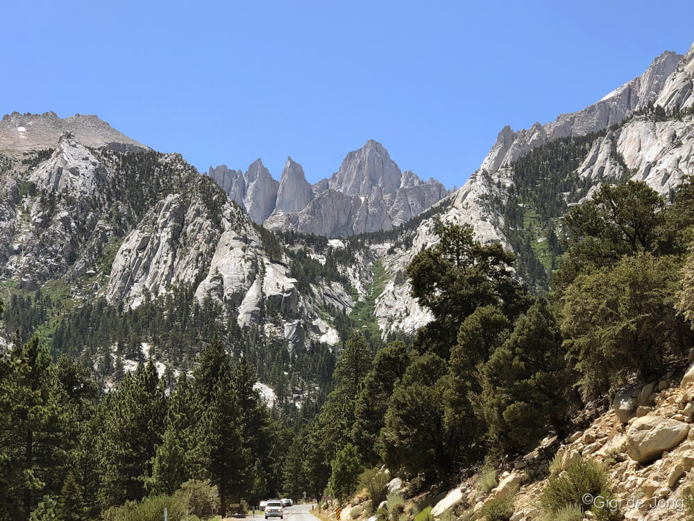
Mt. Whitney from just below the portal
Sometime in late spring, when the snow is cleared, the road to Whitney Portal will be opened to the public to drive to this special scenic spot. The portal is where the trailhead to climb this 14,505-foot mountain begins and ends. It is a mecca for high altitude hikers and climbers as it is the highest point in the lower 48 states. The hike requires experience, planning, and a permit to undertake, but the drive up here can be a fun half-day adventure for the whole family.
From Lone Pine turn west onto Whitney Portal Rd. and take a leisurely 20-minute drive up this winding mountain road. The Whitney Portal Recreation area has 3 campgrounds with some sites on a first-come-first-served basis, a large fishing pond, an impressive waterfall, a café and store, vault toilets, and a picnic area.
Museums & Cultural Sites

Memorial at Manzanar National Historic Site
The history of this region is represented in the ruins and artifacts of times gone by and in the museums and heritage sites that display and protect the stories of those who were here before. It is also depicted in murals that adorn the buildings of these picturesque western towns.
Mining was one of the driving forces of the California boom in the mid-1800s. Remnants of a once‑prosperous silver mine at Cerro Gordo high in the Inyo Mountains above the Owens Lake are the Charcoal Kilns that are slowly crumbling in the desert heat and sun near the old lakeshore.
The tragic history of the internment of almost 120,000 Japanese American citizens and resident Japanese aliens in the Owens Valley during World War II is preserved at Manzanar National Historic Site.
Charcoal Kilns
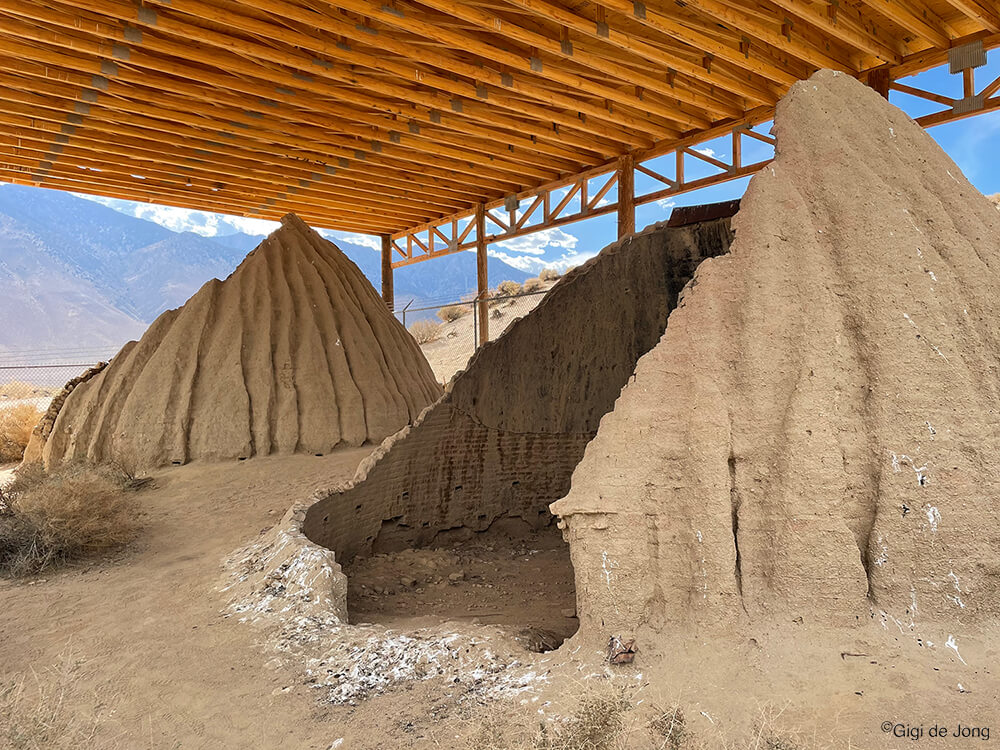
Ruins of old charcoal kilns near Lone Pine.
From the 1860s to the 1870s the Cerro Gordo Mine produced $20-million dollars-worth of silver and lead bullion; it holds the distinction of being the most prosperous mine for those metals in California history. Early on in its short but prosperous heyday the mining operation denuded the forests high in the mountains where the ore was mined. The company set about sourcing fuel for their smelters from the valley. Charcoal was the preferred fuel of the day and so the kilns were built at the mouth of Cottonwood creek on the lakeshore. Trees, which were abundant at that time, were cut, cooked in the kilns, shipped across the lake, and transported by horse-drawn wagon up the mountain road to the mine.
Today the remnants of these unique clay-brick charcoal kilns are protected at their original site along the now dry Owens Lake. From Lone Pine head south on US-395 for 13-miles. Turn left at the sign for the Cottonwood Charcoal Kilns and follow the dirt road for 1-mile.
Manzanar National Historic Site

Manzanar National Historic Site.
During World War II the US government ordered the internment of almost 120,000 Japanese American citizens and resident Japanese aliens. Men, women and children were forced to leave their homes and detained in remote, military style camps. Here, at what was then called the Manzanar War Relocation Center, which was one of ten such camps in the US, over 10,000 people spent all or part of WWII.
Now this large tract of land (814 acres of an original 6,200 acres), with a few remaining original structures, and the Manzanar Visitor Center is a reminder of a period in our history that should not be forgotten. The center has 8,000 square feet of exhibits, a bookstore, and a theater that shows the award winning 22-minute documentary, Remembering Manzanar. The center’s extensive display covers over a century of history from 1885 to the present, with its primary focus that of the internment camp. Among its exhibits is a large-scale model of the Manzanar War Relocation Center crafted by former internees, historic photographs, audiovisual programs, and artifacts. A centerpiece of the exhibit is a large graphic with the names of over 10,000 Japanese Americans who spent many years in this detention facility.
One Camp, Ten Thousand Lives; One Camp, Ten Thousand Stories.
The Manzanar National Historic Site is located about 50-miles south of Bishop on US-395 between Independence and Lone Pine.
Bishop Mural Meander
 On buildings throughout Bishop the history of the Owens Valley is depicted on the exterior walls in the form of historically accurate and visually beautiful murals. The Bishop Mural Society was established in 1997 “to display our heritage in a spectacular outdoor art gallery surrounded by natural beauty.” Today there are fifteen murals, the most recent of which is made up of 421 sculpted ceramic tiles and mosaic, created by 216 community members. The society is a founding member of the California Public Art and Mural Society; mural projects are ongoing through the generous support of the community. Pick up a map at the Bishop Visitor Center or follow the links online on the society’s webpage.
Events

Climb by day. Party at night.
There’s always something happening in Bishop and up and down the Eastside. Here are two excellent spring events to get you outdoors, building community with your fellow sport enthusiasts, and learning more about our beautiful big backyard.
Game to fish? Come join in the Annual Blake Jones Trout Derby.
Game to climb? Don’t miss out on the Annual Flash Foxy Climbing Festival (sells out every year).