
Late fall hike with early snow. Photo: @basakprince
Fall is arguably the most beautiful season of the year in the Eastern Sierra. It begins with an almost imperceptible change and the air feels refreshingly smooth and silky on the skin. A magical light has a clarity and crispness that brings colors into brighter focus. Lethargy is replaced by energy and, although the days begin to shorten, the available active hours increase as temperatures decline. It’s time for fabulous fall color spotting.
It’s also a time when just about every outdoor activity in our big backyard is available, accessible, and fun for the whole family. For photographers this is the magical season. Hikers, bikers, and trail-runners have near-limitless options to choose routes and trails from easy to strenuous and short to long. The season opens for rock climbing and bouldering; sport and trad areas are great in fall as temps begin to cool. Motor touring is magnificent. Fishing is fabulous. Get a little rest & relaxation, see the sights, pop into a museum, and grab tickets to the best fall fun in the region.
Make sure to check road conditions for sights and activities in the high country. Fall is very unpredictable. Dress in layers and have plenty of water and snacks with you. Always tell someone where you’re going and when you expect to be back.

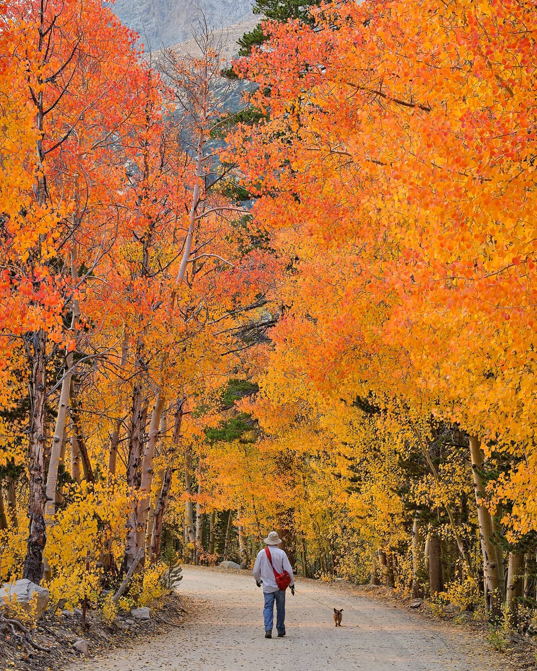
Go leaf peeping in Bishop Creek Canyon OR mountain bike Lower Rock Creek trail under trees of shimmering gold.

Fall Color Spotting

North Lake rim. Photo: Elliott McCucken
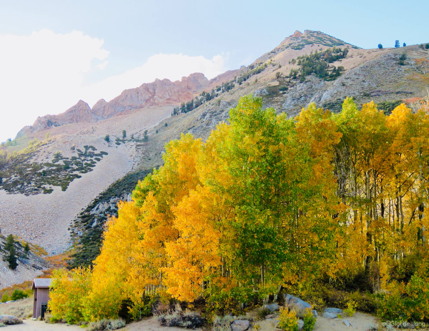
Fall is long in the Eastern Sierra. The topography of the region provides a slow shift into winter that starts first at the higher elevations and descends slowly over the open plains of the Owens Valley below. The color change begins high too, first in the canyons and alongside lakes and streams in the mountains high above Bishop; then it flows down into the Owens Valley many weeks later as the nights grow shorter and temperatures colder.
There are many wonderful and easily accessible places to see fall colors. Bishop Creek Canyon is one of the most beautiful places in the state, if not the country, to witness the magnificent display of fall colors. Another is Lower Rock Creek Canyon. For detailed information on all the fall colors in our area take a look at our page dedicated to all things fall colored here!
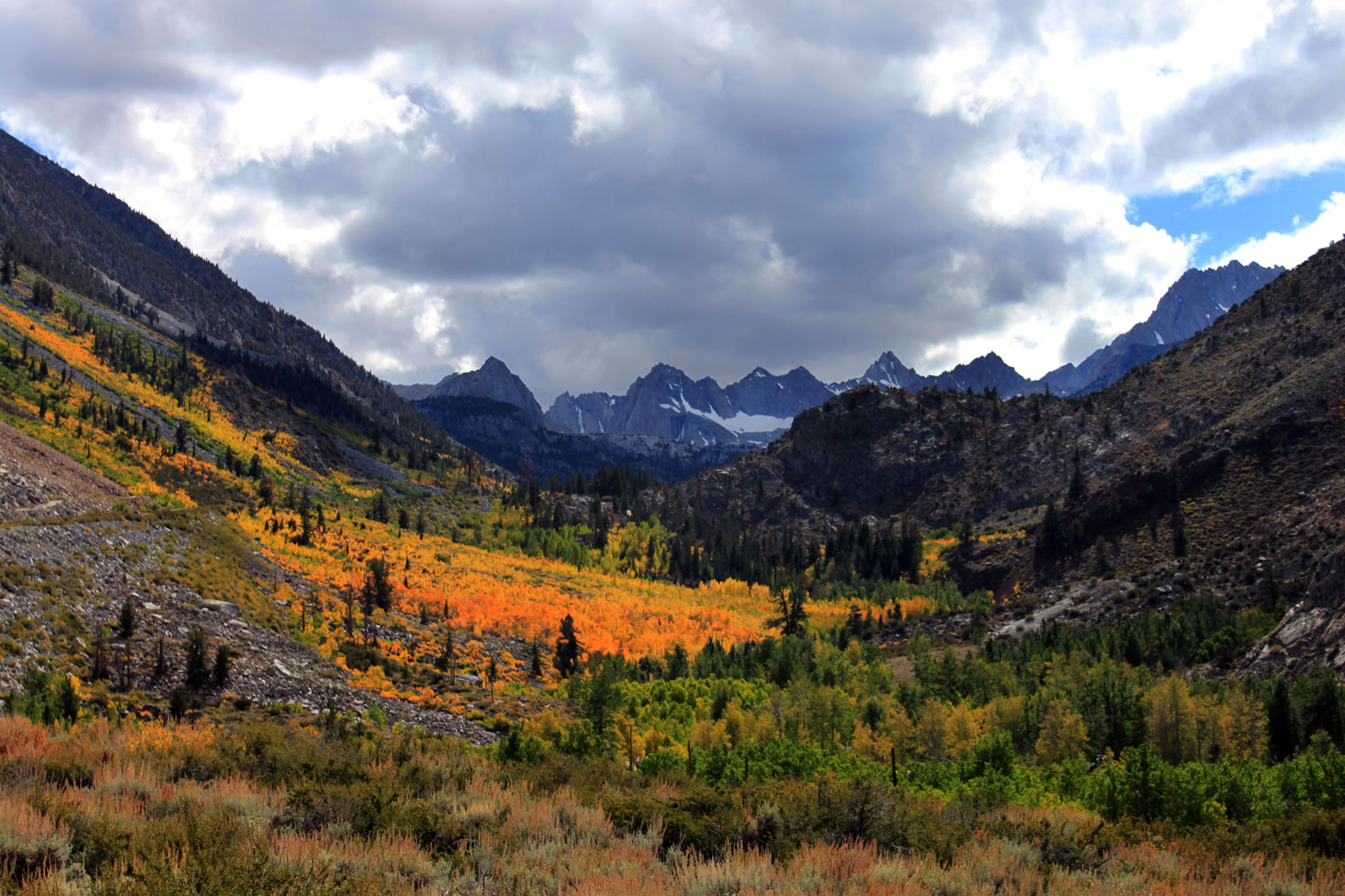
Bishop Creek Canyon
A short journey of no more than 20-miles west of Bishop on CA Highway 168 W. will take you well into the rugged high country. This is the place to start your fall color spotting. From a few days to a week or more before the autumnal equinox, which occurs every year on September 22nd or 23rd and occasionally on either the 21st or 24th, the color change can begin.
Take a look at our comprehensive Fall Colors page here for details on this area and many others.
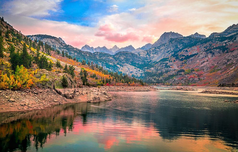
 South Lake road near Tyee trailhead, late afternoon early fall. | South LakeIn early fall, mid- to late-September, the swathes of color are almost uniformly yellow with hints of orange and red. At South Lake the gray granite crags soar above the luminous yellow forest in stark contrast. As the season continues the color deepens to warm orange and crimson with the deepest fall colors materializing in abundance if the growing season has been good. Head west on CA Highway 168 W (W. Line St.) for 15-miles and turn left on South Lake Rd. In 7-miles you will reach the parking area for the lake and trailheads. Along the way numerous turnouts and parking areas will provide incredible views of the canyons that will be awash with fall color. |
 Sabrina Basin in Fall. Photo: Bert Dennison | Lake SabrinaLake Sabrina and many sweet spots along the road to the lake that offer moments of magic where colors blend and pop to highlight the natural landscape. Reflections on rippling ponds create impressionist effects worthy of Claude Monet. The grandeur of the lake and the contours of the craggy mountains are accentuated by the patches of color where trees cling to the rocky mountainside in colorful defiance of gravity. Getting to Lake Sabrina is lovely 19-mile drive from the center of town along W. Line St. to where CA-168 W. ends at the parking area above the dam. |
 Fall colors at North Lake | North LakeNorth Lake is famous among Mac OS users for the hero shot on the High Sierra operating system. It’s real and it happens every year in varying shades and magnitudes of bright yellow, orange, and red. Sometimes early snow will dust the peaks rising above the color like frosting on a colorful, chocolatey layer cake drizzled with berry syrups. It’s a feast for the eyes. From Bishop drive west on CA-168 W (W. Line St.) for 18-miles. and turn right onto N. Lake Rd. Follow this narrow, winding road—which is part paved and part dirt—until you reach the day use parking for North Lake. |
Lower Rock Creek

Lower Rock Creek is iridescent in fall.
In early fall a short walk along the upper section of Lower Rock Creek will present displays of shimmering gold as the aspen begin to turn. A little later in the season a hike up from the lower trailhead will show the colors of the season in a mixed deciduous and evergreen forest along the banks of the creek. It’s quiet and calm in this deep canyon and although near to the settlement of Paradise, it has a wonderful remoteness and closeness to nature.
From downtown Bishop drive north on US-395 for 23-miles. Turn left onto Lower Creek Rd / Old Sherwin Grade Rd and within 500-feet turn right into a small parking area alongside the road. The upper trailhead begins on the opposite side of the road. Walk a few hundred yards down the trail and into the creek side forest. Or drive down the winding canyon road and pull over into one of the many turnouts here and there to view and photograph the fall color. Follow Lower Creek Rd / Old Sherwin Grade Rd all the way (8-miles) down the escarpment to the lower trailhead in Paradise.
To get to the lower trailhead from downtown Bishop drive about 10-miles north on US-395 (N. Main St.) to the junction of Pine Creek Rd. and turn left. In less than 500-feet turn right onto Old Sherwin Grade Rd. Follow the road for 5-miles. At the sharp left-hand turn where the road begins a climb through the settlement of Paradise, turn right into the parking lot for the lower trailhead. Follow the pedestrian signs for the trail. A vault toilet is available for use here.
Fishing

A great catch out of South Lake. @fishstorylori
Fishing is fabulous in fall! All lakes and streams are open until November 15th and options abound. Drive to any accessible lake and trailhead in the nearby Sierra Nevada, fish any of the creeks along the way, or hike up into the high Sierra and fish in remote, mountainous, alpine settings. Be aware that storms can roll in quickly and heavily so be prepared with extra layers, food, and gear. Make sure you let someone know where you’re going and when you expect to be back.
Two great safe, easy and accessible fall fishing locations are Intake 2 in Bishop Creek Canyon, best in early fall, and the Owens River in late fall. You’ll catch more than just fish; you’ll catch some of the most beautiful fall colors in the state.
Intake 2 – early fall

Intake 2 in Fall. @ralph_a._heim
Located in the heart of fall color country, this beautifully maintained reservoir has all the rustic amenities an avid angler could want or need. Paved road access, plenty of parking, a wheelchair accessible fishing pier, a trail all the way around the lake, vault toilets, picnic benches, trees, and regular seasonal fish planting of catchable rainbow trout.
The drive west on CA‑168 (W. Line St.) from Bishop takes 20 minutes to the reservoir nestled in Bishop Creek Canyon at an elevation of just over 8,000 feet. The lake is usually accessible all year, depending on the snowpack, but fishing is only allowed during sport fishing season and licenses are required. Make sure to check out all rules and regs here. Licenses can be purchased in many Bishop stores. The California Department of Fish and Wildlife (CDFW) offers two Free Fishing Days a year. Check it out. Get started.
Owens River – late fall
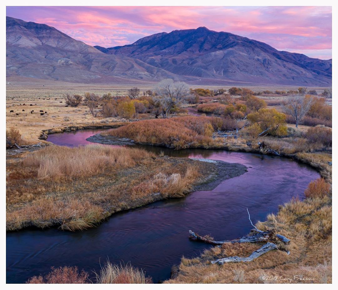
Late fall evening along the Lower Owens River. @sierraimpressions
The Lower Owens River meanders down the Owens Valley from the mouth of the gorge, which it cut during the last 750,00 years on its way down from its headwaters just north of Mammoth Lakes. This long, lazy river covers 55-river-miles from Pleasant Valley Dam to Tinemaha Reservoir compared to a straight-line distance of 29-miles. It weaves sinuously around the town of Bishop and is joined by tributaries that flow down from the massive Sierra Nevada to the west and broaden into pools and ponds at points along its journey south.
Fishing in late fall in this lovely, lazy river is simply stunning. The huge cottonwood trees that dip their roots in the wet, fertile soil of this ancient flood plain, known by its traditional name, Payahǖǖnadǖ – place of flowing water, wear golden crowns and wave gently in the autumn breeze.
There are accessible and beautiful spots to fish just 3-miles east of Bishop where CA-168 E (E. Line St.) crosses the river. Turn right at the dirt road just before the bridge and park along the riverbank at any one of the many tracks and turnouts along this 3-mile stretch of gravel road that parallels the river south to Warm Springs Rd. Or head to Pleasant Valley Reservoir, 6-miles north of Bishop just off US-395. Did you know that fishing is legal all year in the reservoir and all along the Lower Owens River?
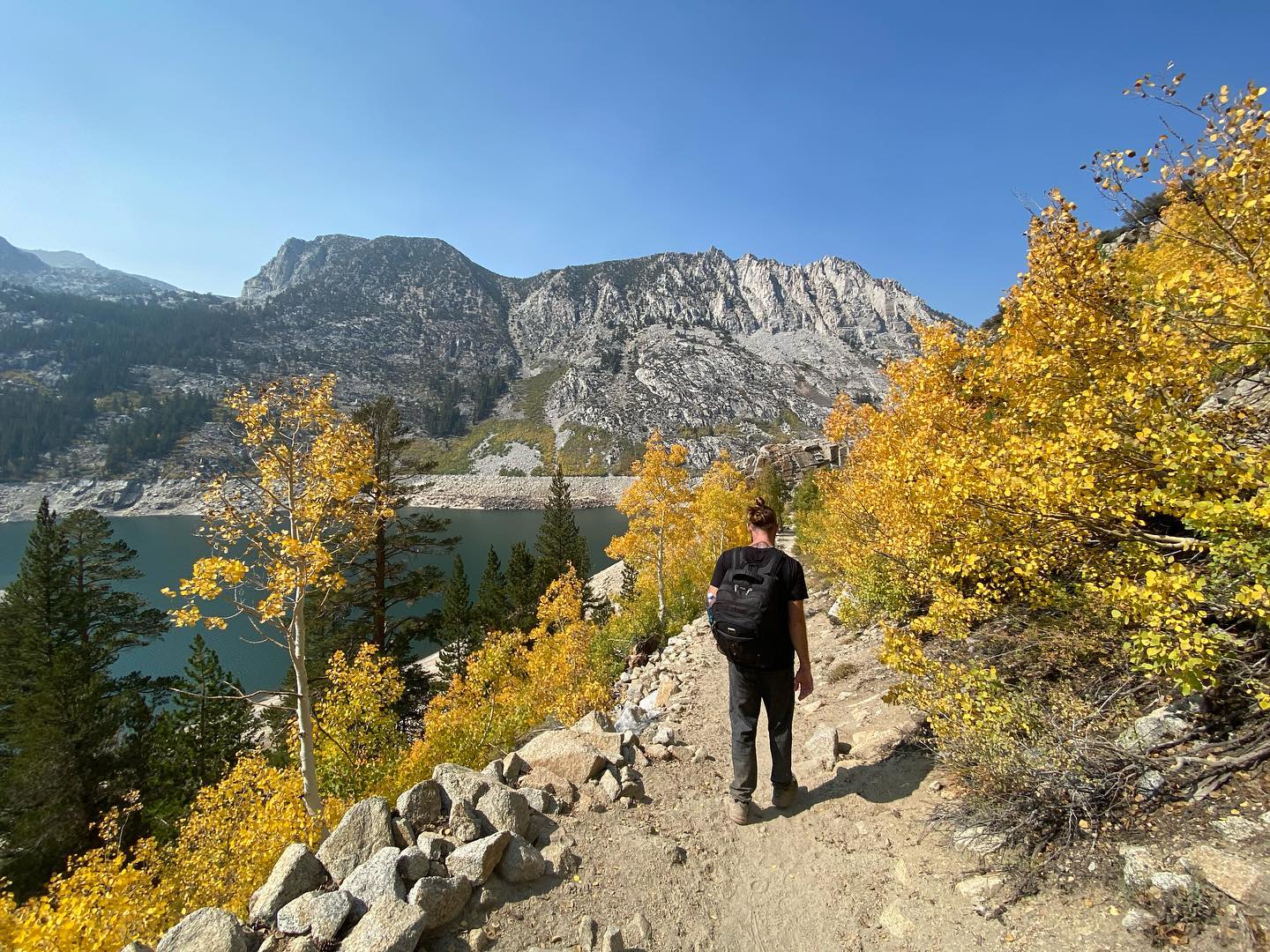
Hiking
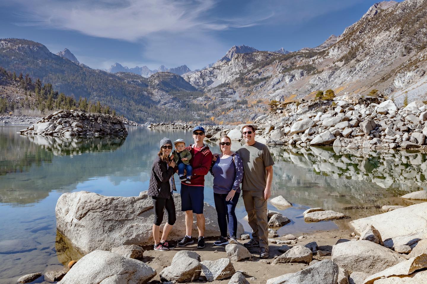
Family hiking adventure at Lake Sabrina. @tdoggphotos
Hiking in fall in the lower elevations of the high Sierra, in the alpine zone below the tree line, is especially wonderful this time of year. The forest begins to change color in early fall, mid- to late-September, with swathes of color that are almost uniformly yellow with hints of orange and red. As the season continues the color deepens as the blush spreads across the mountainsides drawing golden borders around sparkling blue mountain lakes and tracing contours down the canyons and alongside streams. The dark green of evergreen trees punctuates the bright colors and the silvery grey granite crags rise above this tumult of color. Storm clouds often gather over the peaks by day. Then as evening approaches strong winds aloft lift, smooth and shape them into lenticular wave clouds and the setting sun creates a fiery display that rivals the show on the ground. Be aware that storms can roll in quickly and heavily so be prepared with extra layers, food, and gear. Make sure to let someone know where you’re going and when you expect to be back.
Two wonderful lakeside trails in Bishop Creek Canyon, one alongside Lake Sabrina and another on the shores of South Lake are delightful hikes that will fully immerse you into the spectacle of fall in the high Sierra. Closer to town and lower in elevation is the lovely Lower Rock Creek trail that is a delight during late fall.
Bishop Creek Canyon
This area is the crown jewel of Bishop’s beautiful big backyard. It is, quite simply, the most spectacular fall colors area in the Eastern Sierra, AND it’s where some of the best trails take hikers into the high country. Numerous trailheads begin at many points in Bishop Creek Canyon, but two superb trails follow the contours of the mountainous terrain that drops into the two largest lakes in the Bishop Creek drainage. Note that overnight camping in the area requires a permit.
Getting to these trailheads is a beautiful, easy drive of about 30-minutes from downtown Bishop. Drive west on SR-168 W (W. Line St.) for 15-miles, turn left onto S. Lake Rd., then continue for 7-miles to the parking area for the lake and trailheads. To get to Lake Sabrina continue on SR-168 W. until it’s terminus at the lake parking area. The trailhead is about 50-yards back, just before the road’s end, and parking is also available here along the shoulder of the road. Parking is often very limited in fall as it is the busiest season of the year up here.
 Sunset in Fall at Lake Sabrina. @elliotmcgucken | Lake Sabrina lakeside trailThe trailhead is an unassuming path that leads steeply off the road just below the dam. It climbs quickly above the lake level and delivers breathtaking views of the lake, mountains, trees, clouds and sky. You could hike for miles and end up at Midnight Lake or Hungry Packer Lake, so make sure you know the routes, have enough time, dress appropriately, and carry enough food and gear for a sudden change in weather. A good day’s outing is to aim for Blue Lake, 3-miles along with about 1,500 feet of elevation gain. Take a picnic for a little rest time before you return the way you came. |
 Fall hike along South Lake trail. @meaganleeee | South Lake lakeside trailThis trailhead accesses one of the more popular trails, Bishop Pass, which links up to the Pacific Crest and John Muir Trails. Two good options for day hikes are to hike to Long Lake and perhaps continue up to Chocolate Peak, or take the trail to Treasure Lakes, or just hike as far you like and turn back the way you came. Take plenty of water, snacks, sunscreen, and take lots of photos. |
Lower Rock Creek

Hike Lower Rock Creek with your pup.
Late fall along Lower Rock Creek is delightful hike for a few short hours and to get away from it all. It’s close to town, but deep in the canyon so you feel removed from the hustle of life in the fast lane. Best fall colors are at the upper trailhead near Tom’s Place. The lower trailhead can give you peace and solitude and it’s great for kids and dogs.
Getting to the upper trailhead is a 25-minute drive north on US-395 from downtown Bishop. Just before you get to Tom’s Place turn left onto Lower Creek Rd / Old Sherwin Grade Rd and within 500-feet turn right into a small parking area alongside the road. The trail begins on the opposite side of the road. The lower trailhead in Paradise is lovely drive of about 10-miles north on US-395 (N. Main St.) to the junction of Pine Creek Rd. Turn left and in less than 500-feet turn right onto Old Sherwin Grade Rd. Follow the road for 5-miles. At the sharp left-hand turn where the road begins a climb through the settlement of Paradise, turn right into the parking lot for the lower trailhead. Follow the pedestrian signs for the trail. A vault toilet is available for use here.
Trail Running

Lakes are aplenty in the Bishop area, and make the perfect backdrop for a trail run.
As with so much else here in fall, trail running is exquisite in the higher elevations among the trees and alongside streams and lakes. It can be a busy time of year as photographers jostle for position to get the hero shot and parking can be limited. But once you get out on the trail, and the higher you go, the fewer people you will see and your heart will soar as your legs and lungs carry you into the high Sierra. There are numerous trailheads in the many canyons that cut down from the crest of the Sierra Nevada. Here are two great fall runs in our big backyard, Piute Pass from North Lake and Mosquito Flat to Gem Lakes from the top of Rock Creek Rd.
High elevation trail running is for experienced runners as trails can be steep and present many obstacles. Most trails begin at or around 9,000 feet or higher and climb still higher into the wilderness. Be prepared for the altitude and for sudden weather changes. Bring layers, plenty of water, snacks, and tell someone where you are going and when you expect to be back.
Piute Pass
Parking area at North Lake in Fall
This out and back trail of about 8-miles begins at the North Lake Campground at 9,370 feet and climbs steadily to 11,410 feet to Piute Pass. This is the point along the crest of the Sierra Nevada where Inyo and Fresno County meet. The trail weaves through alpine and aspen forest and alongside the lovely Loch Leven and Piute Lake.
Parking at North Lake may be congested during fall when photographers and fall color spotters are cruising for the perfect shot. Just be patient. From Bishop drive west on SR-168 W (W. Line St.) for 18-miles. Turn right onto North Lake Rd. and follow this narrow, winding road—which is part paved and part dirt—until you reach the day use parking for North Lake. The trailhead begins near the campground about ½-mile from the parking area.
Mosquito Flat to Chickenfoot Lake
Fall, just off the trail above Mosquito Flat along Rock Creek
This is a favorite trail of locals and visitors and it can be fairly busy in fall. Even so, our big backyard is big and this a great trail for a fun 6-mile out-and-back run. It’s a gentle climb of a little over 600-feet in 3-miles from the trailhead at Mosquito Flat, passing a number of large and small lakes along the way to Chickenfoot Lake.
From Bishop drive north on US-395 for 24-miles to the junction at Tom’s Place. Turn left onto Rock Creek Rd. and drive for 10.5-miles until the road ends in the parking area at Mosquito Flat. This is a wonderful road for fall color viewing and parking may be limited and patience required to find a spot.
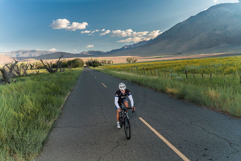
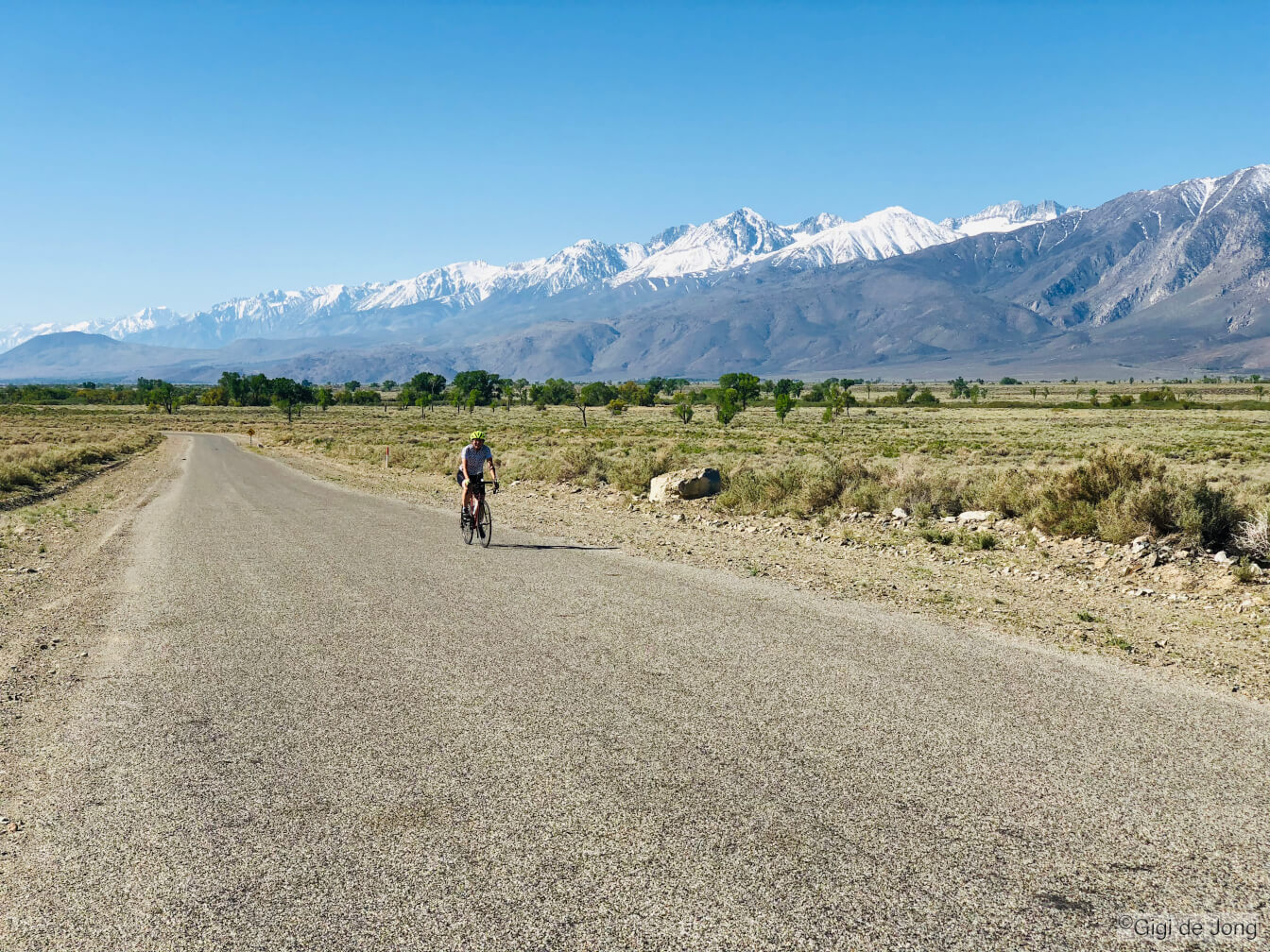
Biking
Miles and miles of beautiful biking roads. Photo: Mike McDermott
Cycling around Bishop and on the excellent paved roads that climb into the canyons of the nearby Sierra Nevada is beautiful in fall, but it is also the season with the most road traffic. Cruising the canyons for fall color spotting is a favorite activity, especially near sunset. An early morning bike ride could be a good moment for exercise and solitude. The recently repaved Rock Creek Rd. has a good wide shoulder for cyclists and is fantastic in early fall. In late fall, the Warm Springs loop around the east side of town on the valley floor is lovely at any time of day. The best mountain biking trail any time of year is Lower Rock Creek, and it’s bestest 🙂 in fall.
Take a look at our comprehensive road biking page here for these and other routes to ride.
Rock Creek Rd. Road bike ride – early fall

Rock Creek Rd in fall
This is road is a steady climb for 10.5-miles with a little over 3,200 feet of elevation gain. The average slope is 5.8% with slopes maxing at between 12%-13% but never for long. And wow, is it a great ride down? This recently repaved road has a wide shoulder on the uphill side to accommodate cyclists and there are many great stopping and viewing spots along the way.
From Bishop drive north on US-395 for 24-miles to the junction at Tom’s Place. Turn left onto Rock Creek Rd. and immediately turn left and park on the shoulder of the service road. Parking at Tom’s Place restaurant is reserved for guests.
Warm Springs Loop. Road bike ride – late fall
Views for miles on the Warm Springs loop
This is a lovely, leisurely ride almost any time of year (it’s super-hot at midday in mid-summer) and fall is when it glows. The big cottonwood trees turn to yellow and gold and the sunsets are spectacular if there are sweeping wave clouds in the sky. It’s an easy ride of a little over 15-miles with minimal elevation gain and loss, just 790-feet.
A good start and end point for this ride is from the east side of Bishop City Park where there’s ample parking. The park offers numerous amenities and things for any non-cycling members of a group to do and keep kids entertained. Plus, there’s a great dog park for furry family members. Take a look at the details of this ride on our road biking page here.
Lower Rock Creek trail. Mountain bike – mid to late fall

Riding Lower Rock Creek trail.
This is probably the best fall mountain bike ride in the area. It has a little of everything: tight corners, sweeping turns, rocks, bridges, and trees—lots of fall colored aspen and evergreen forest. There are three stages, each getting progressively more difficult. The first two are moderately challenging and well suited to MTB riders with some single-track trail experience. Each stage ends at a crossing at the paved road running down the canyon. At the end of stage 1 or 2, ride back up the road to the start at the upper trailhead or arrange a shuttle pick up by friend or family member. Stage 3 is a technical all-or-nothing commitment that drops 1200 feet in 4.5-miles over rugged, rocky terrain. It’s awesome! Take a look at the details of this ride on our mountain biking page here.
Drive north on US Highway 395 from Bishop for 22-miles then turn left onto Old Sherwin Grade Rd. In 400 feet pull over right and park in the clearing for the Lower Rock Creek upper trailhead. This trail is popular with hikers and anglers and dogs are welcome too. Please be vigilant.
Climbing
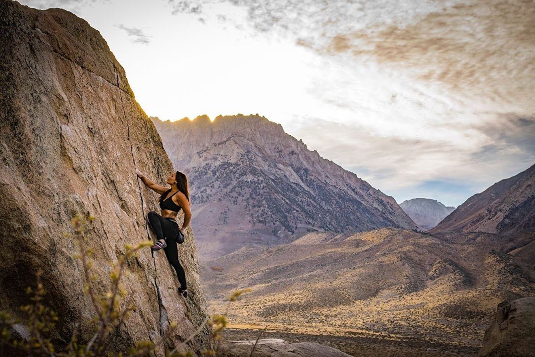
Climb on! @sierraroseknott
Fall climbing is the time when there’s more choice of styles and places to climb than any other time of year. Many fall days are cool enough to go to the Owens Gorge for the best sport climbing in California. Pine Creek is gorgeous in gold with tons of sport and multi-pitch trad routes. Bouldering in the Buttermilks begins.
Buttermilk Country
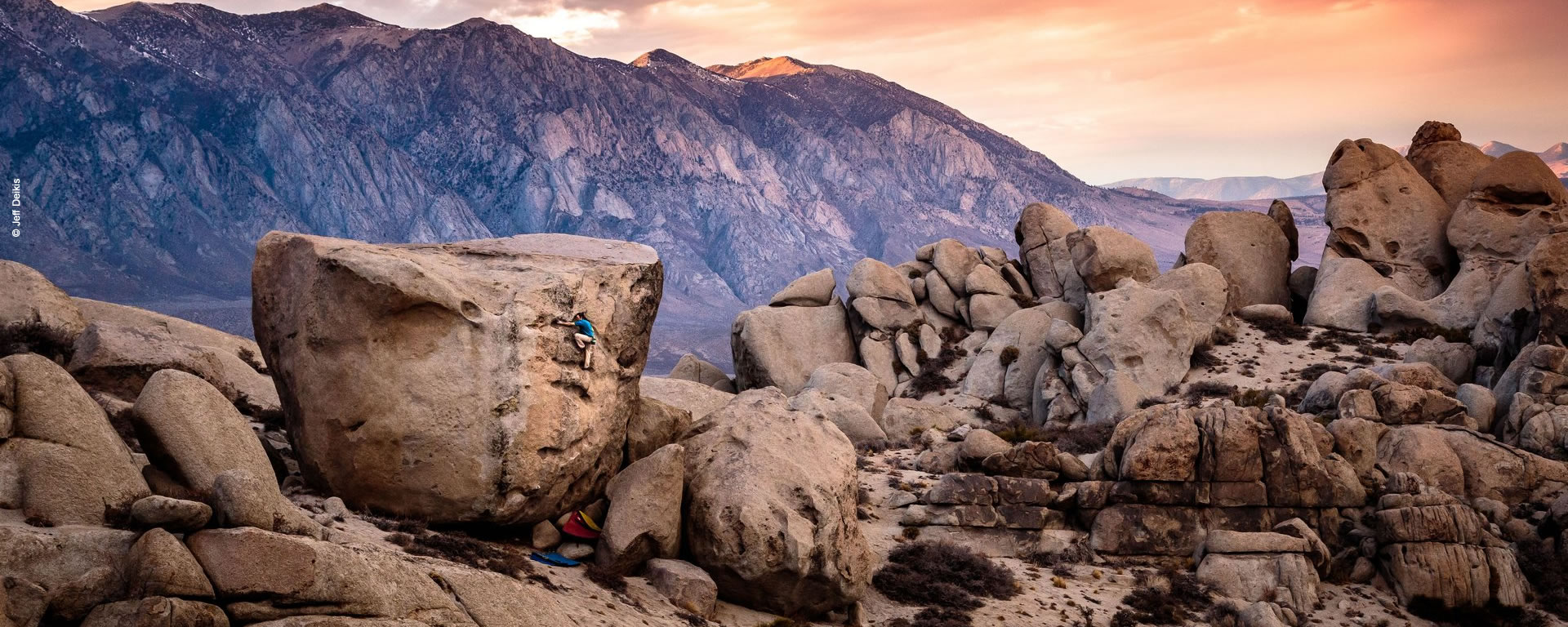
Bouldering in the Buttermilks
This is big boulder country. Fondly referred to as the “Milks” by climbers, Buttermilk Country boasts some of the biggest boulders anywhere. Pushed by glaciers from the nearby Sierra Nevada about 2.5-million years ago, these monster erratics can be more than 40-feet tall. They are spread out in a large area of about 325-acres of scenic, pristine landscape. Experienced local and world-renowned heroes of climbing love this region for the innumerable problems and challenging High Balls. But, beginners and families can enjoy the freedom and learning that can be achieved on the many smaller boulders that abound too.
Getting to the Milks is a short 20-minute drive west of Bishop. Head west on CA-168 (W. Line St.) for 13-miles to the junction of Buttermilk Rd and turn right. The road turns to gravel just beyond the cattle guard and 12-miles further you will find yourself in the heart of Buttermilk County.
Pine Creek

Pine Creek Canyon is a trad mecca with crack climbs interspersed with the bolted sport routes. Photo: Emily Sierra
Pine Creek Canyon is a magnificent example of a glacial canyon—narrow, deep, and steep. It has been a climbing destination for decades, and more recently it has been developed into an extensive sport climbing area. It now has over 630 routes including long multi-pitch climbs, tons of traditional climbs, and one of the largest collections of sport climbs in the state. Fall climbing here is fantastic as temperatures are temperate below and cool higher up. The valley floor glows golden as the leaves on the large cottonwood trees turn from yellow to amber while the rabbitbrush blooms its signature sunshine yellow.
Head north from Bishop along US Highway 395 for 10.7-miles then turn left onto Pine Creek Rd. Drive up into this spectacular glacial canyon for 7.7-miles and turn right onto the dirt track that leads to parking areas for Scheelite Canyon Trailhead. The majority of the climbs are located in this side canyon known by climbers at Pratt’s Crack. Take a look at this information on mountainproject.com for details on all the climbs in Pine Creek.
Owens Gorge

Owens River Gorge has routes for everyone from beginners to more advanced climbers.
This is California’s most concentrated sport climbing area. The Owens River Gorge is a deep, steep-sided canyon almost 20-miles long located northwest of Bishop. About 3.5-miles of some of the deepest, steepest part of the gorge are bolted for excellent sport climbing. It is a favorite destination for beginner and experienced rock climbers, providing over 500 routes. Beginners are encouraged to climb with a guide or experienced climbers who have the right gear.
Take Highway 395 north from Bishop Chamber of Commerce about 12.1-miles to Paradise exit and turn right on the Gorge Road. At the T intersection, turn left (north) on the paved road for about 3.25-miles. Turn right and drive for about 400 feet. Park on the road shoulder before the road barricade. From here, hike down the road 1.5-miles just past the power plant to the climbing area. Much of this area is bolted. Keep dogs on leash as you walk into the canyon to avoid accidents with occasional maintenance vehicles. Great for bikes & stroller access. To reach the central gully (most direct route), continue up the paved road from the 3.25-mile mark for about 1.5-miles. Turn right and travel 0.3-miles to a parking area near a large power transmission pole. The trail is immediately north of the parking area. The trail is very steep, rugged, and loose but provides quick access from the top of the gorge.
Motor Touring
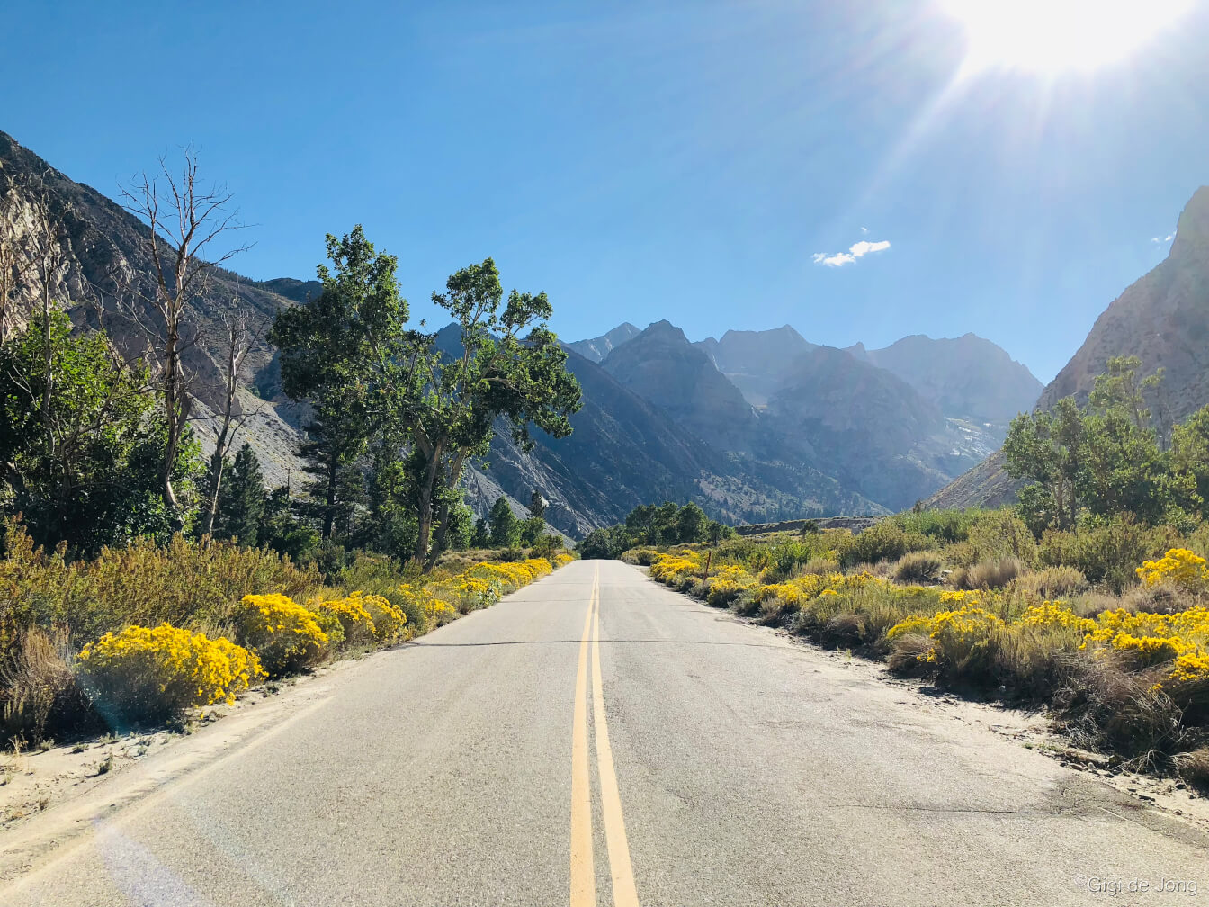
Pine Creek Rd early Fall
There is so much to see in the Eastern Sierra; and it’s a huge and spectacular landscape. So, motor touring is a magnificent way to see and experience the beauty of our big backyard. Fall, of course, is probably the most beautiful season of all. Fall is long in the Eastern Sierra. The high mountains and deep valleys provide a massive change in topography and range in temperatures and fall starts high and slowly slides down the canyons and spreads out into the valleys over many weeks. Some the loveliest places for fall color spotting are accessible by vehicle on good, paved roads. A late afternoon, early fall day is a treat in Rock Creek Canyon. If you’re all about the drive, an impressive and interesting loop “Around the Block” circumnavigates the White Mountains. The Big Bishop Loop is a shorter, and no less impressive, drive that circumnavigates Bishop in 62-miles with plenty of spots to stop, take photos, and visit places to fish, ride a train, or simply enjoy the view.
Rock Creek Rd
Rock Creek Rd in fall
This newly repaved road begins at Tom’s Place, above and north of Bishop, and climbs into the alpine and aspen forest of Rock Creek Canyon for 10.5-miles. There are turnouts and day use picnic areas, a large lake for relaxing fishing, numerous trailheads for short walks and long leisurely hikes, a lodge and resort that serve breakfast and BBQ lunches and accommodation in season, and a pack station that offers day rides and even multi-day fall photography pack trips. Early fall is stunningly beautiful in this canyon. It’s cool and colorful and there’s tons of fun for families and furry friends.
Start your drive in Bishop and head north on US-395 for about 23-miles. Turn left at Tom’s Place onto Rock Creek Rd. and cruise up this winding mountain road until you reach the end at Mosquito Flat. This is a great motorcycle route too.
Around the Block (White Mountains)
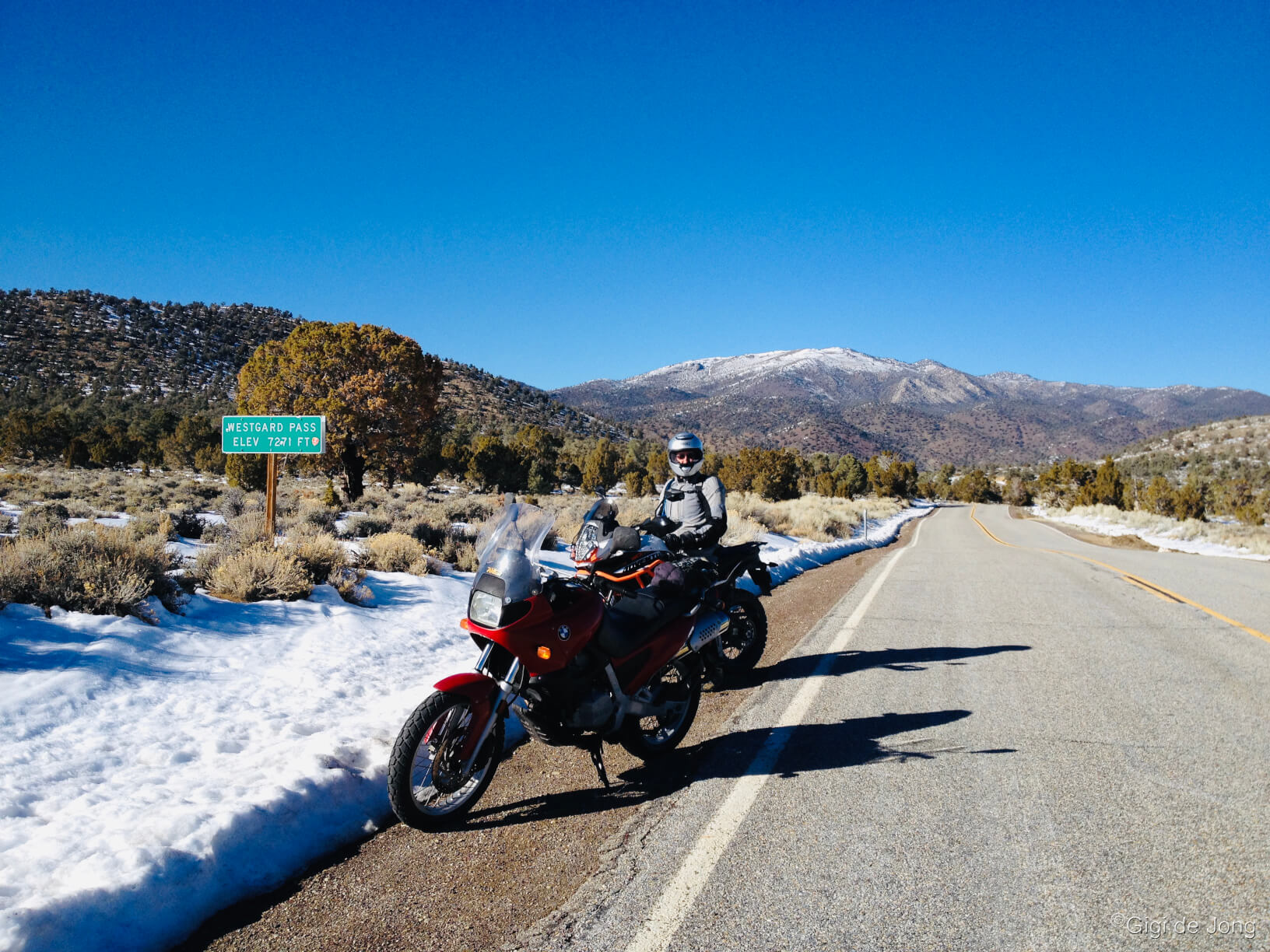
Westgard Pass, near the Ancient Bristlecones. A great tour on two wheels too.
This 150-mile auto tour loop, affectionately known as Around the Block, is an inspiring road trip. The route climbs into the southern end of the White Mountains, near the Ancient Bristlecone Pine Forest, dips down into Deep Springs valley, twists and turns over another high desert crest, then drops into Fish Lake Valley Nevada. Here the route opens up heading north in the wide-open Fish Lake Valley, passing through Dyer, NV to join up with US-6 at the northern tip of the White Mountains block. Turn left and follow US-6 back to Bishop. This is an excellent motorcycle ride.
Add to this loop by visiting the Ancient Bristlecone Pine Forest near the beginning of the ride on the way up into the White Mountains; turn left onto White Mountain Rd about 28-miles from Bishop. This will add 20-miles and at least an hour of drive time to the trip. Then take time to see the old trees and learn about them in the visitor center. Once you hit Nevada, stop in at the Fish Lake Valley Saloon or grab some snacks and gas at Esmeralda Market. When you arrive at Benton, back in California, take a little side trip to see Benton Hot Springs adding a mere 8-miles to your trip. Be sure to plan this tour before you go! Check road conditions as fall can bring snow to the higher elevations. Stock up and fill up in Bishop, because services in Fish Lake Valley can be limited or closed. Book a campsite or room at Benton Hot Springs before you hit the road and soak your troubles and your travels away in a private hot tub.
Driving directions from downtown Bishop: head south on US-395 for 14.5-miles, turn left onto CA-168 E and cruise the bends for 37.5-miles, turn left onto CA-266 N which becomes NV-264 N for 15.5-miles to Dyer, NV, continue for 25.6-miles and turn left onto US-6 W and drive for 23-miles, pass through Benton (or turn right onto CA-120 W to go Benton Hot Springs) and in 30-miles arrive back in Bishop.
Big Bishop Loop
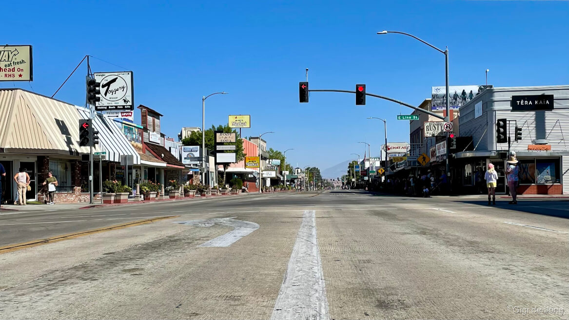
Downtown Bishop. Adventure starts here.
62-mile, part-paved part-dirt, auto tour in Bishop’s big backyard.
Our big backyard has so much to offer and we want to share a suggested auto tour route that circumnavigates Bishop and presents vistas and scenes that will take your breath away. It can be done in a little over an hour, but it’s best when done slowly with stops at the many points along the way to photograph the sights or simply contemplate the views.
At the junction of Main and Line Streets is where adventure calls. To the west is the massive Sierra Nevada range and east are the White Mountains. The main roads that run through and around town, and beyond to destinations north and south, are paved. Many secondary roads are good, graded dirt roads and most tertiary roads are rough gravel tracks. Auto touring in the Eastern Sierra ranges from easy and sublime to challenging and awe-inspiring and everything in between.
Natural History Sites
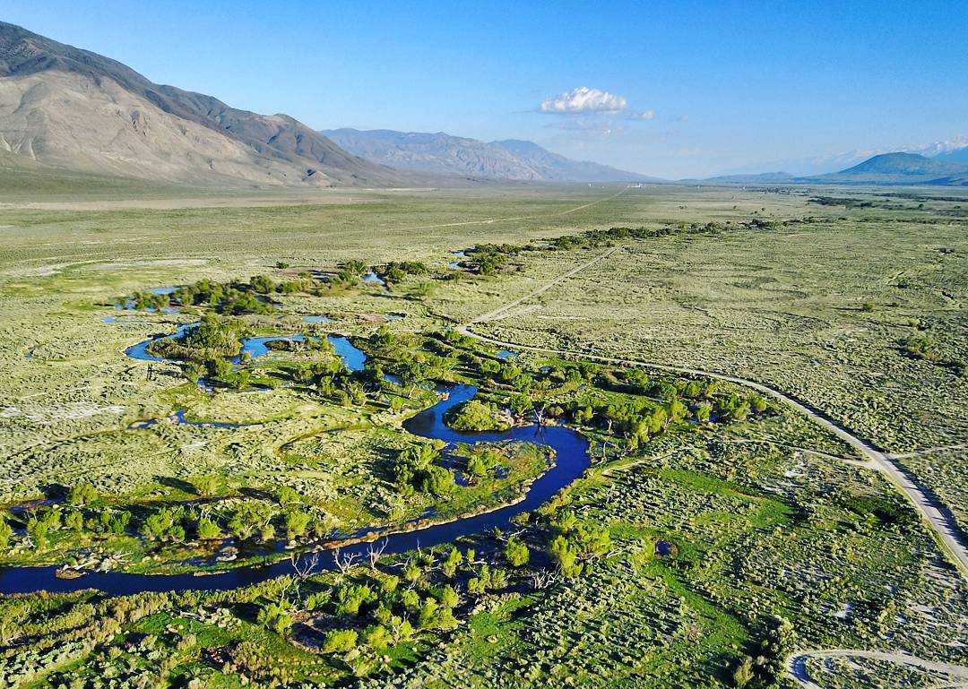
The Lower Owens River, said to be the deepest valley in the country.
The natural history of our region is visibly evident and scholars spend countless hours here studying the large and small signs of our planet’s history. Some are ancient and have been shaped and reshaped over eons. Others are more recent and some even bear the telltale marks of human activity. Fall is glorious time to visit nature. It tells us about our most recent history; the history of water and temperature from the prior year that dictates the progress and intensity of the changing colors of the leaves.
Three very different and awe-inspiring features are well worth a visit and best viewed in early fall. Crowley Columns are the result of the creation of Crowley Lake, a human-made reservoir. The Inyo Craters and Obsidian Dome are younger features of a volcanic chain system that began about 400,000 years ago. The oldest feature, even older than our planet, can still be seen in the Eastern Sierra; the Night Sky is beautifully brilliant in our wonderfully dark, clear skies.
We’ve created an entire page here to describe, map, and guide visitors to these and many other fascinating natural history sights in our very big backyard.
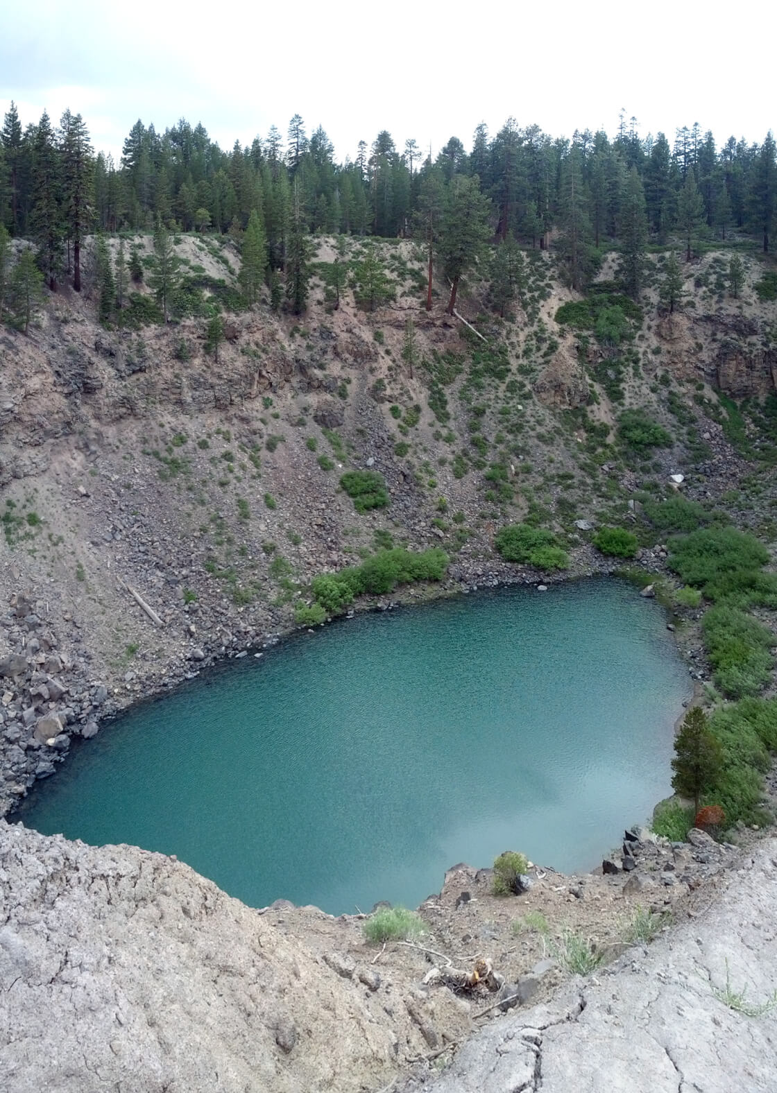
Crowley Columns
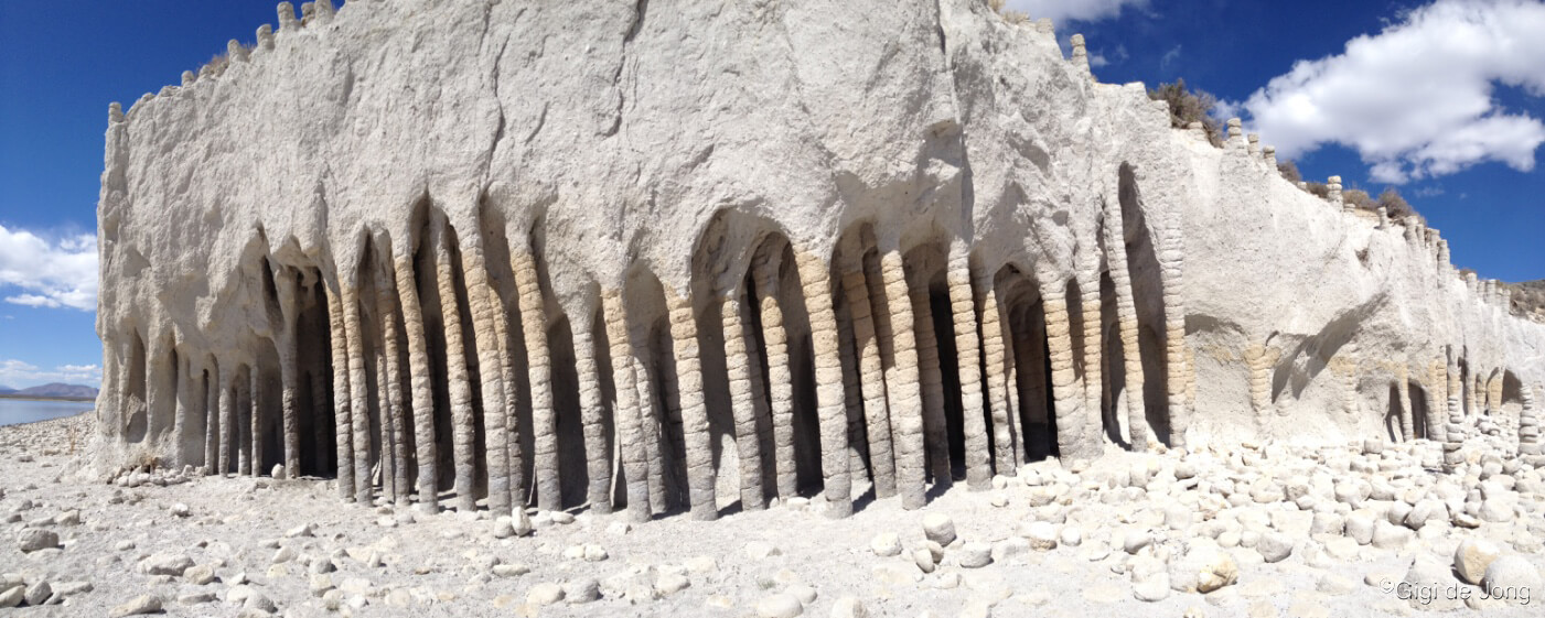
Cavernous Crowley Columns
An exceptional set of circumstances due to the artificially created reservoir, Crowley Lake, caused a curious set of rock features to be exposed. The powerful waves of the lake pummeled the softer rock in the deep water below its shoreline. During a recent, serious, years-long drought, from 2012-2017, the lake level receded revealing a formation of rock columns along the lakeshore. Researchers began to study this unique natural phenomenon, and researchers from UC Berkeley determined, “that the columns were created by cold water percolating down into — and steam rising up out of — hot volcanic ash spewed by a cataclysmic explosion 760,000 years ago.” As the lake level rises and recedes it continues to erode the softer rock around the harder columns and dig deeper into this underground labyrinth.
Getting to the columns can be tricky and usually requires a 4×4 high-clearance vehicle followed by a bit of hiking. A boat is a great way to get across the lake to the beach where exposed columns may be seen if the water level is low. Stop in at Bishop Visitor Center at 690 N. Main St. at the city park. Ask if timing is good and get suitable directions.
Inyo Craters & Obsidian Dome
Inyo Crater Lake. Photo: Wikimedia Commons user Dicklyon
The Mono-Inyo Craters system created a chain of craters, domes, and lava flows over a period beginning about 400,000 years ago. Two of these clearly observable features, Inyo Craters and Obsidian Dome, are youngsters and were formed at about the same time between 40,000 years and 600 years ago. Mere infants in geologic time. Read more about the volcanic system that created these impressive features here.
These features are about 50-miles (50-minute drive) north of Bishop and a few miles apart. Head north on US-395 for 44-miles (just beyond Mammoth Lakes) and turn left onto Mammoth Scenic Loop. Drive for 3.2-miles and turn right onto Dry Creek Spur Rd. and park in the clearing about 1.3-miles along. Follow the trail sign through the forest to reach the Inyo Craters in less than ½-mile and 140 feet of elevation gain. Return to US-395 the way you came and turn left (north) and drive for 5.8-miles. Turn left onto Obsidian Dome Rd. and park at the base of this black, rocky dome about 1.8-miles along. Hike beyond the locked gate up the path onto the dome. This is a strange and otherworldly experience among the glassy black rock formations.
Night Sky from Benton Hot Springs

The skies near Bishop, CA are filled with stars, making night photography spectacular. @katherinebelarmino
The Eastern Sierra still has incredibly dark, clear skies. Visitors to our area tell us that they are awestruck by the abundance of stars and clarity of the Milky Way on a moonless night. From late summer to early fall is the best time of the year to see the Milky Way. The brightest portion of this ribbon of stars arcs almost directly overhead from the southwest to the northeast parts of the sky. Take a look at our comprehensive Night Sky page here for lots of information on current night sky events, answers to many astronomical questions, and a map to the many places to go for a stellar star gazing experience.
There are so many marvelous places to spread a blanket or unfold a low camp chair and stare up at the night sky. Nights begin to cool in fall so a super spot for star gazing is in a private hot tub at Benton Hot Springs. Book a campsite or reserve a room and spend a night or more exploring, soaking, and witnessing the miracle of our universe in a relaxing and rejuvenating venue. Check out all they have to offer here. Getting there is 30-minute drive north on US-6, turn left onto CA-120 W, and pull into the resort 3.8-miles further.
Rest & Relaxation
The golden season near North Lake. @shphotografia
This is the golden season. As the yellow turns to orange with splashes of pink and dashes of red, the overwhelming visual sensation is one of burnished gold. Historically, fall was the season of the harvest when farmers gathered crops to put in storage for the winter season. Festivals and celebrations often marked the harvest as a testament to the commitment and strength of those working the land and in gratitude to mother nature. Autumn was the season to celebrate achievement. Autumn is now more commonly referred to as fall. It is characterized by the splendid visual display that precipitates the falling of the leaves from the trees. No matter how often we witness it, it is always remarkable for its beauty and significance to the passage of time. It is also the season of rest and rejoicing in the small pleasures of life.
A popular rest and relaxation pastime is to submerge into hot springs and hot natural mineral waters. In the Eastern Sierra we do not have to go far to find relaxing and restorative hot springs in which to indulge our desire for calm and beauty. North of Bishop is the gorgeous resort, Benton Hot Springs, where private hot tubs may be booked for day and overnight use as part of the lodgings and campsites available for reservation. South of Bishop is the historic Keough’s Hot Springs that is a favorite among locals and visitors for a delightful family fun outing
Benton Hot Springs

The Inn at Benton Hot Springs
The Inn at Benton Hot Springs is about as beautifully rustic as it gets. The small town of Benton is one of the oldest existing towns in Mono County. The current Inn, built with local pumice materials in the 1940s, replaced an old 10 room hotel first built in 1904. In 1998 the structure was renovated, keeping much of its original structural integrity and historical character intact. Accommodations feature seven rooms at the Inn, a historic miner’s cabin, four houses with private hot tubs, and 12 private tub sites for day or overnight use. This marvelous, off-the-beaten-track resort remains true to its heritage and is kept in beautiful condition and in perfect harmony with its surroundings for those, “Who appreciate its uniqueness and value in this fast-changing world,” say the local owner-operators.
Drive north on US-6 from Bishop for 34-miles (30-minutes) to the little town on Benton. Turn left onto CA-120 W and drive for 3.8-miles where the resort will be on your right.
Keough’s Hot Springs
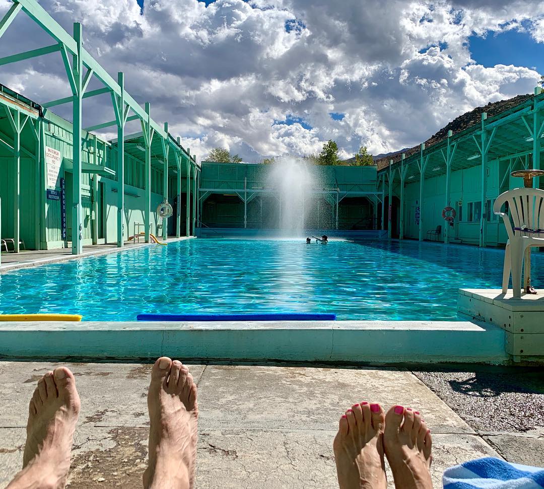
A relaxing fall day at Keough’s Hot Springs. @thegilski
The historic Keough’s Hot Springs resort was a favorite luxury getaway for the early Hollywood stars in the 1920s & 30s. Today it’s still a favorite among locals and visitors for a delightful family fun outing. The tradition of healing through natural mineral, geothermal spring water is hundreds of years old, and Keough’s Hot Springs continues the tradition with rustic, old-world charm. Much of the original wooden structure is still intact and the two pools, a large warm swimming pool and a smaller hot soaking pool, are the original ones built in 1919. A constant flow of hot, fresh mineral water fills the pools, making this a wonderful place to languish in these restorative waters. Enclosed on all four sides the pools are protected from the desert wind, but open to the sky above. Keough’s was conceived as a place to get away and get close to nature. Almost 100 years later it still delivers on that promise.
Head south out of Bishop on US-395 for 7.5-miles and turn right onto Keough’s Hot Springs Rd. In less than a mile the road turns into the parking lot at the resort pool. There’s also a lovely walk up the hill behind the resort with benches and boulders on which to sit and contemplate the view of the valley.
Museums & Cultural Sites

Entrance to the Paiute Shoshone Cultural Center
There are many wonderful museums and visitor centers up and down the Owens Valley to learn about the history of our region. This is an ancient landscape and was industriously and sustainably settled as far back at 10,000 years ago. Stop in at the Paiute Shoshone Cultural Museum in Bishop and learn about the heritage of the first people who lived and toiled here in harmony and prosperity—in the land known as Payahǖǖnadǖ – place of flowing water. In Independence the Eastern California Museum showcases the region’s ancient and more recent history in an impressive display of artifacts and photography.
Paiute Shoshone Cultural Museum

Exhibits at the Paiute Shoshone Cultural Center
Manahuu (Hello). The Paiute Shoshone Cultural Center is both a museum and cultural center that serves the community and safeguards its history. It is a place to preserve and tell the story of the old ways and a place for the community to come together to learn, teach, and continue the traditional ways. Fall is particularly beautiful here when the air outside is cool and the leaves on the big cottonwood trees are turning to gold. Step inside the Cultural Center and then walk the trail through the Conservation Open Space Area (COSA) with a new vision of the importance of the land and its resources.
Located at 2300 W. Line Street, the Cultural Center is just one mile from the corner of Main St. and Line St. Ample parking is available on the grounds and visitors are requested to follow all posted directional and parking signage. Set on beautiful grounds under large spreading cottonwood trees this low building is in tune with its surroundings—as its people have always been.
Eastern California Museum

Entrance to the Eastern California Museum
Absorb the history and culture of the eastside at the Eastern California Museum. This museum is a treasure trove of artifacts, photography, and reference material that represents hundreds of years of recent and ancient history in the region. Beautifully curated displays showcase the people and places that are significant in the cultural and natural history of the Eastern Sierra from Death Valley to Mono Lake. The relics of an old era lie unused, but not forgotten, in the outdoor areas of the museum grounds.
Get to the museum by driving south from Bishop for 41.5-miles on US-395 to Independence. Turn right onto W. Center St. and the entrance to the museum parking lot will be almost directly ahead on Grant St.
Events
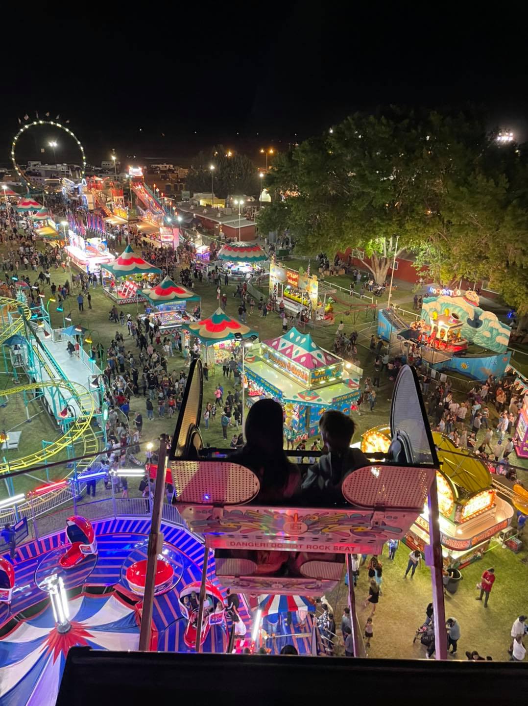
Tri County Fair at night from the Ferris Wheel
There are small and large events happening throughout the Eastern Sierra every month. Fall is one of the busier seasons for big, festive events. The end of summer and start of fall event is the Tri-County Fair during Labor Day weekend. Musically speaking the Millpond Music Festival has been a grand musical tradition in September in Bishop for over 25-years. During the statewide California Native American Day Celebration, the Bishop Paiute Tribe holds its annual Pabanamanina Pow Wow at the end of September. It’s a happy, festive month in the Eastern Sierra.
Tri-County Fair
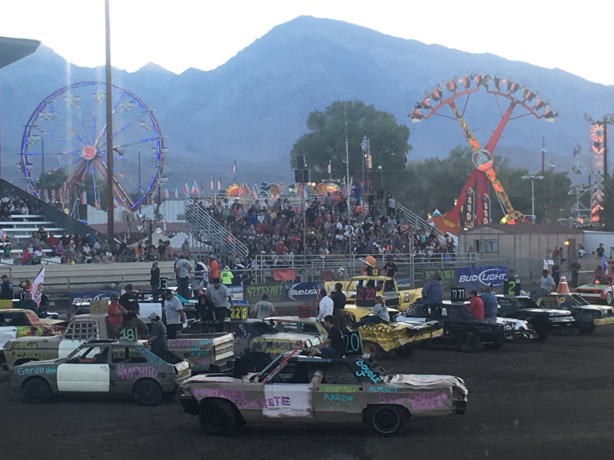
Destruction Derby at the Tri County Fair
The Tri County Fair is a fun family affair with a whole host of fabulous events, exhibits and activities. This fair is a traditional old-style county fair where residents vie for ‘best of show’ in a great variety of creative disciplines, including cooking, photography, quilting, décor, and flower arranging to name just a few. Held every Labor Day weekend it’s a chance for homegrown art and craft talent to shine. It’s also a good ol’ fashioned carnival with rollicking rides, rodeo, Destruction Derby, and vendors offering food, drink, crafts, and wares. The rustic nature of the town and genteel pace of life is balanced by a love of the outdoors and a passion for adventure by residents of this valley. It’s all quite evident during this fun-filled weekend that brings friends and family from three counties together for a good old-fashioned county fair.
Come experience Americana at its California best!
Millpond Music Festival
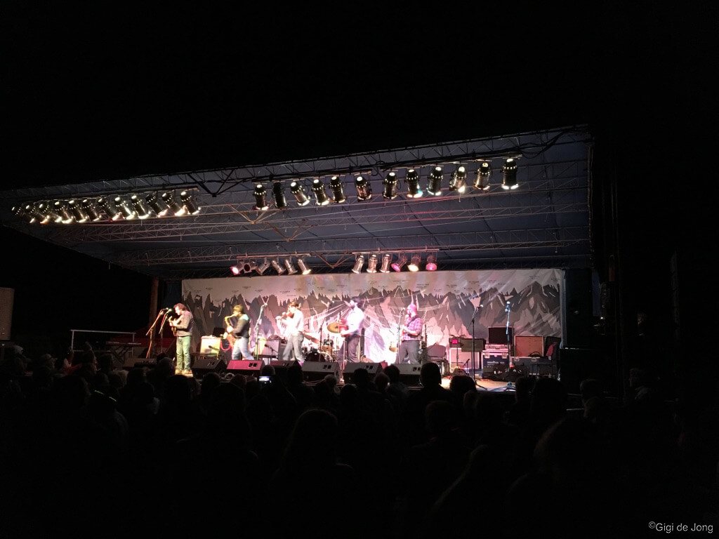
Millpond Music Festival
The Millpond Music Festival is Bishop’s most prestigious three-day music festival. Presented by the Inyo Council for the Arts this festival brings an eclectic mix of music by performers from many parts of the country and abroad. Held at Millpond County Park in September every year, a time when fall colors are typically at their best, it is both intimate in its setting and grand in its surroundings. With the towering peaks of the Sierra Nevada as a backdrop by day and an impressive canopy of stars and the shining Milky Way by night this festival is all about the mingling of music and Mother Nature.
Pabanamanina Pow Wow
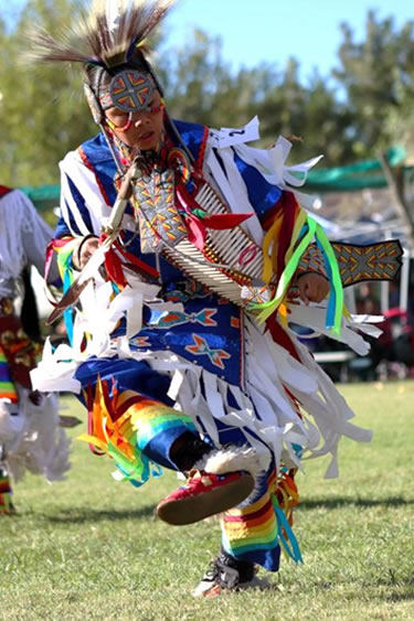
Dancer at the Pabanamanina Bishop Paiute Pow Wow
Every 4th weekend in September the Bishop Paiute Tribe holds an annual Pow Wow and parade during the California Native American Day Celebration. It is a colorful and joyous event to honor and observe deep-rooted cultures and traditions. The weekend is filled with music, traditional dancing, arts and crafts, food and a fabulous parade. The event is held on the beautiful tribal Pow Wow grounds adjacent to the newly remodeled Wanaaha Casino and is open and free to the general public.