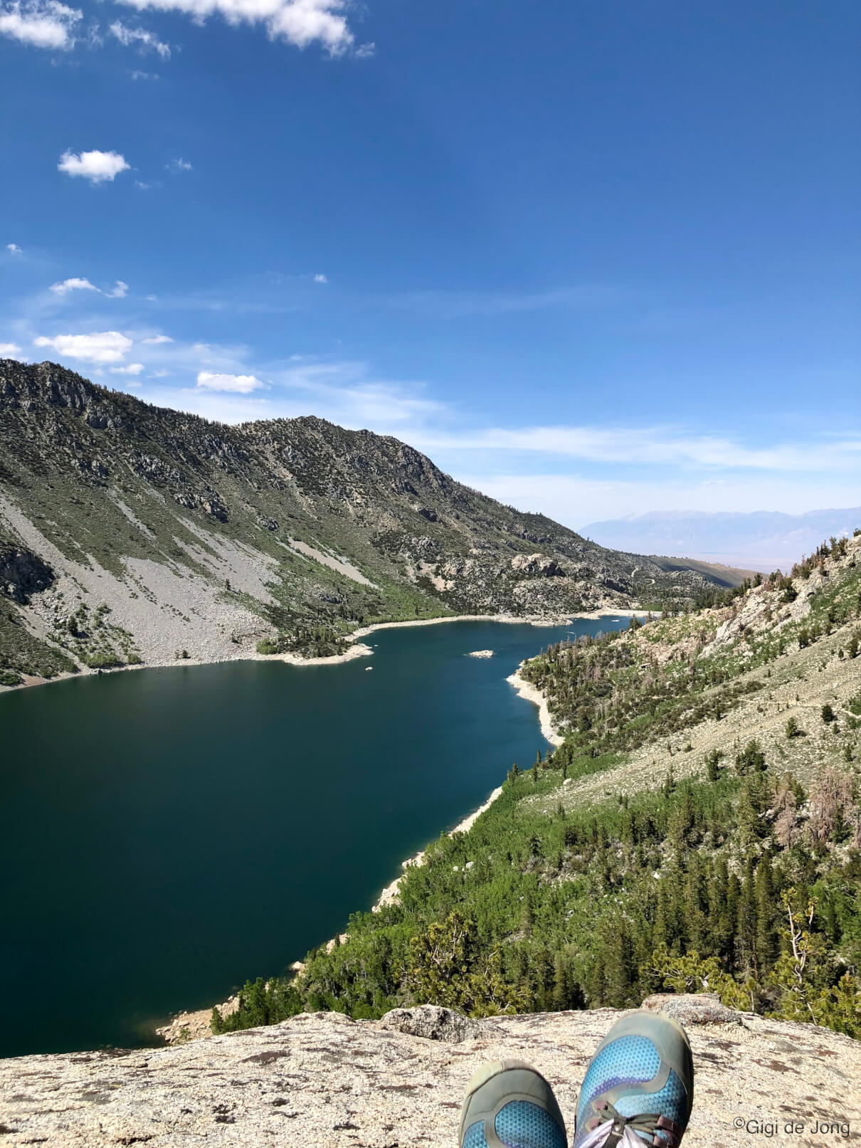
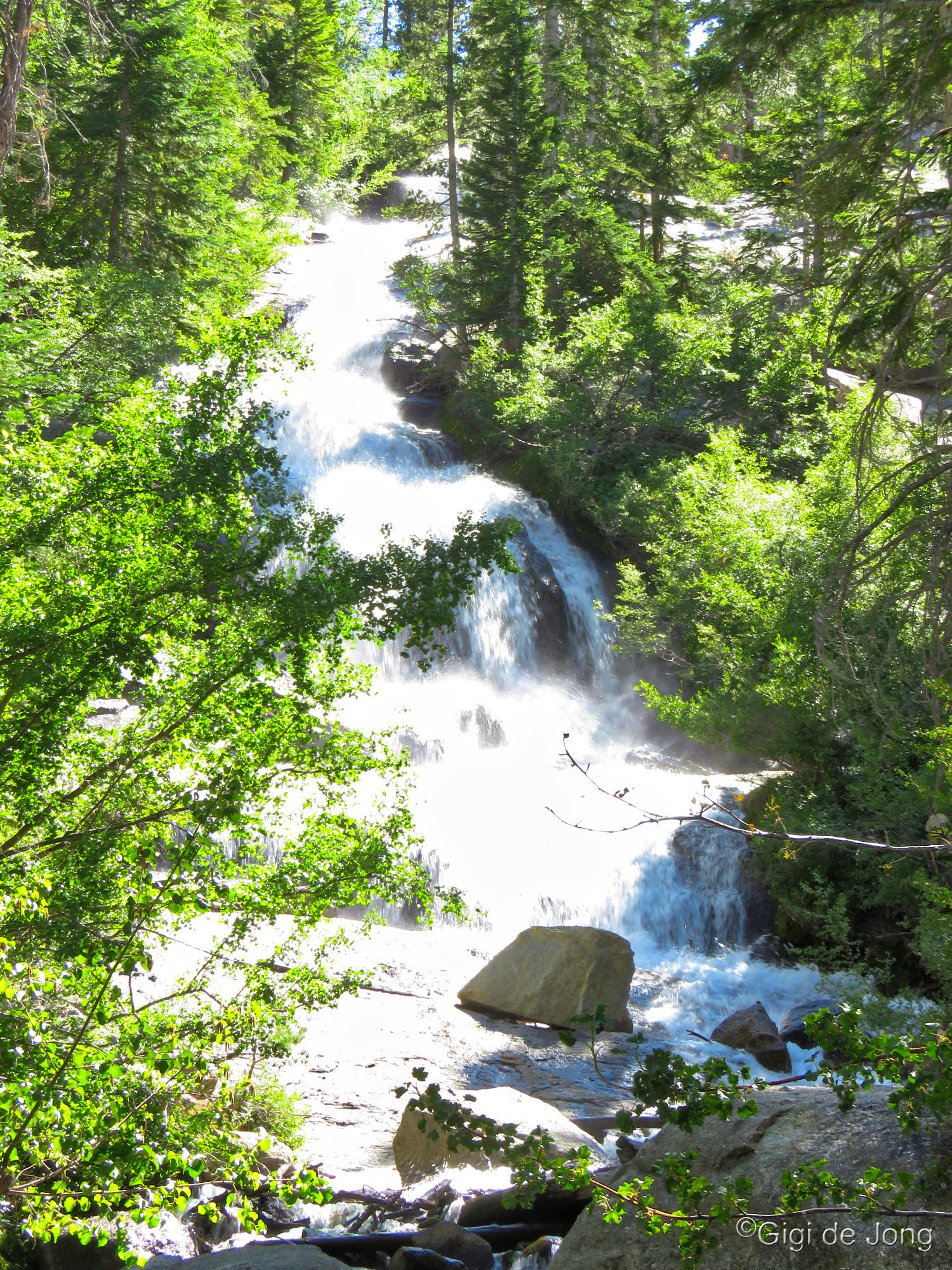
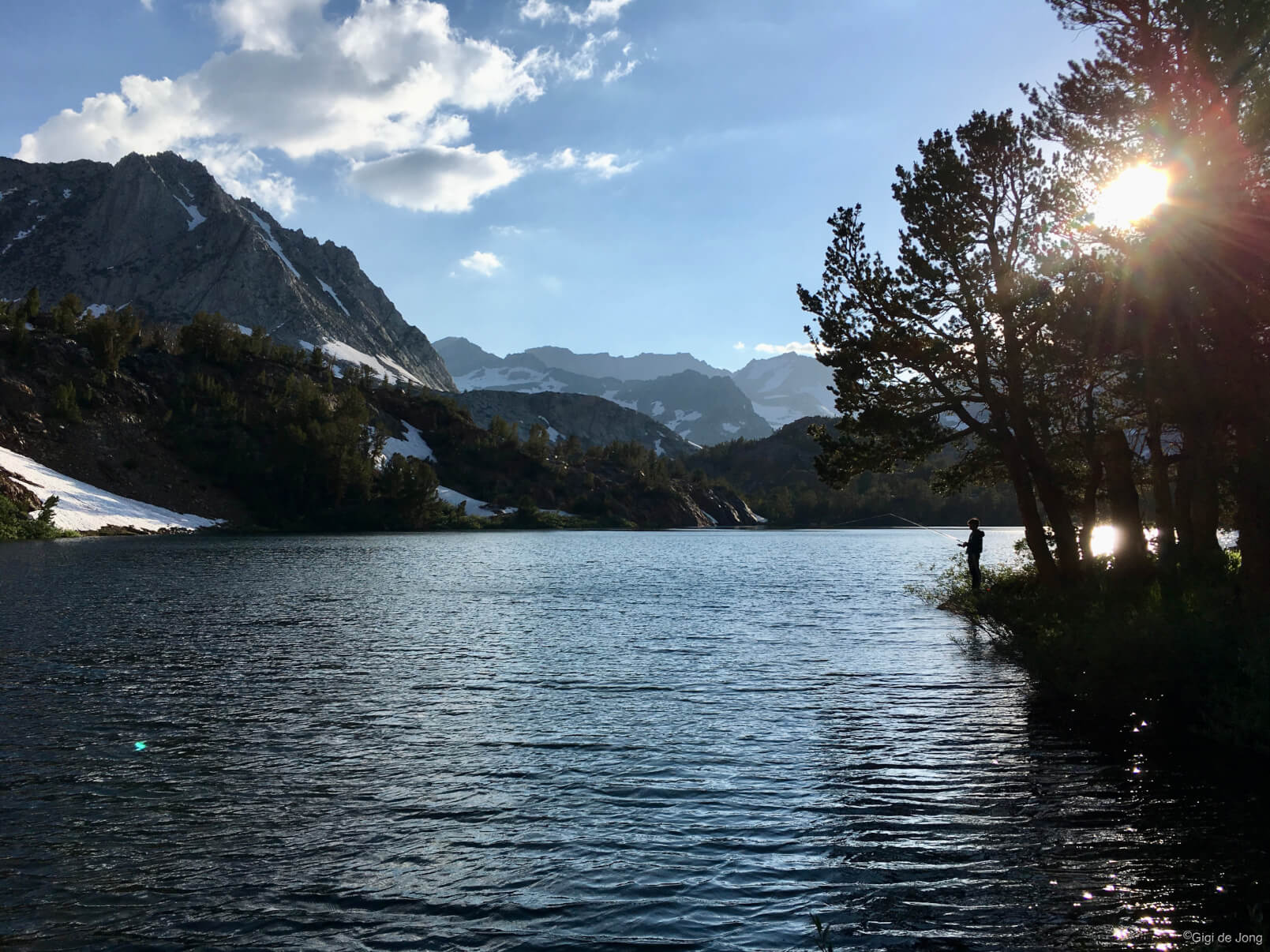
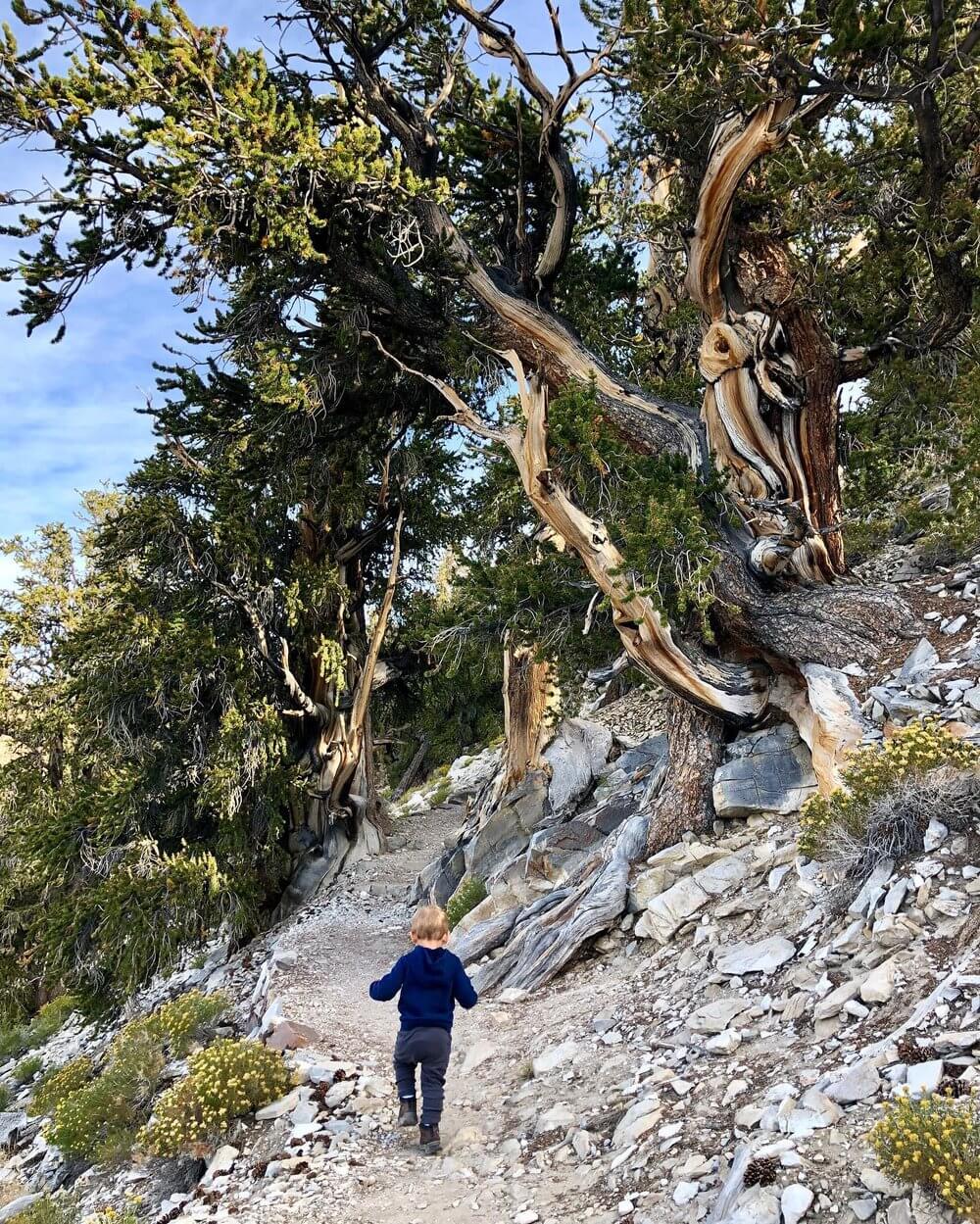
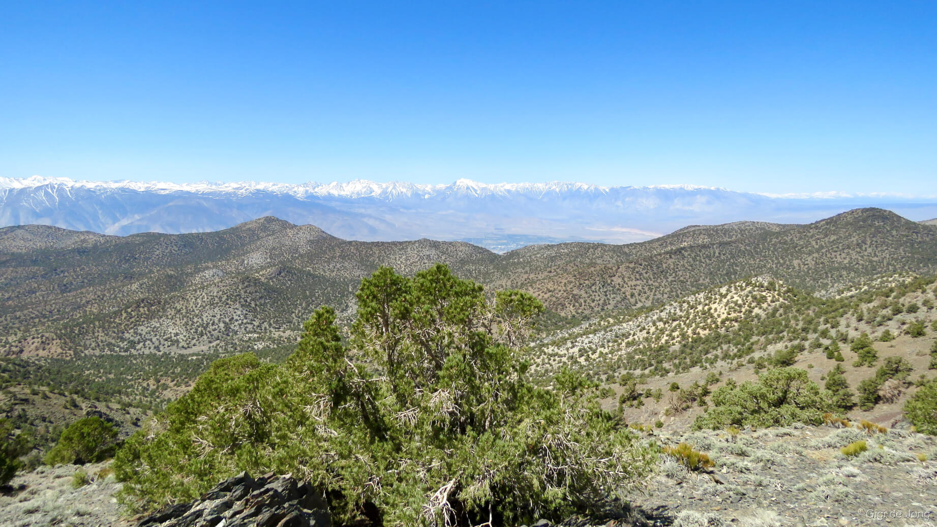
Summer hike above Lake Sabrina
Summer is spectacular in our big backyard. It’s not unusual for temperatures to climb to, and over, the 100-degree mark during the summer months in Bishop. “But it’s a dry heat,” as the saying goes, and that really does make it more bearable. But better yet, there are mountains, lakes, ponds, rivers, and trees where summer adventure is bountiful and beautiful. Bishop is nestled in a deep, high-desert valley between two gargantuan mountain ranges—the Sierra Nevada to the west, which have long been a playground for outdoor enthusiasts and a sanctuary for seekers of solitude; and the White Mountains to the east, that are a bastion for the oldest living things on earth. These landscapes provide endless opportunity for adventure; together they form an immense natural theatre to experience summer in an ever-changing and varied environment.

Beat the summer heat in Bishop with a leisurely float ride along the sinuous Owens River OR take an easy hike along the Discovery Trail in the Ancient Bristlecone Pine Forest at 10,000 feet above sea level. You could visit an old ghost town in the remote hills north of Bishop OR you could spread a blanket on the warm desert earth late at night and gaze up at the splendor of the Milky Way. Here’s what you can do and see in and around Bishop in summertime:
- Water Sport
- Waterfalls
- Fishing
- Hiking
- Trail Running
- Biking
- Climbing
- Motor Touring
- Natural History Sights
- Museums & Cultural Sights
- Events
Water Sport
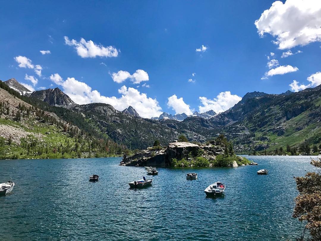
Boats bobbing on beautiful Lake Sabrina. Photo: @cactus_flower
Water is the essence of life. Here in Bishop, it’s also a way to keep cool during the hot, high-desert summers. In fact, there’s plenty of water. It cascades down the mountains and flows along in cool, clear streams and spreads out into ponds and lakes. A quick splash and dash swim in the river or local canal is revitalizing but beware of fast flowing water. A great option is to visit our City Pool and enjoy a safe swim during public swim hours. Check the hours of operation and swim rules here. Have you ever taken a pontoon boat or kayak out on a lake situated at over 9,000 feet? South Lake at 9,750’ and Lake Sabrina at 9,128’ are where you can rent a boat or kayak, or use your own watercraft, to spend an hour or a day exploring the shore and the wild waters of the High Sierra. Another magnificent lake for a kayak experience is the other-worldly Mono Lake.
South Lake & Lake Sabrina rent or bring your own watercraft
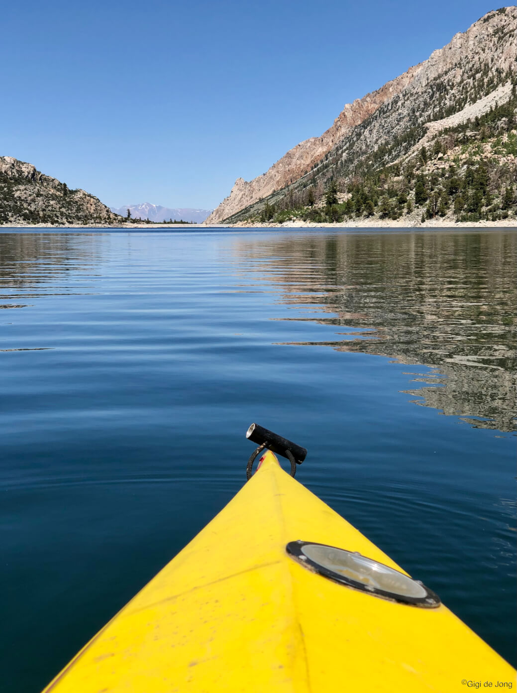
Kayaking Lake Sabrina
Two gorgeous blue lakes surrounded by towering granite peaks lie at the top of Bishop Creek Canyon and are easily accessible by road just 20-miles from Bishop. Rent or bring a watercraft and spend an hour, a day, or more motoring or paddling around, catching fish, swimming, soaking up the sun and generally enjoying a wild and wonderful High Sierra summer. Call and book a boat at Lake Sabrina Boat Landing or from Parchers Resort at South Lake or load up your watercraft and head west on SR-168 W (W. Line St.) from Bishop. Getting to Lake Sabrina is lovely 19-miles from town to where highway 168 ends at the dam. To get to South Lake, take a left turn 15-miles from town and follow S. Lake Rd. for 7-miles, where it ends at the parking area for the lake and trailheads.
Kayak Mono Lake
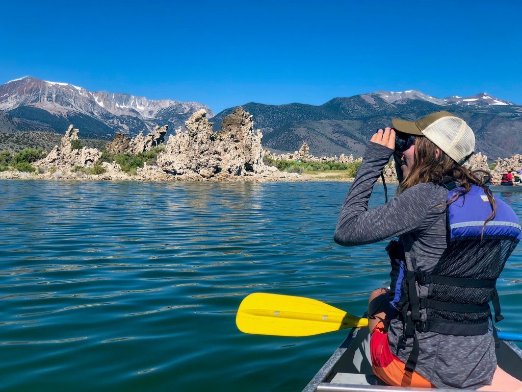
Kayak Mono Lake. Photo: @Mono_Lake
Mono Lake (pronounced Moh-No) is geographically, geologically, and historically unique and wonderful. It is also surreal and ethereal. Of its many fascinating features, none are stranger than the Tufa towers that appear to rise out of the water in unearthly formations. These tufa towers are calcium carbonate deposits which form, under the lake’s surface, as freshwater springs bubble up into this excessively salty and alkaline lake. Although fish do not survive in this water the lake is home to a species of brine shrimp, Artemia monica, found nowhere else the world. Kayaking, canoeing, or stand-up-paddleboarding on Mono Lake is an out-of-this-world kind of experience. It’s best done on an early summer morning before the wind picks up when the lake surface is calm and glassy. Take your own paddle-craft (or rent from local outfitters) to Navy Beach on the south shore of Mono Lake. From Bishop drive north on US-395 for 60-miles (1 hour) and turn right onto SR-120 just south of the lake. Follow the signs the Navy Beach.
Waterfalls

Rainbow Falls. Photo: @basakprince
The mighty Sierra Nevada is the ‘water trap’ for California. It causes precipitation to fall from the moisture-laden air masses that originate in the Pacific Ocean with up to 80 inches falling annually. Most of the precipitation comes down as snow above 6,000 feet with glaciers forming in the higher elevations. When it’s warm, snow and ice melt sending cascades of water down a glacial staircase of connected lakes. The waterfalls of the Eastern Sierra are not the biggest or the highest, but they are probably the most spectacular because of their locations. These three waterfalls are only accessible during the warm months of the year and summertime presents the best viewing opportunities. Onion Valley falls is one of the highest falls, situated at over 9,000 feet that can be seen from a vehicle. Lone Pine falls is also accessible by car and tumbles down into Whitney Portal below Mt. Whitney, the highest point in the lower 48 states. Rainbow falls is nestled in a deep glacial valley west of Mammoth Lakes at the Devils Postpile—a rare geologic wonder.
Onion Valley Falls

Onion Valley Falls in early fall colors. Photo: @viceglass
The drive to Onion Valley falls, or more accurately the Kearsarge Pass trailhead—from where the falls can be seen, is an uplifting experience. Onion Valley Rd out of Independence climbs 13.2-miles up to the campground and trailhead providing spectacular, up-close views of the craggy crests of the Sierra Nevada and expansive views of the Owens Valley below. A great view of the cascades that roar down the creek from the high elevation lakes above can be seen from the parking area. Independence, CA, is located 45-miles south of Bishop on US-395. At the center of Independence turn west onto Market St. which becomes Onion Valley Rd. as it exits the community in ¼-mile. Take a lovely, leisurely drive deep and high into the Sierra Nevada and feel the grandeur of this magnificent mountain range.
Lone Pine Creek at Mt. Whitney Portal
Lone Pine Creek Waterfall, Whitney Portal.
A big cascade and series of small falls drops down Lone Pine Creek at the famed Whitney Portal trailhead. The main falls, a long, large cascade is obvious from the south-western end of the trailhead parking lot loop. It can be heard before it is seen. Whitney Portal is a busy hub of outdoor activity in the region as visitors come to experience the portal or climb to the highest point in the contiguous United States. Climbing Mt. Whitney requires a permit (these are limited to 160 permits per day issued months in advance) plus a good deal of mountaineering experience and trip planning. Lone Pine is located 60-miles (60-minutes) south of Bishop on US-395. From here drive 11.8‑miles west on Whitney Portal Rd. to the trailhead parking lot. Finding a parking space on a good summer day can require a little patience, but it will be worth the wait. Spend some time walking the trails around the portal and, if clambering on the rocks near the falls, be careful of slippery conditions. A large pond here is a great place for fishing.
Rainbow Falls at Devils Postpile
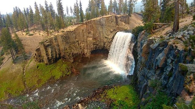
Rainbow Falls. Photo: Rainbow Falls
Rainbow falls is in Reds Meadow Valley, just west of Mammoth Mountain, near a rare geologic feature known as Devils Postpile. Huge columns of geometrically shaped basaltic rock create an enormous formation that seems improbable in this organic, natural landscape. The forces that created this monolith also sculpted the river and rocks to form stunning waterfalls in this valley. Rainbow Falls is a quintessential waterfall with a wide mouth flowing smoothly over a rocky precipice into a wide pool. Getting here in summer from Bishop requires a drive of 50-miles (50-minutes) to Mammoth Mountain Ski Area. From there take the shuttle bus to Red’s Meadow and spend some time contemplating these marvels of nature. A relatively short and easy hike of about 2.5-miles roundtrip from the Red’s Meadow Resort takes you to a lovely view of the falls. Along the way you will cross the Pacific Crest Trail.
Fishing
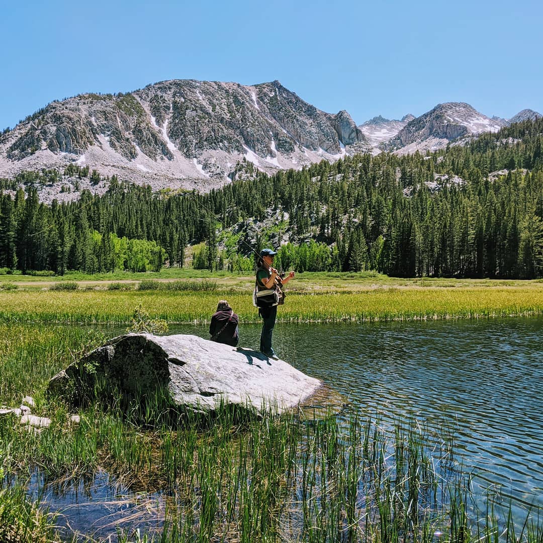
Summer fishing in the Eastern Sierra. Photo: @dw_blakey
Fishing on the Eastside has drawn anglers from all over the world for over 100-years. It’s one of the most spectacular fly-fishing regions in the country. Summertime is the best time of year for fishing. On the last Saturday in April every year the sport fishing season opens and every stream, lake, pond, and creek up and down the Sierra Nevada is open for fishing. A California fishing license is required for anglers 16 years of age or older and all regulations must be obeyed to fish legally in these waters. Two free fishing days each year are offered by the California Department of Fish and Wildlife when licenses are not required, but all other regulations must be followed. Within 20-miles (a 20-minute drive) from Bishop are four large lakes all easily accessible, well stocked, and in a setting that’s supremely beautiful. Bishop Creek Canyon is where the three forks of Bishop Creek each flow into large lakes all above 9,000 feet elevation—North Lake, Lake Sabrina, and South Lake on the north, middle, and south forks respectively. A large reservoir known as Intake 2 lies a little below at 8,000 feet and is also high regarded for great summer fishing. Upward and into the High Sierra Wilderness are yet more lakes and some of the most spectacular scenery you will ever see.
Bishop Creek Canyon
Fishing in Lake Sabrina. Photo: @hamidosati
This area is the jewel in the crown of Bishop’s beautiful big backyard. Bishop Creek Canyon is a large area of about 30 square miles where the North, Middle, and South Forks of Bishop Creek drain down toward the Owens Valley. Along each fork lies a large lake: North Lake, Lake Sabrina at middle, and South Lake all situated above 9,000 feet above sea level. Numerous other smaller lakes lie along these creeks above and below—the largest of which is Intake 2 at 8,000 feet, just below the settlement of Aspendell. The lakes and streams are stocked seasonally with rainbow trout and all canyon waters have self-sustaining populations of wild Brown and Brook trout.
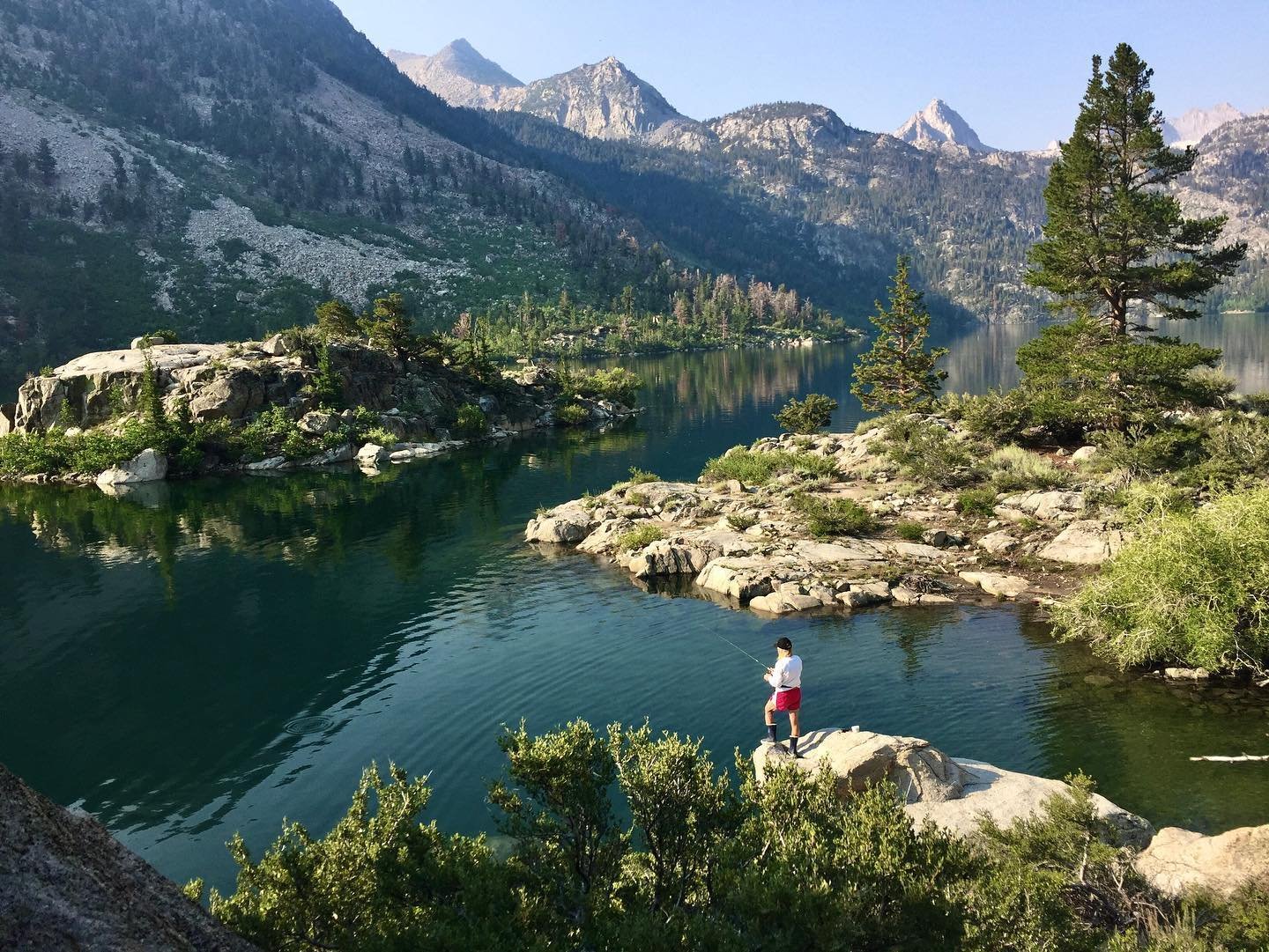
High Sierra Wilderness
Fishing Bull Lake in the John Muir Wilderness
Numerous trailheads begin at many points in Bishop Creek Canyon where you can truly get away from the pressures of daily life and into the adjacent wilderness. Hundreds of lakes and countless streams flow down ravines and collect in basins of the High Sierra. They are only accessible by foot (or hooves) and it is here in the wilderness where the pursuit of happiness and the art of fishing are in total harmony. A few notable trails are Bishop Pass trail from South Lake, Sabrina Basin trail from Lake Sabrina, Lamarck Lake trail and Piute Pass trail from North Lake. These are well all used trails, yet seekers of solitude can find side trails to stream access and lakeshores that are secluded and idyllic.
Directions to the Bishop Creek Canyon lakes and High Sierra wilderness
Hiking
Hike from Bishop Pass trailhead starting at South Lake
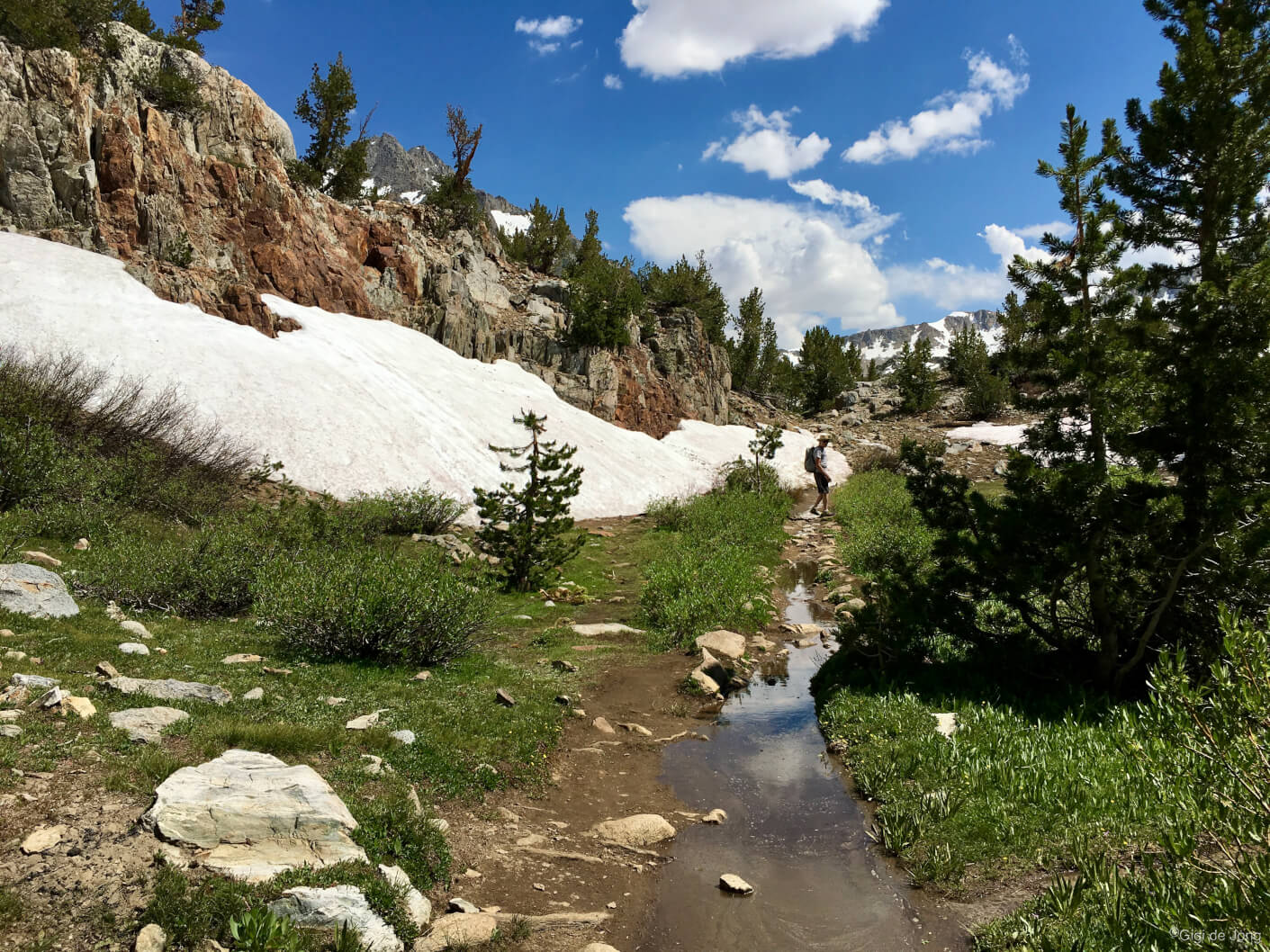
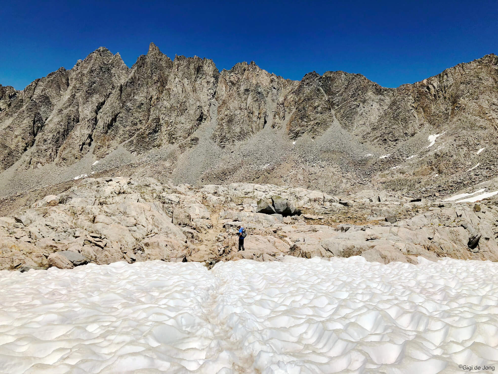
Summer is hiking season! The Eastern Sierra is one of the world’s greatest hiking destinations. The highest and most challenging sections of the Pacific Crest Trail and John Muir Trail pass by here. Bishop is perfectly situated for thru-hikers to rest and resupply, but it is even more perfectly situated to for day hikers and backpackers to experience the Sierra Nevada in just a day or a few. Easy access by paved road along SR-168 W (W. Line St.) to numerous trailheads is little more than 20-miles from town. Trails to the High Sierra begin at each of the big lakes in Bishop Creek Canyon. Another equally beautiful and popular canyon is Rock Creek canyon where trails can take you to nearby lakes and overlooks or well into the high country. Some of the highest elevation trailheads, accessible by vehicle are in the White Mountains at over 10,000 feet above sea level. These trails weave through one of the most incredible places on earth, the Ancient Bristlecone Pine Forest, where the oldest living things on the planet eke out a cold, mountaintop life.
Bishop Creek Canyon trailheads
Sun cups near Bishop Pass. Elevation 11,950ft.
Trailheads begin from each of the three main lakes along the three forks of Bishop Creek: South Lake, Lake Sabrina, and North Lake; and at points along the roadways that climb up into this spectacular canyon area. Hikes range from easy to hard with most becoming strenuous depending on how far and high you hike. The trails climb well up into the Sierra Nevada and toward the Pacific Crest and John Muir Trails through alpine forests, around yet more lakes, dipping into meadows, and cresting craggy summits. This is where you really pick your path. Take a slow and steady out-and-back alongside a lake or go big and bag a peak. Have you ever seen the sun cups in the glacial snowbanks high in the Sierra Nevada? Summer is the time to see them. From Bishop drive west on SR-168 W (W. Line St.) for 15-miles. To get to South Lake turn left at the junction with S. Lake Rd. and continue for 7-miles to the parking area for the lake and trailheads. Or continue straight on SR-168 W for 3-miles and turn right onto N. Lake Rd. Follow this narrow, winding road—which is part paved and part dirt—until you reach the day use parking for North Lake. Lake Sabrina is at the end of US-168 W just one-mile beyond the N. Lake Rd. junction. There are numerous trailheads along all these roads, just look for parking and signage as you go.
Rock Creek
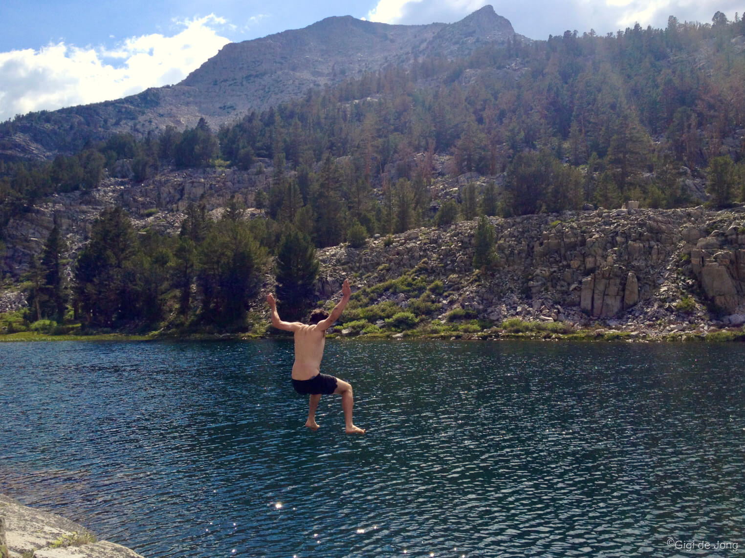
Hike Rock Creek trail and take a jump into Box Lake
Rock Creek Rd. begins at the junction with US-395 a little under 25-miles north of Bishop. This newly resurfaced paved road winds up this alpine canyon for just over 10-miles, passing campgrounds, lakes, lodging, a restaurant, and mule pack station until it ends at Mosquito Flat where the main trailhead begins. It starts with an easy amble up a rocky path then soon offers options to higher and more challenging hikes. Paths and trails around Rock Creek Lake present easy lakeside hiking and lounging in an idyllic alpine setting.
Ancient Bristlecone Pine Forest
A young one among the old ones – Ancient Bristlecone Pine Forest. Photo: @drbrookejune
The Great Basin Bristlecone Pines are not just the oldest things in California or even North America, they are the oldest living non-clonal organisms on our planet! The oldest tree, Methuselah, is almost 5,000 years old and still living. The healthy and growing Ancient Bristlecone Pine Forest is located high in the White Mountains above Bishop. The trails that weave through the forest are some of the highest and easiest hikes you can get to by vehicle on a spectacular paved road. Did you know they have become known as the trees that rewrote history? Visit the Schulman Grove Visitor Center to learn more about these natural wonders and take a hike among these ancient beings—the Discovery trail is a short hike of just less than one-mile, and the Methuselah trail is a longer 4-miles hike deeper in the forest. From Bishop drive south on US Highway 395 for 15 miles and turn left onto State Route 168 East. Follow the road for 13 miles then turn left onto White Mountain Rd. Ten miles further you will arrive at the Schulman Grove Visitor Center. This is a drive of a little over one hour on a good, paved road. It is steep and winding most of the way and there is no gas, food, water, or cell phone service available at the top or along the route. Before you go, call the White Mountain Ranger station in Bishop for more information, road conditions and visitor center hours (760) 873-2500.
Trail Running

Buttermilk Tungsten trail running. Photo: Mike McDermott
Summer trail running in the Eastern Sierra is world class! There is no better place for trail runners to train at altitude. Few other regions offer such easy access to trailheads that provide an array of options to run long and high. These trails give runners the chance to test legs, lungs and heart, and be rewarded with awe inspiring views and a sense of absolute satisfaction. Grass Lake and Tyee Lakes trails are just two of the many single-track trails that begin in the Bishop Creek Canyon area and climb thousands of feet into the John Muir Wilderness. An incredible dual-track trail in the White Mountains begins at just over 11,600 feet to summit White Mountain Peak standing at 14,183 feet high. In summer it is accessible by road, part paved and part gravel, and may require a high clearance vehicle for the gravel section.
Grass Lake trail
Hikers on Grass Lake Trail
This trail begins at North Lake Campground and is a quick, easy run of 1-mile with 675 feet of elevation gain. It’s a spur trail off Lamarck Lakes trail which is a moderately challenging route of 4-miles round trip with just over 1,600 feet of elevation gain. From Bishop drive west on SR-168 W (W. Line St.) for 18-miles and turn right onto N. Lake Rd. Follow this narrow, winding road—which is part paved and part dirt—until you reach the day use parking for North Lake. Park and warm up as you jog the ½-mile to the trailhead in the campground.
Tyee Lakes trail
Dogs loved running Tyee Lakes trail. You will too.
Tyee Lakes trail sets off from the trailhead along S. Lake Rd. It is a moderate to strenuous out-and-back run of 7-miles with 2,135 feet of elevation gain. Dogs are welcome and may be off leash in some areas. This trail passes by four lakes set in a deep, steep-sided canyon and is less frequently used by hikers. Drive west out of Bishop drive on SR-168 W (W. Line St.) for 15-miles and turn left onto South Lake Rd. Continue for 4.9-miles and pull over into a large, obvious roadside parking area. The trail begins at the wooden bridge crossing the South Fork of Bishop Creek and quickly begins to climb up the rocky canyon slope.
White Mountain Peak trail
Last few hundred yards to White Mountain peak. Late summer, early snowfall.
White Mountain Peak is the third highest peak in California and the only fourteener in the White Mountain range. It’s a mere 253 feet lower than Mt. Whitney, the tallest peak in the contiguous United States. Getting to the top of White Mountain Peak is not a walk in the park, but it can be done in a day and without the need for a permit. The trail is a dual-track road used infrequently by scientists who live and conduct research here at high altitude. It offers a great trail running experience on an exposed mountain ridge with spectacular views. This out-and-back trail is a little over 15-miles long with almost 3,500 feet of elevation gain. From Bishop drive south on US Highway 395 for 15 miles and turn left onto State Route 168 East. Follow the road for 13 miles then turn left onto White Mountain Rd. Ten miles further you will arrive at the Schulman Grove Visitor Center. This is a drive of a little over one hour on a good, paved road. It is steep and winding most of the way and there is no gas, food, water, or cell phone service available at the top or along the route. Continue on White Mountain Rd. which is graded gravel beyond the visitor center. Many sections along this 16-mile section are rough and rocky. Park in the turnout at the locked gate and begin the run here.
Know before you go, call the White Mountain Ranger station in Bishop for more information about current weather and road conditions. (760) 873-2500
Biking
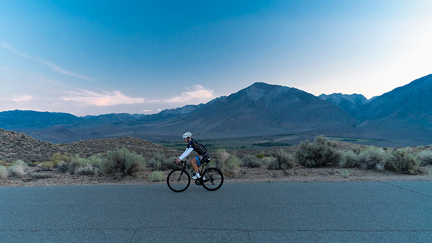
Cyclist on Old Sherwin Grade
The beauty of our big backyard, besides its gorgeous scenery, is that there’s always somewhere to go cycling no matter the season and temperature. When it’s hot in the valley in summer, we go high! A road ride up (and down) a Sierra Nevada canyon is a very special experience. Mountain biking the tracks and trails of this rugged range is challenging and exhilarating. A sweet ride on Rock Creek Rd. travels through alpine forest along a newly resurfaced road with a wide biking shoulder provided for the way up. The Benton Crossing Rd. between Benton and US-395 is a super 38-mile section of the Mammoth Gran Fondo race route. A challenging mountain bike trail begins at Rock Creek Lake and ends above Swall Meadows on the other side of Wheeler Ridge. Check out many more cycling options on our dedicated Road Biking page here and Mountain Biking page here.
Rock Creek Canyon – road bike

Rock Creek Rd in fall
This is a delightful 20-mile ride (10 up / 10 down) starting at Tom’s Place, 25-miles north of Bishop on US-395, and ending at the Mosquito Flat in heart of the Rock Creek Canyon. The road is in excellent condition with a wide shoulder on the upward, southbound side of the road. There are picnic spots and swim spots along the way and Rock Creek Lodge and restaurant is about two-thirds of the way up. From Bishop drive north on US-395 for 25-miles. Turn left at Rock Creek Rd. and park along the Crowley Lake service road to the left. Please don’t take up parking spaces in front of Tom’s Place.
Benton Crossing – road bike
Wildrose summit on Benton Crossing Rd during Mammoth Gran Fondo
Benton Crossing road from the small settlement of Benton on US Highway 6 (34-miles north of Bishop) to the junction with US-395 (34-miles northwest of Bishop) is a perfect summer ride with very light road traffic. This 37.4-mile ride is a locals’ favorite and forms the southern part of the Mammoth Gran Fondo 100-mile loop ride held in September each year. You’ll need arrange a shuttle to do it one way or rack up miles and ride back to your starting point. To begin at Benton drive north out of Bishop on US-6 for 34-miles, turn left onto SR-120 and park in the clearing west and behind the Post Office. Cycle route 120 for 7.1-miles then turn left onto Benton Crossing Rd. and ride for another 37.3-miles to the junction with Hwy 395. Hop in your prearranged shuttle here or turn and ride back to your vehicle in Benton.
Upper Rock Creek Sand Canyon – MTB

Fatbiking Sand Canyon Trail
This is a challenging, technical ride at the start to get up the first 1-mile of stepped uphill trail. Ride or carry depending on your skills. Then the trail sweeps along the base of the Wheeler Crest, above Rock Creek Canyon, and slowly descends through meadows and alpine forest for about 7-miles. It cuts around the north end of Wheeler ridge where it drops toward Lower Rock Creek. The trail then follows Birch Creek down a steep ravine for another 7-miles to end at Sky Meadows above the settlement of Swall Meadows. This ride definitely requires a little planning and a shuttle to the start and pick up at the finish. To get to the start drive north on US-395 for 25-miles to Tom’s Place and turn left onto Rock Creek Rd. Drive for 86-miles and turn left onto Rock Creek Lake Campground Rd. About ½-mile further park in the day use parking area. Getting to Sky Meadows from Bishop, drive north on US-395 for 10.7-miles and turn left onto Pine Creek Rd. Immediately turn right onto Old Sherwin Grade Rd and drive for 8.7-miles. At the sign for Swall Meadows, turn left, and in 0.7-miles turn right on Sky Meadow Rd. and just over ½-mile further park in the large clearing on the right of the road.
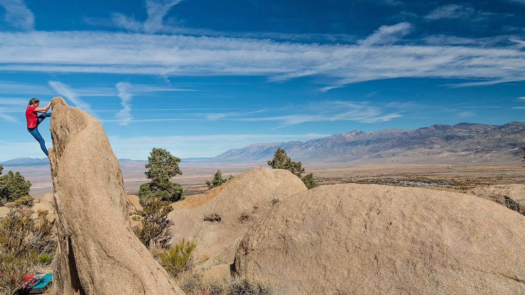
Climbing

Summer is mountaineering time. Climbing Mt. Tom. Photo: @tarahhnasaurus
Summer climbing in our big backyard is when we go high! Summer is mountaineering time. Seasonal temperature ranges here are as extreme as our magnificent topography. The low valleys are hot in summer and perfectly chill in winter, and the high mountains are refreshingly cool in summer and snowcapped in winter. That means there’s always somewhere to climb. And there’s perfect rock everywhere. These are some of the best summer climbing destinations: bouldering on the Druid Stones, sport and trad climbing in Pine Creek Canyon or Clark Canyon, trad at Whitney Portal and mountaineering to the top of Mt. Whitney.
Druid Stones
Climbing the Druid Stones. Photo: @michellerjohnsonphotography
Two thousand feet above Bishop this large collection of big monzonite boulders is home to hundreds of boulder problems. It’s an uphill hike to reach the spot and along the way you may be tempted to stop and drop a pad and just climb the nearest rock. Persevere. You will be rewarded. The view alone is worth the hike. High quality climbing identical to the Buttermilks is found here, but cooler and seldom crowded.
Getting to the trailhead is a short drive out of Bishop along S. Barlow Lane, bear right at the fork up Bir Rd and in 1.7 miles look for a sandy dual-track road to your left. Follow the track toward the base of the hill and park at the road’s end. A Google Map search of Druid Parking, Bir Road will pinpoint the spot.
Pine Creek Canyon

Pine Creek Canyon is a trad mecca with crack climbs interspersed with the bolted sport routes. Photo: Emily Sierra
This classic example of a deep glacial canyon is Bishop’s best offer of summer granite climbing. It has a long and proud history of climbing greats who have put up classic and technically challenging routes. The canyon continues to be developed as a sport climbing area and is a new trad mecca with crack climbs interspersed with bolted sport routes. Pine Creek now boasts over 630 routes including long multi-pitch climbs, tons of trad climbs, and one of the largest collections of sport climbs in the state. It is popular with experienced local climbers and summer visitors. The Tungsten mining history of Pine Creek Canyon is as fascinating as the climbing and a drive to the end of the canyon shows an intriguing glimpse of a time gone by.
Head north from Bishop along US Highway 395 for 10.7-miles then turn left onto Pine Creek Rd. Drive up into this spectacular glacial canyon for 7.7-miles and turn right onto the dirt track that leads to parking areas for Scheelite Canyon Trailhead. The majority of the climbs are located in this side canyon known by climbers at Pratt’s Crack. Take a look at this information on mountainproject.com for details on all the climbs in Pine Creek.
Whitney Portal
Summiting Mt Whitney. Photo: @wanderlust.explore
Climbing some of the many sport and traditional routes at and around Whitney Portal is an undertaking for more experienced climbers. It’s a high alpine climbing experience with multiple-pitch routes that rival those of Yosemite and Tahquitz, but without the crowds. Although camping (which is only allowed in designated campgrounds) and parking at the portal can be crowded and hikers on the well-known trails are plentiful, the trails to the many walls and buttresses in the canyon will get you away from the hubbub. Check out the route descriptions on mountainproject.com here.
A full ascent to the top of Mt. Whitney requires a permit, planning, training, and time. If this is on your to do list, begin your preparation a year or more in advance. Find out more about permits and planning here.
Whitney Portal is located 12-miles west of Lone Pine. From Bishop drive south on US-395 for 60-miles (60-minutes) to the center of Lone Pine and turn left onto Whitney Portal Rd. Follow this winding mountain road to its end at Mt. Whitney Trailhead.
Clark Canyon

Top roping in Clark Canyon
Well off the beaten path, Clark Canyon is in a remote, wooded area just below Bald Mountain almost 60-miles north of Bishop. Almost all of the over-100 routes in this area are bolted and range from 5.7 – 5.11d in grade. A notable feature of climbing here is that this rock is Bishop Tuff. It was formed from a volcanic explosion 760,000 years ago and eons of wind and water erosion have sculpted a gazillion holds and pockets on routes that are steep and relatively short. It’s perfect for lead improvement and top roping and a fantastic area for summer camping, climbing, and exploring with the whole family.
Clark Canyon takes a little care with navigation to get here and is best done in a vehicle with high clearance. Drive north on US-395 from Bishop for 46.4-miles the turn right onto Owens River Rd. just beyond the Crestview Rest Area. Drive for 2.1-miles and turn left toward Big Springs Campground and immediately turn right onto Big Springs Dr. (Forest Service road 2S04) Follow this road for 2.1-miles then turn right onto FS-2S06. In 1.5-miles turn right onto FS-1S47 and drive a further 1.8-miles. Turn right onto an unnamed road and drive 0.6-miles to where it ends in a small loop parking area. Please don’t camp in the parking area. There is plenty of boondocking nearby and along the way.
Motor Touring
It’s a spectacular view from the Sierra View Overlook
A summertime drive from the valley floor to the high mountain ridges and canyons is when the diversity of this landscape is fully revealed. Feel the change in temperature from low to high. Observe the change in vegetation from arid to alpine. Drive to 10,000 feet above sea level and look across the deepest valley in the United States and view 100-miles of jagged ridgeline of the Sierra Nevada from Mt. Dana to Mt. Whitney at the Sierra View Overlook. Touch a living tree that’s older than 4,000 years old in the Ancient Bristlecone Pine Forest. See the results of glaciers that carved the canyons of the Sierra Nevada with drive up Onion Valley Road. Tackle the tough tracks with your off-highway vehicle to see the stunning spires on Papoose Flat.
The Eastern Sierra offers opportunity for a few hours of beautiful and comfortable exploration on lightly trafficked paved roads. It also provides numerous opportunities for adventurous off-highway driving from easy, well-graded dirt roads to extreme technical, rocky tracks. On four wheels or two wheels motor touring on the Eastside has something for everyone.
Ancient Bristlecone Pine Forest
White Mountain road to the Patriarch Grove
The Great Basin Bristlecone Pines are not just the oldest things in California or even North America, they are the oldest living non-clonal organisms on our planet! Did you know they have become known as the trees that rewrote history? They live high in the White Mountains between 9,000 – 11,000 feet elevation. The verified oldest living tree is named Methuselah; it is almost 5,000 years old! A visit to these ancient ones in summer is as easy as a Sunday afternoon drive, but you can go any day. State Route 168 East snakes its way up the mountain and traverses the crest all the way to the Schulman Grove Visitor Center at 10,000 feet—more than 5,000 feet above the valley floor. It’s cool and beautiful and uplifting. A more challenging route for OHV enthusiast is up Silver Canyon Rd to White Mountain Rd. to the Patriarch Grove and return via the visitor center.
From Bishop drive south on US-395 for 14.6-miles and turn left onto CA-168 E just before you reach Big Pine. Enjoy the twisting, turning drive of 12.9-miles on a good, paved road, weaving through a short narrow one-lane canyon, to the junction with White Mountain Rd. Turn left and continue to climb the mountain for 10-miles more until you reach the visitor center. Along the way stop at the Sierra View Overlook and take in this bird’s eye view of the Owens Valley and 100-miles of the Sierra Nevada crest beyond.
The Patriarch Grove, where the biggest of the old trees live, is 12-miles beyond the Schulman Grove Visitor Center on a gravel road that is generally graded but may present a few rocky obstacles. It’s best to attempt this with a high clearance vehicle. Experienced OHV enthusiasts can access this section of White Mountain Road via Silver Canyon Road from near Laws on the valley floor. Go north from Bishop on US-6 for about 5-miles, turn right onto Silver Canyon Rd. and take slow, technical drive for 16-miles up this canyon. Turn left onto White Mountain Rd. to get to the Patriarch Grove 10-miles along. Return via the Schulman Grove Visitor Center and head down on the paved road for a mellower descent.
Onion Valley Road

Nearing the top of the steep, serpentine Onion Valley Rd.
This is one of the steepest and highest roads in California and it’s all paved. The route profile describes an almost perfect pyramid—all up and all down—but along the way it curves and switchbacks up 5,250 feet in 13-miles! It’s cool, high, and provides spectacular views of the Owens Valley below. Don’t run your AC and use your lowest gears, especially on the way down. The original road was constructed circa 1865 as a ‘haul road’ to the trailhead for Kearsarge Pass. Miners, probably with mules, hiked the next 4-miles and 2,600 feet of hiking trail, to access and supply Kearsarge Mine just beyond on the eastern side of the divide.
Drive south out of Bishop for 40-miles on US-395 to Independence. Turn left onto W. Market St. at the corner with the Post Office. In 0.2-miles the road becomes Onion Valley Rd. There are vault toilets and piped water at the trailhead parking lot. This is a busy trailhead in summer and parking may be scarce. Hop out and take a deep breath of cool, mountain air and spot the waterfall tumbling down from the pass above.
Papoose Flat OHV

Papoose Flat. Photo: @exploreabitmore
Papoose Flat is known for its unique landscape of randomly isolated granite spires that dot the flat, and for the marvelous views of the Sierra Nevada crest and Owens Valley below. It is situated almost directly above Tinemaha Reservoir, at the crest of the Inyo Mountains, which separate Saline Valley from the Owens Valley. This high desert flat is a circular, tree-less expanse of scrub desert dominated by tall granite spires rising out of the ground at irregular intervals. It has a sense of being ‘otherworldly’. Nighttime up here is a stargazer’s dream.
Getting to Papoose Flat from Bishop, head south on US Highway 395 for 15-miles, and turn left, onto CA-168 E. In less than 2.5 miles turn right onto Death Valley Road. Follow this quiet, scenic mountain road for 11.3-miles until you see a sign on your right for Papoose Flat. Turn right onto the dirt road and, almost immediately, in 0.1-mile keep right at the fork. The road will take you along the washes, down some dips, and up and over rocks, as you climb the switchbacks to get to the flat. It will serve up some fun 4×4 challenges from steep slopes to rocky scree to big steps and tight squeezes. There are a number of cleared areas for primitive camping nestled under the towering rock formations. More are situated in the trees at the edge of the crest overlooking the Owens Valley as well as on the high ridges surrounding the flat. Please stay on track and only utilize spaces already cleared for camping.
Natural History Sights
The abundance of nature in the high Sierra in summer
There are few places in the world where evidence of the natural history of a region is more obvious and interesting than in the Eastern Sierra. The rocks tell stories of the upheavals of the earth, and the valley shows where the Earth’s crust has stretched and dropped while the mountains rose to shelter it from storms. Tiny fish and wild bighorn sheep, a million-year-old lake and the planet’s oldest living things, all endemic to this region, survive, protected by their stewards, so that we can learn about our past and perhaps secure our future.
Because of our unique topography some are accessible and best viewed in summer. These are just few recommendations of the many incredible sights you can see in our big backyard. There’s the highest—Mt. Whitney, and the oldest—the Ancient Bristlecones, the brightest—the Night Sky and Milky Way, and the very surprising—Devils Postpile.
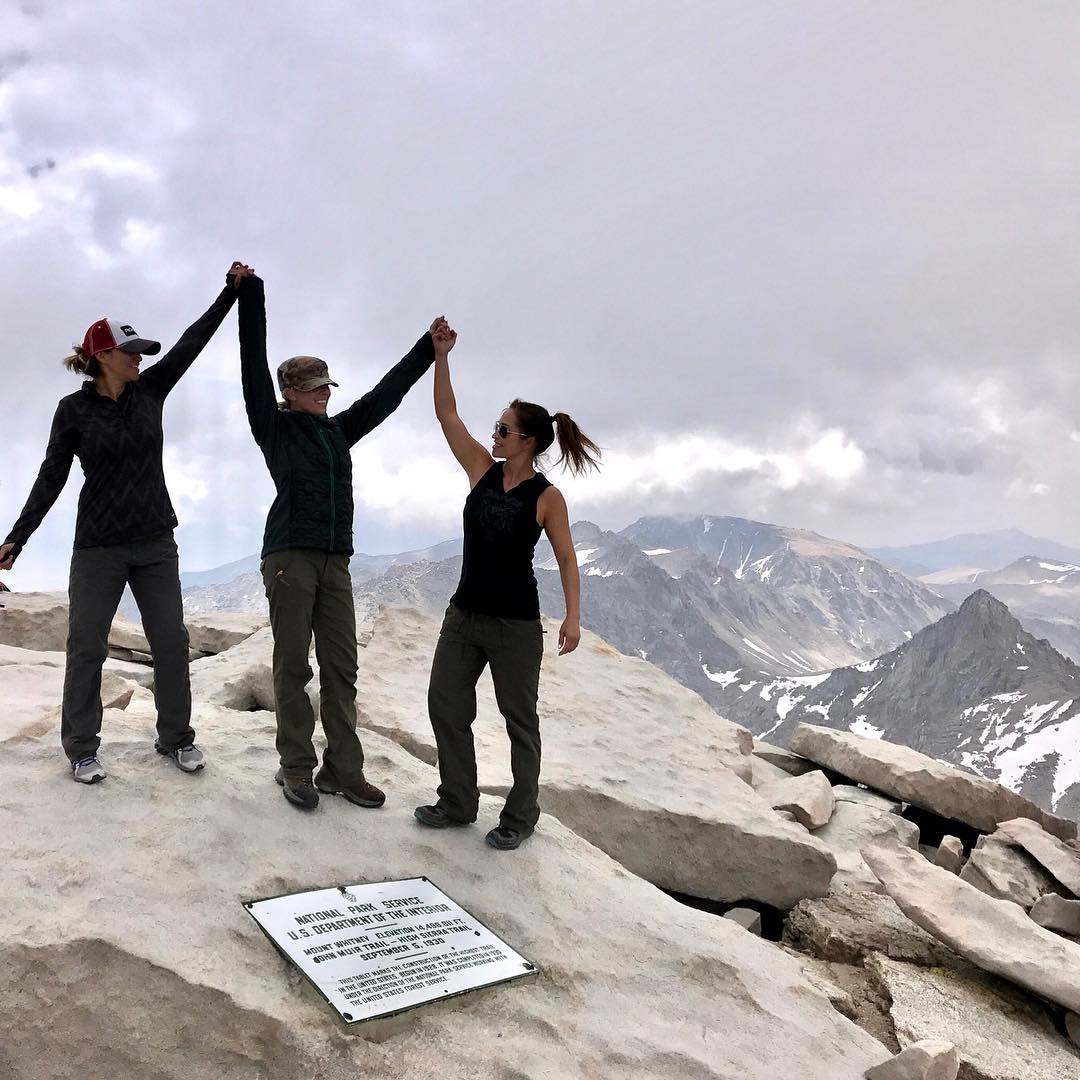
Mt. Whitney

Sunset on the hike up to Mt. Whitney. Photo: @phil.parrish
The mighty Sierra Nevada range runs about 400 miles down the eastern side of California. It is part of an almost continuous chain of mountain ranges known as the American Cordillera that forms the ‘backbone’ of North America, Central America, South America, and Antarctica. Along this inland mountain spine is the highest point in the contiguous United States, Mt. Whitney, which rises to 14,505 feet above sea level. Climbing Mt. Whitney requires a permit (these are limited to 160 permits per day issued months in advance) plus a good deal of mountaineering experience and trip planning. Viewing Mt. Whitney can be done from many points along US Highway 395 near Lone Pine, and the closest you can get to the summit by car is Whitney Portal.
Drive 60-miles (60-minutes) south of Bishop on US-395 and turn left onto Whitney Portal Rd in the center of Lone Pine. A curvy mountain road will take you to the trailhead parking lot 11.8-miles along. Finding a parking space on a good summer day can require a little patience, but it will be worth the wait. Spend some time walking the trails around the portal and perhaps grab a bite and drink at the Whitney Portal Café.
Ancient Bristlecones
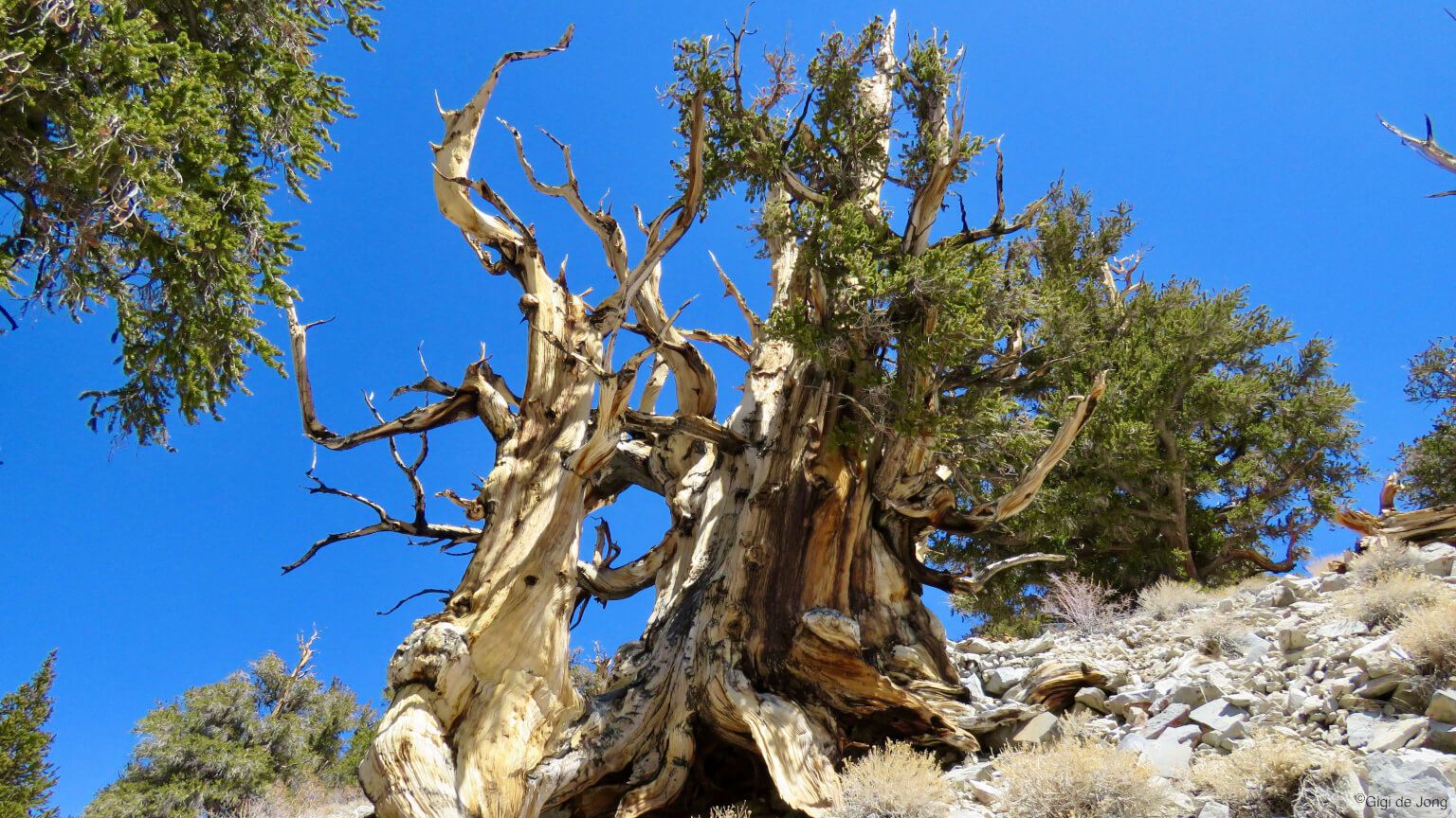
Gnarled and weatherbeaten old Bristlecone pine
The planet’s oldest living things live here, high up on the desolate, windswept peaks of the White Mountains. The Great Basin Bristlecone pine trees live for thousands of years and the oldest of these gnarled, weather-beaten, and resilient old trees is confirmed to be almost 5,000 years old. It has been named Methuselah and its location is kept secret by the guardians of this forest. No other living, individual thing on this planet is older. The have become known as “the trees that rewrote history.” Come see why.
From Bishop drive south on US-395 for 14.6-miles and turn left onto CA-168 E just before you reach Big Pine. Enjoy the twisting, turning drive of 12.9-miles on a good, paved road, weaving through a short narrow one-lane canyon, to the junction with White Mountain Rd. Turn left and continue to climb the mountain for 10-miles more until you reach the visitor center. Along the way stop at the Sierra View Overlook and take in this bird’s eye view of the Owens Valley and 100-miles of the Sierra Nevada crest beyond.
The Night Sky
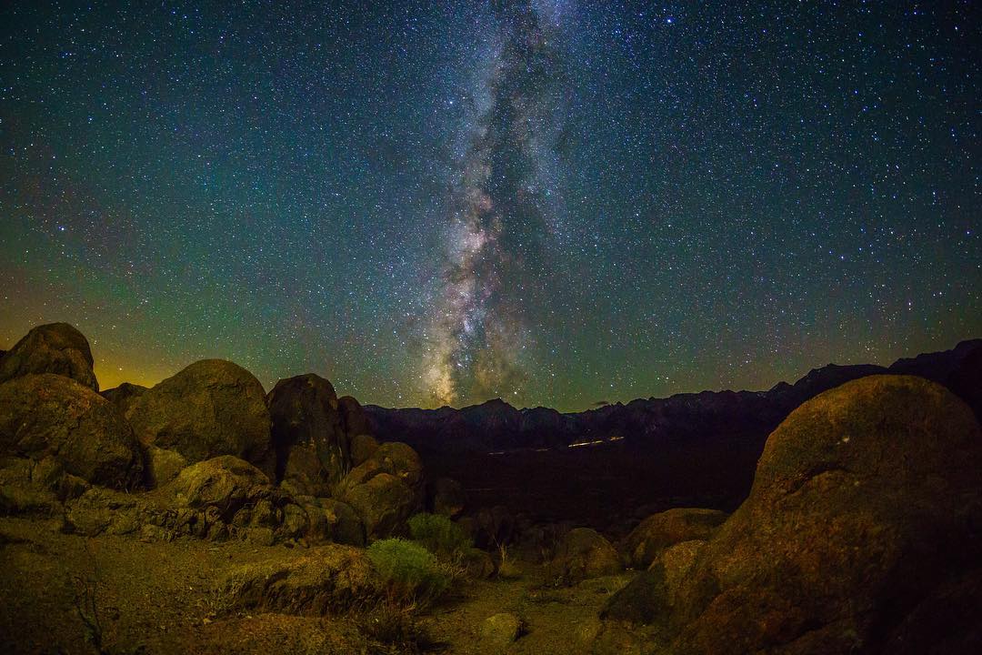
Galaxy of Stars. Photo: @siebrandjeff
The night sky in the Eastern Sierra is one of the last remaining places on earth where the stars still shine as brightly as they did when Galileo first focused his rudimentary telescope at this phenomenon in 1610 and discovered that it was made up of stars. Visitors to our area tell us that they are awestruck by the abundance of stars and clarity of the Milky Way on a moonless night.
The Owens Valley has low light pollution, clear air, and very few cloudy nights; and many of the best view locations have spectacular natural beauty of their own. It is perfectly situated for a brilliant night sky experience. Summer is probably the very best season to see the magnificent canopy of stars and a creamy Milky Way.
Here are two lovely locations for stargazing: the Tablelands—less than 5-minute drive north of town, and the White Mountains. There are many more excellent stargazing sites, take a look at our Night Sky page for more information.
Tablelands
This volcanic plateau rises about 300 feet vertically just a few miles north of Bishop. It’s an expansive landscape with incredible views any way you look—including up! It is one of the most expansive views of the sky in the area. The tablelands were formed about 760,000 years ago when a massive volcanic eruption emptied the magma chamber below the area that is now the Long Valley Caldera, about 22 miles northwest as the crow flies. It released very hot ash that subsequently cooled and became the soft rock we now call Bishop Tuff that makes up this 300‑foot high escarpment.
Follow US Highway 6 north out of Bishop for 2 miles and turn left onto 5 Bridges Rd. Follow the paved road for 2 miles and, where the pavement ends, continue straight ahead onto the dirt road, Casa Diablo Rd., that ascends the escarpment. Drive for a few miles and pick a turnout where you can stop and stare skyward for a few hours. If you spend some time here, and identify the North Star, pick out a constellation and see how it moves across the sky.
White Mountains
High above Bishop is the Ancient Bristlecone Pine Forest. These trees, the Great Basin bristlecone pine, are the oldest living non-clonal organisms on earth and, if trees could speak, they might tell us of a slightly different sky than the one we see now. The oldest tree, with a verified age almost 5,000 years old, Methuselah, and was just a sapling when the star Thuban was the pole star at the time when the Egyptian pyramids were being built.
The Schulman Grove Visitor Center and Patriarch Grove within this protected forest are closed from 10pm – 6am. However, there are many excellent view sites along the roadway leading up to this national treasure. The Sierra View Overlook offers a wonderful vista of the valley below and the night sky above. Arguably the best place for an overnight stargazing experience is at Grandview campground. From Bishop head south toward Big Pine for 15-miles, turn left onto CA-168 East. In 13-miles turn left onto White Mountain Rd. A little over 5-miles along is the campground and 2.5-miles further is the Sierra View Overlook.
Devils Postpile
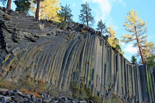
Columnar basalt at Devils Postpile. Photo: Frank Kovalchek – Wikimedia commons
In an area known today as Reds Meadow Valley, just west of Mammoth Mountain, is a colossal rock formation of near-perfectly geometrically shaped rock columns. This columnar basalt is the result of a volcanic explosion about 100,000 years ago that produced a huge lava lake that subsequently cooled, hardened, and cracked into near symmetrical hexagons and polygons.
Getting here in summer from Bishop requires a drive of 50-miles (50-minutes) to Mammoth Mountain Ski Area. From there take the shuttle bus to Red’s Meadow and spend some time contemplating these marvels of nature. It is a short walk of under a half-mile from the Reds Meadow visitor center to the base of this massive rock buttress. A little further the trail climbs a few yards up onto the top of the Postpile, where the evidence of the glacial scouring and polishing is so startling that it makes one feel as if one has entered the hallway of a grand mansion.
Museums & Cultural Sights
Museums and interpretive centers are numerous along the Eastern Sierra corridor of US-395. They tell the stories of the people who lived here, settled here, and came in search of fortune. Some reveal the marvels of nature like the Mono Lake Visitor Center, others preserve and showcase the workings of the early settlers in the region like the Mt. Whitney Fish Hatchery, and another, Bodie State Historic Park, is a stark representation of the dashed hopes and dreams of fortune seekers.
Mt. Whitney Fish Hatchery
Mt Whitney Historic Fish Hatchery. Photo: @craigsuchovsky
This old building was built to last. The architecture was inspired by the mountains and the stately structure and picturesque grounds are an integral part of the Owens Valley economy and community spirit. From the moment this facility opened in 1917 the hatchery produced “unmatched quality and quantity” hatchlings. The first eggs were collected from Rae Lakes and, for ten years, transported to the hatchery by mule train. Golden Trout eggs were collected in 1918 from Cottonwood Lakes and this hatching program was the only source for our California State fish throughout the Sierra Nevada. The Mt Whitney Fish Hatchery was once the largest and best-equipped hatchery in California. It is now an educational facility that serves to preserve the historical significance of the hatchery and promote awareness and understanding of our natural resources.
Drive south from Bishop on US-395 for 39 miles. Just before the town of Independence turn right onto Fish Hatchery Rd. and follow the signs to the historical building. Feed the fish. Watch the informative video. Read the interpretive displays. Wander the grounds. Get a feel for fishing in the Eastern Sierra.
Bodie State Historic Park

Bodie general store and gas. Photo: Wim Aarts
Clusters of weather-beaten old houses lean in toward each other like neighbors reminiscing quietly about the past. Large tarnished-steel factory buildings dominate a hillside yet remain eerily silent as if having lost the will to keep working. An old church stands tall, its bell no longer ringing. As many as 10,000 people once lived here on this harsh, cold, windswept, plain. They toiled in search of a better life lured by the promise of gold. As quickly as the town boomed in the 1880s, it declined less than two decades later and by the early 1900s it was declared a ghost town. Of the 2,000 buildings that made up this once prosperous western gold-mining town, now only about 110 structures still stand in a picturesque state of arrested decay.
Bodie State Historic Park is a 96-mile drive (about 2-hours) north of Bishop. Take US-395 north for 83-miles to the junction with SR-270, Bodie Rd. and turn right. Drive east 10-miles to the pavement end and continue for 3-miles along a dirt road (which can be somewhat rough) to Bodie. Although the park is open from about mid-March, the road may be closed to regular vehicle traffic due to snowpack. Oversnow equipment is necessary and required to reach the park during early spring—call the park, visit the official website here, and check road conditions online. Mid-summer is the perfect time to visit this sprawling ghost town.
Mono Basin Scenic Area Visitor Center
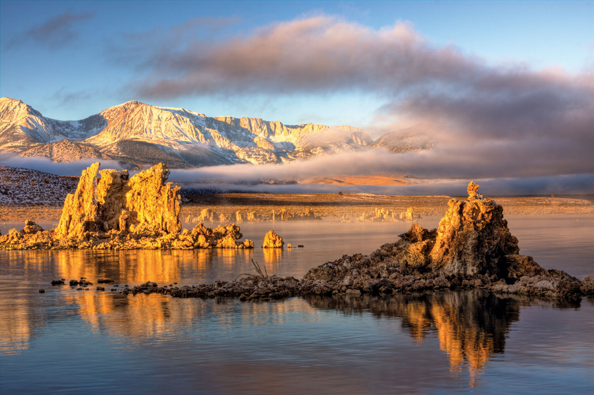
Mono Lake with Tufa and storm clouds. Photo: Mono County tourism
Mono Lake is surreal and ethereal. It is a huge inland sea with tall, crusty rock spires that rise out of the water like submariners surfacing to call for the alien life that left them here a million years ago. These tufa towers are actually calcium carbonate deposits which form, under the lake’s surface, as freshwater springs bubble up into the excessively salty and alkaline lake. The lake in its present form was probably created by the Long Valley eruption some 760,000 years ago, but it is also thought to be a remnant of a larger, older lake that is 1-million years old. It sits in a closed basin and evaporation concentrates the remaining water to twice the salinity of the world’s oceans. Fish do not survive in this water, but the lake is home to trillions of brine shrimp and alkali flies that are the food for millions of migratory birds that visit here each year.
The Mono Basin Scenic Area Visitor Center is open seasonally and summer is a great time to visit. From Bishop drive north on US-395 for 65-miles (one hour) and turn right onto Visitor Center Dr. Study the many exhibits about the natural and human history of the Mono Basin in the interpretive center and take a walk along the trails to see the many unique features on this lake.
Events
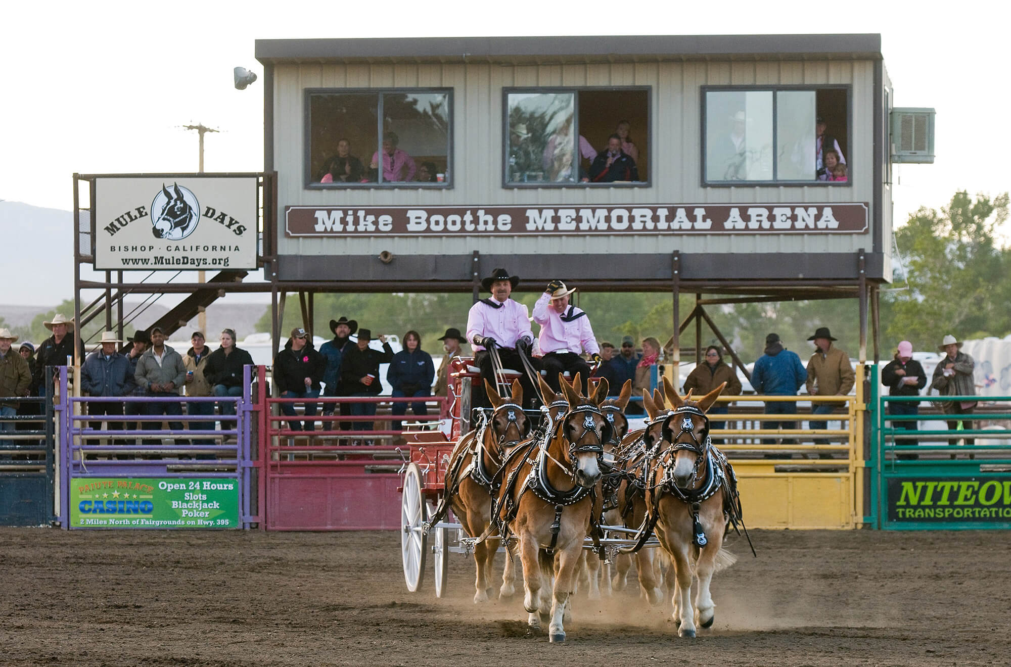
Mule chariot competing in Mule Days
Summer is when some of our biggest community-wide events happen. If you thought the traditional ‘West’ was no longer, our picturesque town and our annual Mule Days Celebration, a world-class equestrian event promoting the legacy, heritage and talents of the mule, is a fun-filled event that will take you back to a bygone era. July 4th is celebrated in a big way too, at the Bishop City Park. Train rides at Laws Railroad Museum and Historical Site are great summer fun on many Saturdays and Sundays from Memorial Day weekend to Labor Day weekend
Mule Days: May 24th – 29th, 2022

We celebrate mules and packers every Memorial Day weekend.
For five days, every Memorial Day weekend, more than 30,000 fans from around the country (and the world) converge on Bishop for this colorful and fun festival. Mule Days is a tradition that began in 1969 as a send-off event for local packers and outfitters to get the summer season going. Now over 700 mules with their trainers, riders and packers attend 14 mule shows that include equestrian disciplines such as: Western, English, youth, barrel racing, gymkhana, packing, shoeing, chariot racing, team roping and driving. The result is a tremendous display of human and animal skills. Among the many highlights of the weekend is a parade along Main Street that is believed to be the country’s longest non-motorized parade. All parade floats and entries must be animal and/or human powered and, naturally, mules are the predominant mode of transport.
The Mule Days motto says, “Anything a good horse can do, a good mule can do better.”
4th in the Park

Fireworks, a July 4th tradition.
Celebrate America’s birthday in the Bishop City Park. Together with its amazing community partners, the Bishop Fire Department is preparing to give Bishop an Independence Day to remember. The entire park will be full of activity throughout the day, and everyone is invited to join the fun! There will be food vendors, live music, and fun for all. Families are invited to come out to the park and enjoy a tasty treat from local food vendors. Those who live downtown are encouraged to ride their bikes or walk to the park. Come early to get a good parking spot, since parking in the area is limited. Bring a picnic blanket, lawn chairs and the whole family for an afternoon celebration.
There will be no personal fireworks allowed, no alcohol, and no dogs in the park, but lawn games and picnics are welcome. Be sure to bring a portable radio for tuning in to KIBS, 100.7 FM after sunset for synchronized music to go along with the town fireworks show. After 9 p.m. tune in to KIBS, 100.7 FM and look to the sky for the fireworks spectacular, which will be launched from the east side of the Bishop City Park. Guests are welcome to spread out throughout the park, in the baseball fields, or watch from home in the downtown area.
Laws Train Rides

Relive history and take a ride on a 1920s Motor Car. Photo: Joe Pollini.
Take a trip back in time and experience the daily life of the early settlers of the Owens Valley. The Laws Railroad Museum and Historic Site celebrates the rich history of the period and tells of a time when the railroad station was the heart of a bustling western town. Close to 50 authentic structures on eleven acres are filled with artifacts and original objects that depict the lifestyles of the homemakers, artisans, and townspeople of the period. All the historic buildings are original structures. Some, like the Laws Depot, the Agent’s house, the locomotive turntable, and the oil and water tanks were constructed right here and have stood on this site since the first train rolled in in 1883. The section of narrow-gauge track that remains on the site still carries restored and working railroad cars – all of which date back to the early days of the railway.
Summer is super for kids of all ages and train rides on the old Death Valley Brill Car No. 5 are fun for all. Check the schedule, as trains run on most Saturdays and Sundays from Memorial Day weekend to Labor Day weekend.