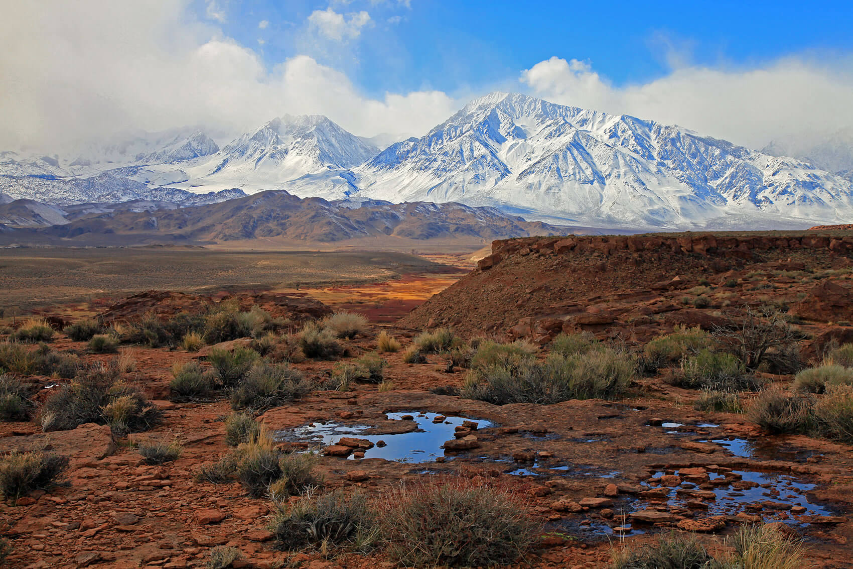
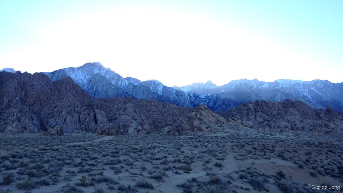
Sierra Nevada seen from the Tablelands by Tony Milici.
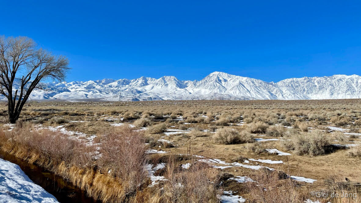
Bishop is nestled in a deep, expansive valley between two gargantuan mountain ranges, the Sierra Nevada to the west, and the White and Inyo Mountains to the east. Precipitation from winter storms that develop over the Pacific Ocean and move eastward, falls on the Sierra Nevada creating a massive snowpack on the higher elevations (above 6,000 feet) all along its 450-mile crest. The White and Inyo Mountains receive a good blanket of snow in winter too.
But Bishop is warm! The town sits at an elevation of around 4,500 feet above sea level and while the snow piles high on the mountains all winter, the town receives just a light snowy blanket a couple of times a season. The valley is bathed in sunshine an average of 335 days a year and the average daily highs in winter, between 50-60 degrees, keep the sidewalks and streets clear of slippery snow and ice. The winter air is crisp and exceptionally clear and the snow-covered mountains that rise dramatically above this charming western town are a magnificent sight to behold.
Our town is warm and welcoming and our big backyard is wild and exciting. Because our big backyard is natural and untamed, conditions can change from day to day so it’s always advisable to speak with a knowledgeable local about what’s best and where to find it.

These are some of the many great things to do in and around Bishop in winter:
- Fishing
- Hiking & Walking
- Trail Running
- Biking
- Climbing
- Snow Sports
- Motor Touring
- Museums & Cultural Sights
- Rest & Relaxation
Fishing

Winter Fishing. Photo: Jim Stimson
Bishop is well known as a world-class seasonal fly-fishing destination. It is also a magnificent winter fishing region. Fly, bait, and lure fishing are legal all year long in the Lower Owens River from Pleasant Valley Reservoir all the way to Big Pine. There are miles of canals, protected ponds, and large reservoirs, some offering handicapped-accessible fishing piers, that are easily accessible by car. The rivers and reservoirs are regularly stocked with trout by the California Department of Fish and Wildlife. The warmer waters of the protected Owens Valley Warm Water Fisheries yield catches of bass, bluegill, carp, and even catfish. All California fishing regulations must be followed and a fishing license is required year-round.
The Owens River, although relatively short at 183 miles, compared to the major rivers of the USA, has a long and legendary history. Known by its traditional name, Payahǖǖnadǖ – “place of flowing water”, the Owens Valley was once a vast, wet, floodplain that sustained populations here for centuries. Evidence of the first peoples’ early hunter-gather culture has been documented in the traces of their sophisticated irrigation systems that were built to sustain small, efficient croplands.
The river has been the source of life and inspiration for explorers and settlers since its modern-day discovery in the early 1800s. Its importance is far more significant than many people know and understand. It is more than just a river that runs through an otherwise dry, semi-arid valley. It is the giver of life to millions. It is a significant contributor to sustaining the lives and lifestyles of millions of California residents today. Since the early 1900s much of the water from this revered river system has been redirected to supply the needs of Southern California.
Pleasant Valley Reservoir

Pleasant Valley Reservoir as smooth as glass
Pleasant Valley Reservoir more than lives up to its name. It’s gorgeous. Winter is one of the best seasons for fishing in this reservoir. Average winter day temperatures range from 50-60 degrees and, with the reservoir set low in the mouth of the Owens Gorge, it is protected from the wind. Hatchery trout are planted here and Browns reside in these waters.
Access to the water’s edge is by foot or bicycle from nearby vehicle parking. From the Bishop Visitor Center, at 690 N Main St., drive north on US-395 N for 6.5 miles. Turn right onto Pleasant Valley Dam Rd. and drive for 2.4 miles until the road ends at the base of the dam. Park in the turnouts alongside the roadway and walk through the pedestrian gate and up the ramp to the right of the dam. The reservoir weaves in this narrow gorge for 3 miles from the confluence of the Owens River and Rock Creek where the Bishop Power Plant is located. There are access points for fishing along the entire length of the reservoir, with some requiring a little bit of scrambling. At 1.6 miles from the vehicle parking area is a ramp that provides easy access for small craft and float tubes.
Lower Owens River
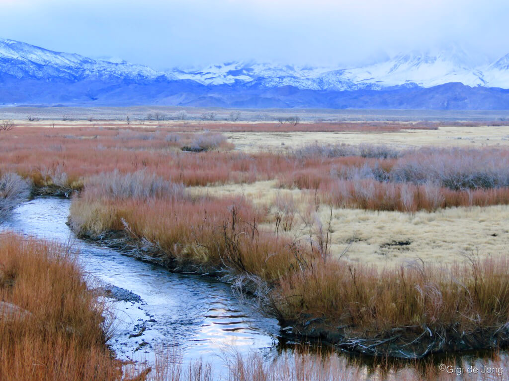
Lower Owens River in winter
The Lower Owens River meanders down the Owens Valley from the mouth of the gorge, which it cut during the last 750,00 years on its way down from its headwaters just north of Mammoth Lakes. This long, lazy river covers 55 river miles from Pleasant Valley Dam to Tinemaha Reservoir compared to a straight-line distance of 29 miles. It weaves sinuously around the town of Bishop and is joined by tributaries that flow down from the massive Sierra Nevada to the west and broaden into pools and ponds at points along its journey south.
Winter fishing along this river is sublime. The Owens Valley is bathed in sunshine an average of 335 days a year and the average daily highs in winter are between 50-60 degrees. The winter air is crisp and exceptionally clear and the snow-covered mountains that rise dramatically above the valley are a magnificent sight to behold.
There are accessible and beautiful spots to fish just 3 miles east of Bishop where CA-168 E (E. Line St.) crosses the river. Turn right at the dirt road just before the bridge and park along the riverbank at any one of the many tracks and turnouts along this 3-mile stretch of gravel road that parallels the river south to Warm Springs Rd.
Owens Valley Warm Water Fisheries
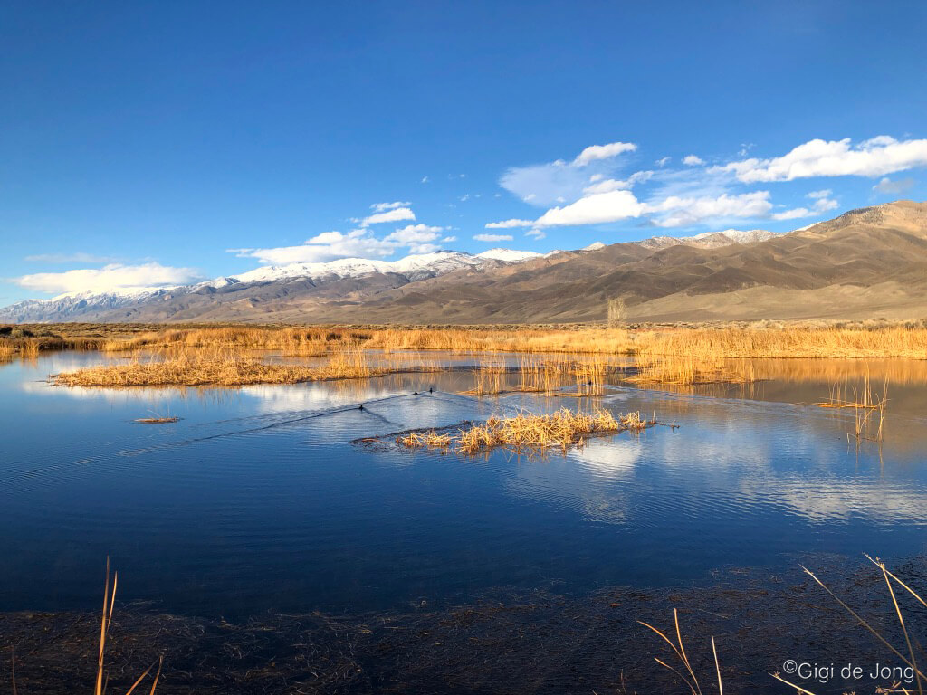
Owens Valley Warm Water Fisheries
These restored and maintained ponds lie along the Rawson Canal, an engineered tributary of the Owens River, just west of the river between Poleta Rd. and Warms Springs Rd. The ponds can yield bass, bluegill, carp and even catfish. Although only 3 miles from the center of Bishop these ponds can make you feel as though you’re way out there. The blue water is often as still as glass and reflects the snowy peaks of the White Mountains that rise almost 10,000 feet above the valley floor to the east. Both ponds have handicapped-accessible fishing piers built along the reedy shores that make fishing easy, fun, and safe.
Head east along E. Line St. from the junction with Main St. in Bishop for exactly 2.3 miles. Just beyond the cemetery look for a small dirt road to the right with a large Cottonwood tree (dry in winter) and turn right. Follow the canal road for about 2 miles until you reach the Rawson and Buckley ponds. The piers are at the southern end of each pond.
Hiking and Walking

Wonderful winter hiking
Winter walks and hikes among the hills and around the valley floor are a delightful way to spend a warm and sunny winter day in Bishop. There are options for a quick or leisurely walk under an hour or many hours of hiking and exploring. One of the best is the Tungsten Hills area which is so often overlooked because the magnificent Sierra Nevada dwarfs these much older rocky hills. Other wonderful winter walking paths lie alongside the many canals that make up waterways of the valley floor. Bishop Creek springs from the high Sierra to the west and tumbles down the mountain to join the Owens River. As it goes, it is diverted into numerous canals to converge and re-converge with the Owens River along its way. These carefully maintained canals weave through wetlands and alkali meadows on the outskirts of town, in and out of town, and alongside the river in its historic floodplain. Most have good, graded gravel roads that run alongside the canals and these provide miles of magical moments for walking, hiking, fishing, trail‑running and simply standing and staring at the view.
See our brochure for more details on these and other hikes here.
Tungsten Hills
Our big backyard. Looking south over Buttermilk Country from Tungsten Hills.
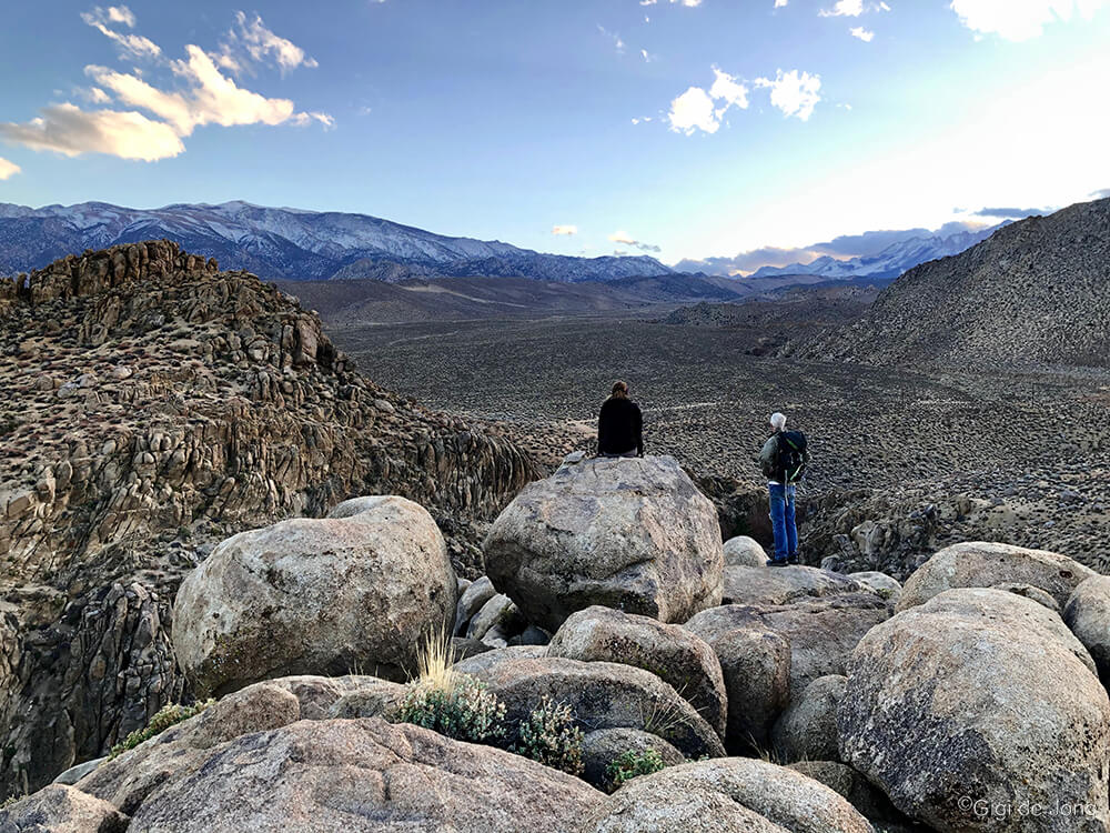
The air is warm and the sun is bright and hiking out across the sagebrush and up onto the rocky outcrops of the Tungsten Hills is especially lovely in winter. If you’re looking for a winter hike when the surrounding mountains are deep in snow, the seemingly endless roads and trails that wind among these hills are easy to access and yet feel like you’re well out in nature. Named for the tungsten that was mined here until the late 1940s these hills are composed primarily of granite and quartz diorite. It’s a favorite place for rock hounding, and crystals of red garnet can still be found here. You may encounter uneven terrain, short but steep elevation change, and sandy tracks or creek crossings to add to the excitement of it all.
There are several good access points with the closest to town being Tungsten City Rd. at just a little over 6 miles from the Bishop Visitor Center. Millpond Recreation Area is also a great place to start and end your Tungsten hike as it offers well-maintained amenities, such as ample parking, restrooms, picnic areas, and a playground. If you’re visiting with a group of friends or family that just want to relax in a camp chair this is the venue for you. Just beyond Millpond along S. Round Valley Rd is Horton Creek campground. It’s closed for camping during winter, but you can park your car here and hike up to and around this fascinating geological feature.
Bishop Creek Canals

Late afternoon walk along Bishop North Fork from Dixon Lane.
The Bishop Creek Canals are favorite winter walks and runs. Close to downtown Bishop are several easily accessible trails along flat, graded dirt roads. They follow the twists and turns of the canals, ditches and waterways that run in and around town, and offer panoramic views of the two majestic mountain ranges on either side of the Owens Valley. These are well suited to a quick ‘stretch-your-legs’ walk or a longer walk for a little solitude or safe fun with kids and pets. Be aware that these are multi-use tracks frequented by runners, mountain bikers, anglers, and the occasional vehicle. Try the canal walk off E. Line St. or Bishop Creek North Fork from Dixon Lane.
Line St. Canal Walk

E. Line St. Canal walks map
The canal off E. Line St. is a mere ½-mile east from the junction of Main St. in downtown. Drive until just after First St. and just over the bridge that crosses the canal turn right into the parking area. Walk south through the pedestrian gate and follow the walk alongside the canal for a quick out and back for a mile or so. Or do a loop by heading east (left) at one of crossings over the canal, then make another left at the next gravelly intersection. That will bring you back to your original path. Then turn right to get back to your car. Download this simple map to give you some guidelines to follow for a great canal walk. Short walk is 2.9-miles, medium walk is 4.3-miles, long walk is 5.9-miles.
Dixon Lane Canal Walk
Snowy skyline from Dixon Ln canal
North of town the N. Fork of Bishop Creek has a long and winding canal road that is also easy to access and delightful to walk. From downtown Bishop drive north on Main St. and follow the curve left onto N. Sierra Hwy (US-395 N.) to Brockman Dr just beyond the Wanaaha Casino. Turn right onto Brockman Dr. In one-mile turn right onto Dixon and in less than ½-mile, at the bridge over the canal, pull over into the clearing on the shoulder and park. Walk north through the pedestrian gate and follow the canal walk for a ½-mile to Riverside Dr. Cross over the road and pick your path on either side of the canal and continue your walk. This section of the canal trail is 2.1 miles and meets up with the Owens River in the wetland just below Chalk Bluff. You can choose out on one side of the canal and back on the other. There’s a bridge crossing where the river feeds into the canal. The views here are spectacular.
Trail Running
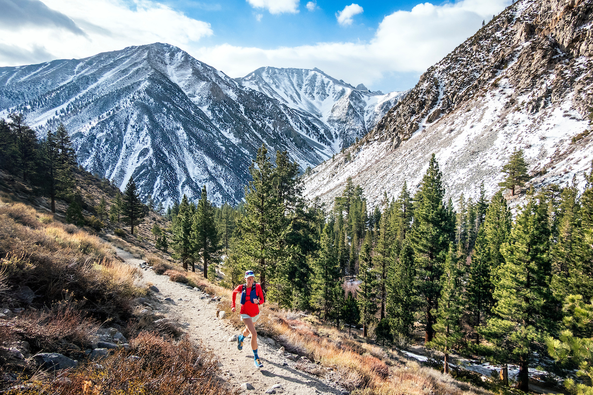
Trail running in the Eastern Sierra Nevada’s North Fork of Big Pine Creek, California in dry winter conditions.
Nestled between two gargantuan mountain ranges, the Sierra Nevada and the White Mountains, both rising to over 14,000 feet above sea level (ASL), Bishop is perfectly situated to offer a broad range of trail running options. From the wide-open terrain of the Owens River valley to the rocky outcrops of Buttermilk Country and the Tungsten Hills to the jagged peaks of the Sierra Nevada to the west and rugged ridges of the White Mountains to the east – this is the good, better, and best of trail running. Trails vary in length, grade, terrain, and altitude to provide something for everyone, whether you’re a beginner or a seasoned trail runner.
Winter trail running is especially beautiful when the valley floor is cool (average seasonal daytime temps are 50-60 degrees) and the vista is of high mountain peaks covered in snow. This is also high-altitude training at its best. Bishop sits at an elevation of about 4,500 feet and the foothills provide about 1,000 feet or so of elevation change. Novice runners will do well along any of the many tracks and trails that run alongside the canals and creeks. More experienced runners will love the undulating climbs up and around the Tungsten Hills.
South of Bishop is the lovely town of Lone Pine, the gateway to Mt. Whitney and the Alabama Hills. This protected 30,000-acre parcel is also fondly known as Hollywood’s largest backlot. The beautiful rock formations of the Alabama Hills bordered by a vast open plain rising majestically to the snow-capped mountains beyond have been a prime filming location for over 100 years. You’ll never tire of running in this monumental landscape.
Tungsten Hills

Winter trail running.
The Tungsten Hills and adjacent Buttermilk Country appear to be foothills of the huge block that is the Sierra Nevada that rises dramatically and steeply here. But they are older than the massive mountain nearby and somewhat different from each other. The Tungsten Hills are part of a larger feature known as the Coyote Warp that lies between Bishop and the Sierra Nevada and is distinctly different from all the surrounding features due to their mineral composition. The presence of naturally occurring Tungsten makes them unique and resulted in extensive mining in this area in the early 1900s. Old mine sites and mining debris remain scattered around these hills. Mining activity also produced a vast network of roads and tracks and today they make for a wonderful trail running experience.
There are several good access points with the closest to town being Tungsten City Rd at just a little over 6 miles from the Bishop Visitor Center. Millpond Recreation Area is also a great place to start and end your Tungsten trail run as it offers well-maintained amenities, such as ample parking, restrooms, picnic areas, and a playground. If you’re visiting with a group of friends or family who isn’t as keen on running as you—this is the venue for you.
A short, but difficult trail (some scrambling required) is Tungsten Peak just above the Millpond Recreation Area. It’s about 1.5-miles from the trailhead to the peak with about 1,340ft elevation gain. The reward at the top is a beautiful 360-degree view of our big backyard. There’s a summit register so you can bag the peak too.
Tablelands

View over Owens Valley to the Sierra Nevada from the Volcanic Tablelands
If you feel the need to stretch your eyes and your legs the Tablelands will provide sweeping vistas and long, undulating roads for a rhythmic run. Of the routes available some skirt the protected wetlands of Fish Slough, or wander through indigenous alkali meadow that comprises much of this plateau and the valley floor below the escarpment. Others curve in and around the rock formations that are sculpted in the Bishop Tuff from which this plateau is created. Formed as a result of a massive volcanic eruption a mere 760,000 years ago, very recent in geological time, the Volcanic Tablelands rise dramatically less than 5 miles north of Bishop. This area offers a variety of fairly flat high desert running on graded dirt roads and well-worn trails with few obstacles.
Getting here is a short drive from downtown Bishop. Head north on Main St. and take US-6 N toward Benton. In about 1.4 miles turn left onto 5 Bridges Rd. Follow this for the 2.4 miles curving left to a multi-road junction with Casa Diablo Rd., Chalk Bluff Rd., and Fish Slough Rd. Park at this intersection where the pavement ends and the fun starts. Go for a run along any of these graded gravel roads or look for trails that go up onto the escarpment and among the rocky ravines that eons of water runoff have cut in the Bishop Tuff. Loops out here can be long and if you’re not familiar with the terrain an out and back is recommended. One of the loveliest things you’ll find out here is solitude.
Alabama Hills

Trail Running Alabama Hills. Photo: Jim Purdum
The almost endless network of roads and trails winding through the stunning rock formations of the Alabama Hills are a magnificent place for trail running—especially in winter. The landscape is evocative of the old west and it feels remote and rugged. Many movie locations are scattered among rocks and washes, some with plaques that pay tribute to old Hollywood, others recognizable if you know the film. The nearby Museum of Western Film History has a tour map for self-guided movie exploration.
One of the most visited rocks these days is the Mobius Arch. It is a natural rock arch that perfectly frames Mt. Whitney and the Sierra Nevada crest in the distance. A loop trail of 0.6-miles is a fun run for a quick jaunt and great view. A longer loop of just over 5 miles incorporates some of this trail and includes sections of Movie Flat Rd. Roads and trails in this area are well used and often busy, but well worth the effort.
Biking

Road Biking Velo rides
We believe there is no other place on earth that offers as much opportunity for year-round cycling as the Eastern Sierra. It’s one of the most topographically diverse and beautiful landscapes in our country and is also one of the most photographed regions in the US. Road cyclists rejoice! Our paved roads are lightly trafficked, and a cyclist can ride for many, many miles without encountering a traffic light or a stop sign. Mountain bike rides range from super easy and leisurely, to highly technical and challenging — and everything in between. We have an abundance of dirt trails and tracks that seem almost endless. And there’s access to all sorts of cycling in our wonderful winter.
Two favorite road rides around the valley floor are Round Valley Pleasant Valley loop and Warm Springs loop. If you’re unused to biking at altitude (Bishop sits at about 4,500 feet) these are great rides to test your mountain fitness. Seasoned riders can enjoy these as easy warm-ups with gorgeous scenery. Death Valley is place for long rides beginning low elevation—below sea level, in fact—with climbs and descents that may test you to the limit. Take a look at our Road Biking landing page for maps of the rides below and many more.
Round Valley Pleasant Valley loop – road ride

Car-free ride along the shores of Pleasant Valley Reservoir
This is a ride that has a little of everything in just the right measure. It has uphills and downhills, sharp corners and sweeping bends. You’ll work hard enough to stay warm, but not so hard that you can’t lift your head and admire the awe-inspiring views. It’s about 18.5 miles of quiet country lanes and a pleasant, car free ride along the shores of the Pleasant Valley Reservoir. There are several good points along the route where you can park a car safely to ride this loop. It really is a pleasant ride!
One starting point is at Millpond Recreation Area, about 7 miles west of Bishop just off US Highway 395, on Sawmill Rd. There is plenty of parking and amenities include restrooms, picnic area, and a playground. It’s a perfect starting point especially if you’re with a group and not all are cyclists. Other start/end points are at Pine Creek Rd junction with Highway 395, Gorge Rd & Old Sherwin Grade junction (just off Highway 395), or the Pleasant Valley Dam parking area.
Warm Springs loop – road ride

Biking the Laws Poleta – Warm Springs Loop
This is an excellent loop with minimal elevation gain and loss – just 790ft. Ride it at an easy cadence for a relaxing and energizing outing or push hard for an energetic workout. The views are marvelous as you roll across the river and ride along the base of the White Mountains where the vista out across the Owens Valley is wild and expansive.
A good start and end point for this ride is from the east side of Bishop City Park where there’s ample parking. The Park offers numerous amenities and things for any non-cycling members of a group to do and keep kids entertained. Plus, there’s a great dog park for furry family members. Park on Spruce St. or the lot adjacent to the city park on Bruce St. Begin the ride by following Hanby St. south to E. Line St. then turn left, and head east toward the White Mountains. At about mile 4.5 the road turns south and changes name to Eastside Rd. At mile 7 the route turns westerly onto Warm Springs Rd. The highest point of the ride is at the junction of US 395 where the route turns north to head back to town. To avoid the narrower, busier section of downtown take a right at Clark St. then, in a couple of blocks, turn left at First St., then do a quick left/right onto E. Line and Hanby St. to get back to the Bishop City Park.
Death Valley – road ride
Long and lovely road to Badwater Basin
Death Valley National Park has miles of great roads with the most stunning scenery that’s just perfect for winter road cycling. Some roads have long flat sections at or below sea level, some have steep, winding climbs with swoopy, twisty downhill runs. One especially serene and sublime ride is a loop from Furnace Creek to Badwater Basin and return via Artists Drive. Be prepared with plenty of water, snacks, repair kit, and let someone know about your ride plans.
Artists Drive weaves through a rugged canyon etched by eons of wind and water revealing layers of rock in a rainbow of earthy colors. It is spectacular any time of day, but the colors are most dramatic in the afternoon light. This scenic drive is a one-way road north and delivers a sweet, sustained climb of a little over 1,110 ft in 3-miles. The ride in total is 35.6-miles with the lowest point at 266ft below sea level at Badwater Basin and 945ft above sea level along Artists Drive.
Lodging and camping options are various and extensive in Furnace Creek, but spaces fill up fast. Book a stay in advance if you’re planning a multiple day trip in the park. A day trip to Death Valley from Bishop is a long day trip, but certainly doable. Look at the details and our map of this ride on our Road Biking landing page here.
Tungsten Hills, Little Shot loop – mountain bike ride

View from the Tungsten Hills
The Tungsten Hills were once a booming mining area a little over 100-years ago and, although all mining has long since ceased, the network roads and trails that remain are perfect for fast, fun, and sometimes technical mountain biking. The Little Shot loop, named for an old mine here, is a technical, expert-level, short ride of 5.3-miles. It has a sustained climb of almost 1,200ft in just over 3-miles. Then it dips and weaves through the jagged rocks and careens down the north side of the hill back to your starting point. It can be snowy and icy in the shady spots and at the top, and sandy lower down. A fat bike can be a super substitute for a regular mountain bike—especially in winter.
Drive 6.5 miles from downtown Bishop north on US-395 N. Turn left at Sawmill Rd. (Pleasant Valley Rd. is opposite to the right) carefully crossing the south bound lane of US-395. At 0.2-mile further turn right on S. Round Valley Rd. and drive for 2.1-miles. Turn left on Round Valley Tungsten Rd. which is a graded dirt road. This section can have deep sandy patches or thick snowy patches depending on what the season brings. Be mindful of the road ahead and turn around if it looks challenging. In 0.7-miles see a wide, sandy embankment and turn left and immediately park in a clearing. Don’t drive far too onto the embankment. Cycle west around the base of the hill to climb the switchbacks and up onto the hill. Get a route map on our Mountain Biking landing page here.
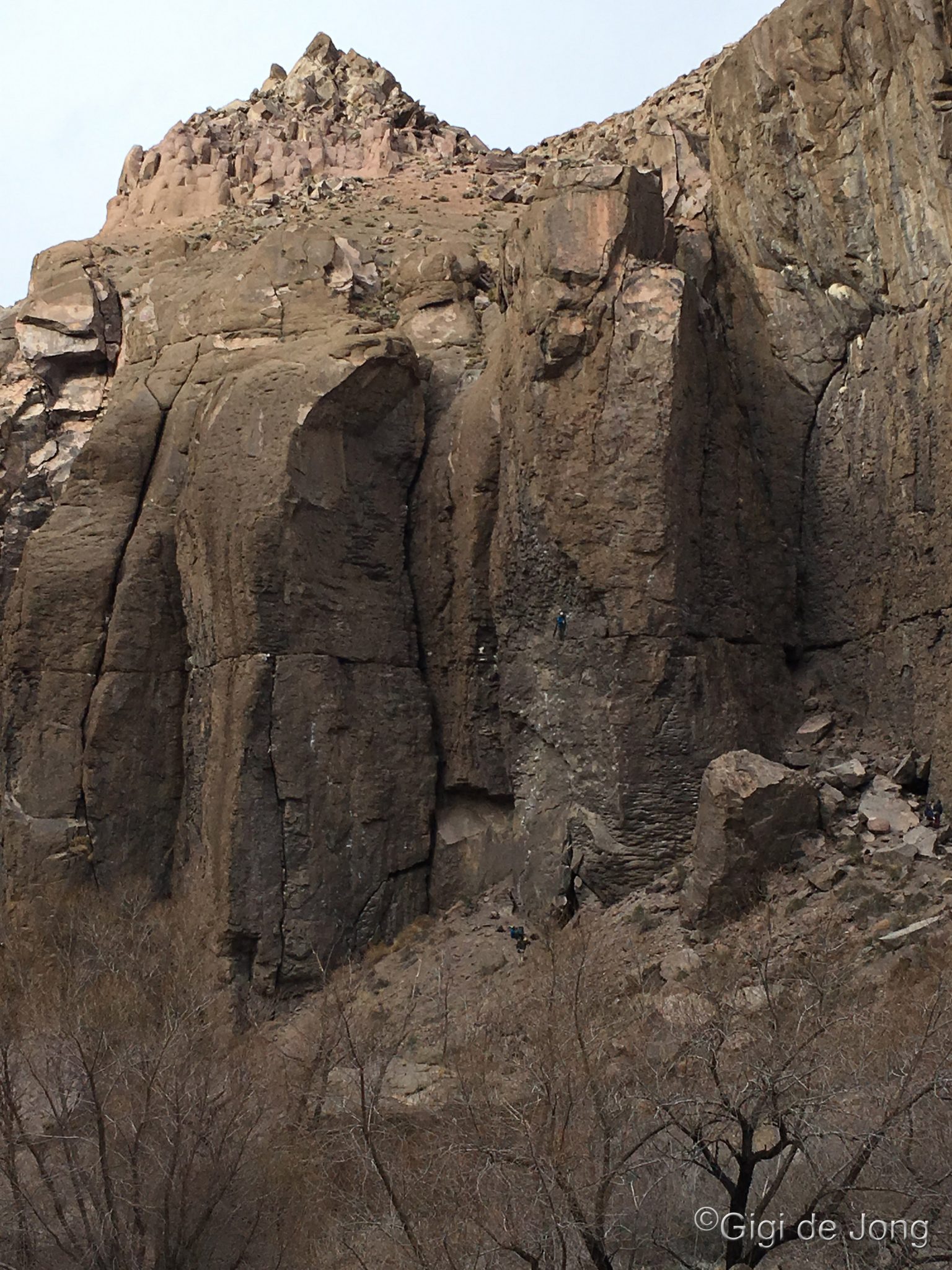
Climbing

Options abound for winter rock climbing
Climbing in Bishop is world renowned. The options for rock climbing range from bouldering to sport climbing to trad climbing and even ice-climbing. The grades range from easy to expert with locations that are easily accessed very near town to more remote locations. Some have convenient vehicle access and others require some hiking from a parking area. If you want to climb, we probably have just the right spot for you. Winter is when some the best climbing happens and many experienced climbers (who don’t already live here) make the trip to practice their skills. Two great winter climbing destinations are the Owens River Gorge for great sport climbing and Buttermilk Country for fantastic bouldering.
Owens Gorge
Winter climbing in the Gorge
The Owens River Gorge is a deep, steep-sided canyon almost 20-miles long located northwest of Bishop. About 3.5-miles of some of the deepest, steepest part of the gorge are bolted for excellent sport climbing. It is California’s most concentrated sport climbing area. It is a favorite destination for beginner and experienced rock climbers, providing over 500 routes. Beginners are encouraged to climb with a guide or experienced climbers who have the right gear.
Take Highway 395 north from Bishop Chamber of Commerce about 12.1-miles to Paradise exit and turn right on the Gorge Road. At the T intersection, turn left (north) on the paved road for about 3.25-miles. Turn right and drive for about 400 feet. Park on the road shoulder before the road barricade. From here, hike down the road 1.5-miles just past the power plant to the climbing area. Much of this area is bolted. Keep dogs on leash as you walk into the canyon to avoid accidents with occasional maintenance vehicles. Great for bikes & stroller access. To reach the central gully (most direct route), continue up the paved road from the 3.25-mile mark for about 1.5-miles. Turn right and travel 0.3-miles to a parking area near a large power transmission pole. The trail is immediately north of the parking area. The trail is very steep, rugged, and loose but provides quick access from the top of the gorge.
Buttermilk Country

Bouldering the Buttermilks
Buttermilk Country is fondly called the “Buttermilks” or simply the “Milks” by climbers and is considered by many to be the best bouldering area in the country. It is certainly California’s premier bouldering spot and entices some of the world-renowned heroes of climbing, like Kevin Jorgensen, a frequent winter boulderer who works on bouldering problems during his off-season from big wall climbing.
The boulders here are known as glacial erratics. Huge rocks plucked from the Sierra Nevada 4 miles away, some 2.5 million years ago. The Buttermilks boast some of the largest erratics anywhere. Some boulders are more than 40 feet tall. The Buttermilks, however, are not just for experienced climbers and there are numerous smaller rocks where kids and the young-at-heart can experience scrambling and begin to get the feel of rock climbing.
Getting to the Milks is a short 20-minute drive west of Bishop. Head west on CA-168 (W. Line St.) for 13 miles to the junction of Buttermilk Rd and turn right. The road turns to gravel just beyond the cattle guard and 12 miles further you will find yourself in the heart of Buttermilk County.
Snow Sports

Snowshoeing in the backcountry
We have the best of both worlds – easy access to some of the best backcountry snow play in the state with no parking problems and no ticket required AND easy proximity to one of California’s best ski resorts. Go skiing, snowboarding, sledding, snow shoeing, and ice-skating in the wild or on the groomers.
Bishop Creek Canyon

North Lake in winter. Photo: Dennis Jahn
Every backyard has that one most-special, magical place. In our big backyard Bishop Creek Canyon is it. It’s a year-round playground and winter is when it’s a true wonderland. When the snow falls thick and heavy on the crests and deep into the canyons it becomes a playground for family-friendly snow play and energetic snow sports. There are three wonderful destinations for snow fun and each offers something a little different—what you get also depends on the seasonal temperatures and snowfall. Stop in at the Bishop Visitor Center at 690 N. Main St. for a quick chat about current weather and snow stats and what you and your family are looking for. Our friendly, knowledgeable staff can give the best advice.
Head west on CA-168 W. out of Bishop (W. Line St.) for 15-miles. If you’ve chosen to go for the more adventurous snowshoe or cross-country ski tour, turn left onto South Lake Rd. If you’re aiming for an easy family-fun outing keep going. One mile further at the entrance to Intake 2 reservoir, you may find some great sledding near the road above the lake. Another mile further you’ll come to Aspendell—and pick your path here. Take the right turn down to Cardinal Village Resort and tromp around in snowshoes or sled the hills in this safe, family fun area, If it’s still early winter before too much snow covers the pond, go ice-skating. Check with the resort staff first before you go out on the pond ice. Or, for a more adventurous snowshoe outing, drive a few hundred yards further to where the road is closed for the season and snowshoe up the snow-covered road toward Lake Sabrina or up N. Lake Dr. Know before you go that is rugged backcountry so check Eastern Sierra Avalanche Center reports for snow conditions.
The drive alone is worth the effort. The mountains are rugged, the snow is serene, and every view is like a picture postcard. Best of all it’s all free. We do suggest that you check road and weather conditions and ‘know before you go’! Also make sure to tell someone (who’s not with you) where you are going and when you expect to be back.
 A blustery winter day along S. Lake Rd. | Snowshoe or Cross-Country Ski S. Lake Rd.The junction of CA-168 W. (W. Line St. in Bishop) and S. Lake Rd. is just 15-miles from downtown Bishop. Turn left at the junction and drive for 2.5-miles and stop at the seasonal road closure just beyond Bishop Creek Lodge. Park, gear up, and get out on the snow for an out-and-back adventure on the snow-covered S. Lake Rd. The first few hundred yards are relatively flat and easy and then the trail winds up the canyon among the trees. This is not a groomed trail and is best for more experienced snowshoers and skiers. |
 Making snowshoe prints up N. Lake Rd. | Snowshoe CA-168 to N. Lake Rd.The seasonal road closure of CA-168 W. (W. Line St. in Bishop) is 17-miles from downtown Bishop. The drive itself is scenic and spectacular. Just beyond Aspendell and above Cardinal Village the road is closed for winter and it’s a great place for an easy snowshoe adventure. If the snow is deep shoe up from here to N. Lake Rd or beyond; or walk up if some pavement is still showing. Snowshoe on up N. Lake Rd for a magical trek high above the canyon. |
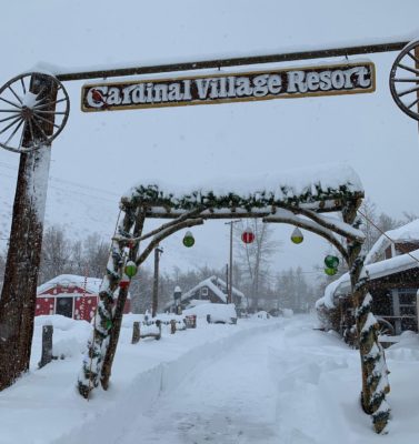 Cardinal Village Resort | Ice Skating or Sledding at Cardinal Village ResortIn late fall and early winter, before the snow falls and when the temperatures are cold enough, the pond at Cardinal Village Resort may ice up enough for an enchanting natural-ice skating experience. Drive out on W. Line St. (CA-168 W.) for 17 miles to Aspendell. Turn right at Cardinal Rd. and follow the signs to Cardinal Village Resort. December at the resort is a magical time for kids and adults during their holiday festival. When winter brings the big snowstorms the resort staff build super fun sled runs, Santa comes to visit, and there’s fun and games to be had for all. |
Mammoth Mountain Ski Area
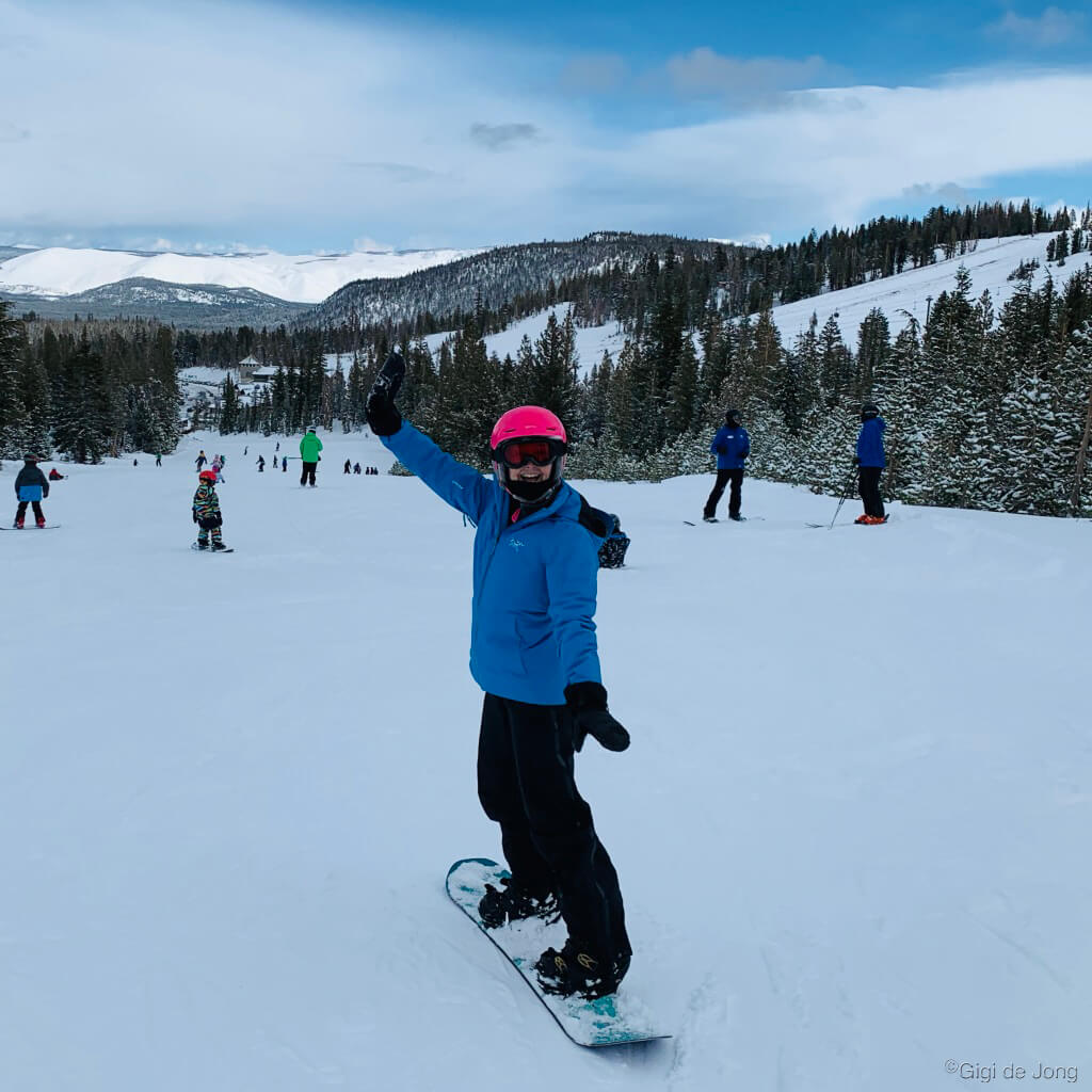
Snowboarding Mammoth Mountain
A beautiful 40-minute drive north of Bishop on US-395 N is the town of Mammoth Lakes and the location of one of California’s premier ski resorts. Mammoth Mountain Ski Area (MMSA) boasts the highest lift-served summit in California at 11,053 feet. The average annual snowfall on this mountain is higher than most other Eastern Sierra peaks due to its location in a low gap in the crest. It gets over 400” (33ft) annually and yet it also has an average of 300 sunny days per year. It the highest, snowiest, sunniest ski mountain in California.
This massive mountain provides 3,500 skiable acres served by 25 lifts with an excellent mix of terrain options from beginner to expert. From Woolly’s tube park to the Unbound terrain park, and 163 varied trails with the longest run being 3-miles, there’s something here for everyone. The resort facilities include rental and repair shops, sport shops, ski and snowboard school, lockers, slopeside restaurants and bars, childcare, a free shuttle service to and from town and around the mountain, and highly trained ski patrol and safety personnel.
MMSA is lively resort experience for anyone wanting to try out skiing or snowboarding for the first time or for expert skiers looking for easy mountain access and great groomers. It’s the place to be seen and it’s also the venue to see some of the greatest snow sport competition in the country, like the US Grand Prix of Snowboard and Freeski among others. Check MMSA’s schedule of events to see top Olympians and Olympic hopefuls battle it out on Mammoth Mountain.
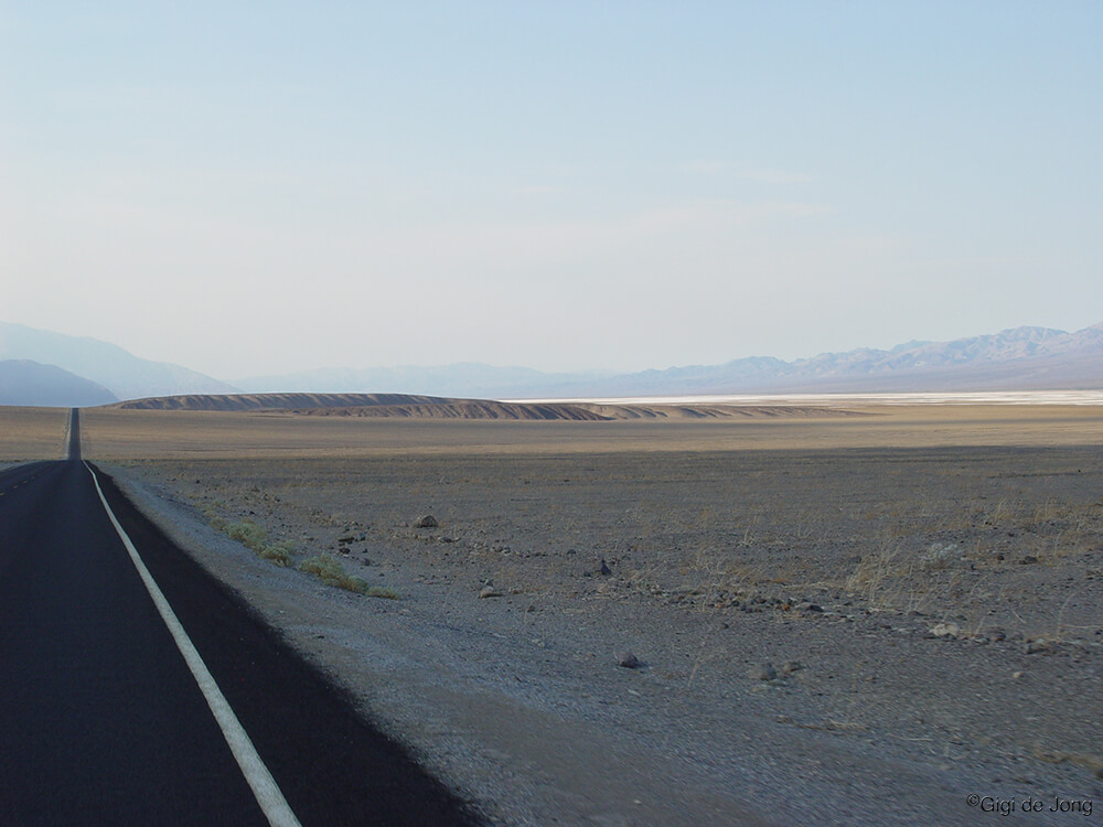
Motor Touring
Driving across Panamint Valley in Death Valley National Park
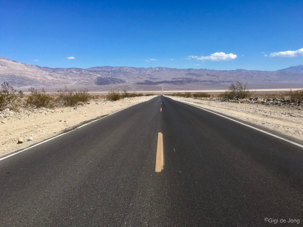
There are few places in the world where evidence of the natural history of a region is more obvious and interesting than in the Eastern Sierra. It is a vast and unspoiled region that offers exceptional opportunity for recreation and discovery. It is world renown for many outdoor activities such as fishing, rock climbing, trail running, and landscape photography. It’s also an amazing place for auto touring!
Winter in Bishop and the lower elevations of Inyo County are seldom covered in snow for any length of time and our roads are hardly ever icy. A day or two (or more) of motor touring in the region will yield some of the most impressive sights in our state and on this earth. Driving between the portal to the highest point in the lower 48 states and the lowest point on the north American continent reveals exquisite rock formations, tall mountains, expansive deserts, and vast sand dunes.
Just below Mt. Whitney, the highest peak in the contiguous USA at 14,505-feet above sea level, is an evocative landscape known as the Alabama Hills. Maintained gravel roads weave through this rocky region and provide opportunity for sightseeing, exploration, and learning. Just 130-miles east is Badwater Basin, the lowest point on the continent at 282-feet below sea level, in Death Valley National Park. A trip here reveals evidence of our planetary upheavals and the extremes of our natural world.
Alabama Hills Movie Flat Road
Hazy sunset behind Mt Whitney from the Alabama Hills
The Alabama Hills, nestled in the foothills of the Sierra Nevada just west of Lone Pine, is one of Hollywood’s favorite filming locations. This monumental landscape provides innumerable settings for movie backgrounds and evocative scenes. The beautiful rock formations of the hills bordered by a vast open plain rising majestically to the snow-capped mountains beyond has been a prime filming location since the early 1900s.
The rounded contours of the Alabama Hills appear in stark contrast to the chiseled peaks of the Sierra Nevada and, although considered geographically a separate range of hills, they were formed at the same time and are geologically part of the Sierra Nevada Mountains. Percolating water rounded the granite blocks and sculpted the many outstanding formations of the Alabama Hills. The Mobius Arch, the largest and most picturesquely situated of the many natural arches in the Alabama Hills, almost perfectly frames Mt. Whitney, the highest peak in the contiguous USA. It is the result of chemical weathering when the hills were still covered with soil.
Take a drive west from the center of Lone Pine (40-miles south of Bishop on US-395) along Whitney Portal Rd. for 2.7-miles and turn left onto Movie Flat Rd. Follow this good, graded dirt road for 1.6-miles to the Mobius Arch Trailhead parking lot. If you have the inclination and some time, take the short loop hike to see the stone arch. More details and a map can be found here. Continue along Movie Rd. as it dips, weaves, and climbs through the hills heading north. About 5.5-miles further the road becomes Moffat Ranch Rd. and 2-miles further, at the T-junction, turn right, cross the Los Angeles Aqueduct, and come to a stop at the intersection with US-395. This is a spectacularly scenic drive on graded dirt that will give you a sense of being in the rugged backcountry that looks like the good ol’ west.
Download this great Backroad Tours in the Eastern Sierra brochure for more details on this and other adventurous motor tours in the area.
Death Valley – Ubehebe Crater

Ubehebe Craters aerial view
Death Valley National Park covers 3,000 square miles of southeastern Inyo County. The lowest point on the North American continent is here at 282 feet below sea level. It is known as Badwater Basin. The ancient natural history of this valley is presented in a strikingly visual display of extremes. Tall mountains, snow-capped in winter, flank deep rift valleys with windswept sand dunes that rise and fall across the plains below. Rugged canyons etched by eons of wind and water reveal layers of rock in a rainbow of earthy colors. Massive craters in the alluvial fans, draped across the valley floor, are surreal evidence of recent volcanic activity.
A drive from Furnace Creek, the tourism hub of this magnificent park, to Ubehebe Crater reveals all this and more to travelers in this ancient land. The craters are a 56.4-miles north of Furnace Creek on a good, paved road that terminates in a parking area for these amazing sights. A cluster of Maar volcanoes, which are created by steam and gas explosions, formed these craters—estimated to be between 2,000 and 7,000 years old. The largest is Ubehebe about a half-mile wide and about 700 feet deep. Three trails present opportunities to see Ubehebe and nearby Little Hebe up close. A rim trail loops around Ubehebe, with a spur trail leading to the edge of Little Hebe. A more strenuous hike can be done to the bottom of Ubehebe—descending is fairly easy, but ascending can be exhausting.
Museums & Cultural Sites
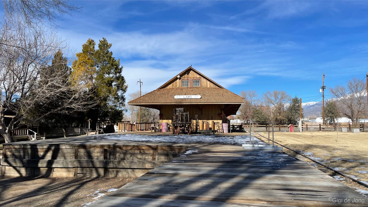
Depot at Laws Museum & Historical Site
The preservation of history and display of historical objects in a museum and area for public viewing and learning are indicators of the cultural and economic health of a community. There are thousands of museums around the world and it is believed that the oldest museum dates back to c. 530 BCE. The ancient landscape of the Eastern Sierra has evidence of sophisticated human habitation as far back as 10,000 years ago. But the more recent history of explorers and settlers is just little under 200-years old. The museums and cultural sites that offer a look back to our interesting history hold treasures and stories that are as diverse as the region.
A visit to a local museum is a splendid way to spend a day or more looking at and learning about the past and the people who were here before us. Two uniquely different museums in the Owens Valley showcase the lives and dreams of folks who saw this valley and its bounty from completely different perspectives.
The Laws Railroad Museum and Historical Site located 6-miles north of Bishop, on US Highway 6 protects and preserves the antiquities of the early settlers in the region. The Museum of Western Film History displays artifacts and memorabilia from an industry that has capitalized on the scenery and beauty of this impressive landscape. Both are fascinating and deserving of a visit to learn about the history of the Eastern Sierra.
Death Valley National Park is the largest national park in the lower 48 states and is notable for its geologic history. Its cultural history is equally significant. This region has a long and storied history in mining. The historic structures, equipment remnants, and artifacts from days of old can be seen throughout the park. It has an older, thousand-year history of human inhabitance by the Nümü (meaning People) Native American tribe, better known today as the Timbisha Shoshone Tribe. Members of the tribe live on ancestral lands within the park at Furnace Creek.
Laws Railroad Museum and Historical Site

Engine No 9 at Laws
Take trip back in time and experience the daily life of the early settlers of the Owens Valley. Laws Railroad Museum and Historic Site celebrates the rich history of the period and tells of a time when the railroad station was the heart of a bustling western town. Read about the railway known as the Slim Princess on this blog page here.
Close to 50 authentic structures on eleven acres are filled with artifacts and original objects that depict the lifestyles of the homemakers, artisans, and townspeople of the period. Most of these objects of antiquity are the actual tools used by the practitioners of their crafts such as, newspaper publishers, gold miners, ranchers, blacksmiths, dentists, physicians, and pharmacists who lived and worked here. There are wonderful interactive exhibits that are fun for the whole family. If it’s a warm winter’s day bring a picnic and enjoy the sun and scenery.
Head north on US-6 out of Bishop for 4-miles and turn right onto Silver Canyon Rd. Just less than ½-mile further the museum is on the right with parking on the left of the road. The museum is open year-round, most days from 10am – 4pm. Closed Thanksgiving Day and Christmas Day. Admission is by donation.
Museum of Western Film History
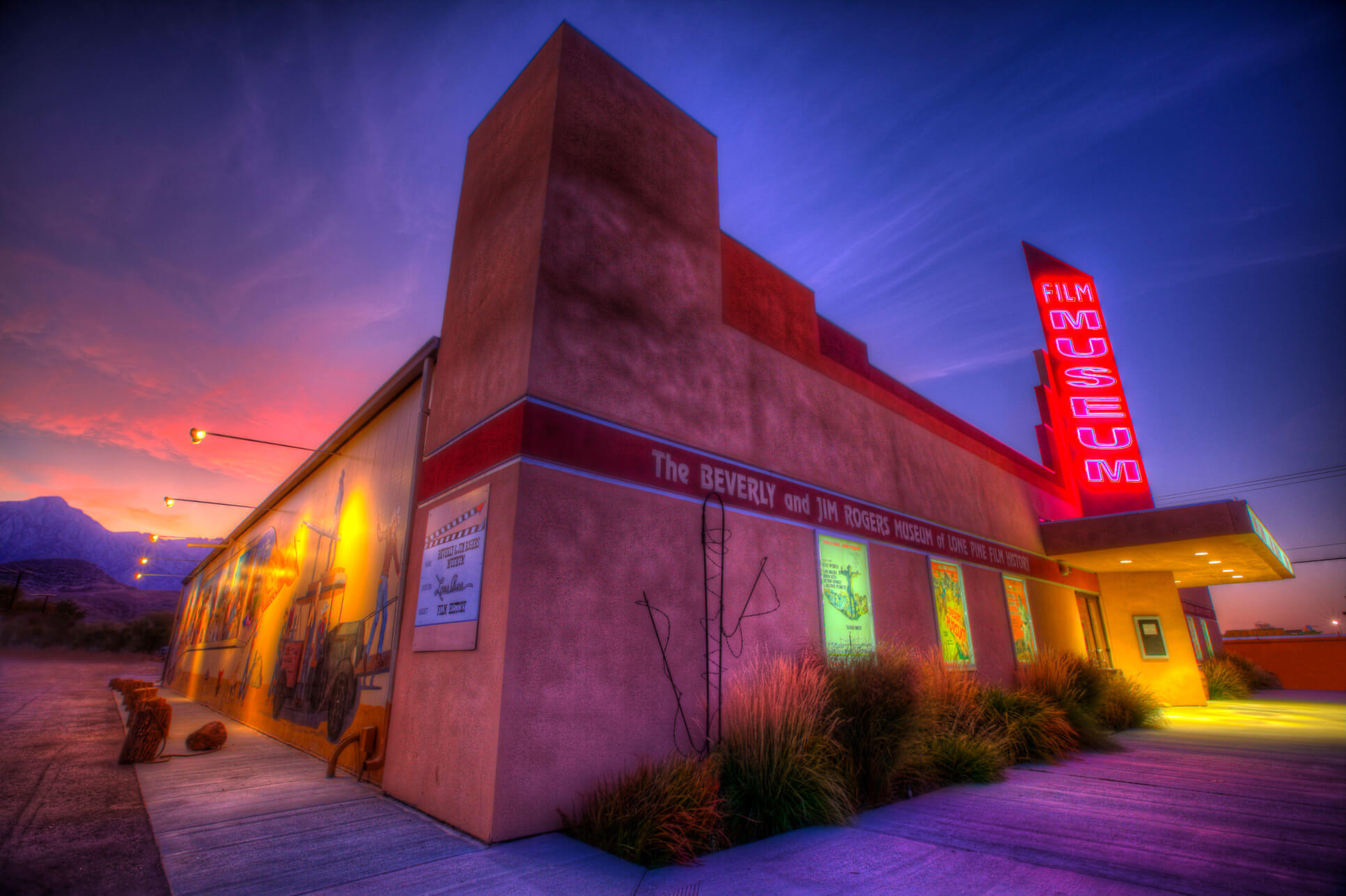
Museum of Western Film History. Photo: Michael Carr
The Alabama Hills area is fondly called Hollywood’s largest backlot. The first documented production filmed here was “Round Up” just over 100 years ago and the area continues to be a sought-after location for feature films, TV shows and commercials. The Museum of Western Film History in Lone Pine houses an extensive collection of original costumes, vehicles, props, posters, and other memorabilia. It is a wonderful representation of the industry, its producers, directors, actors, crews, and entourage who visited here and created the films that will entertain for generations to come. Spend a couple hours in the museum then take a self-guided tour (a brochure is available at the museum) of Movie Road and get an up-close view of the actual locations of so many pictures filmed here. Also see winter motor touring.
A little south of Bishop on US Highway 395 (60 miles) is Lone Pine. The town is best known as the trailhead for Mt. Whitney, the highest point in the Continental USA. It is also well known as a film location for hundreds of Hollywood movies since the early 1900s. The museum is located at 701 S. Main St. in Lone Pine and is open daily.
Furnace Creek in Death Valley National Park
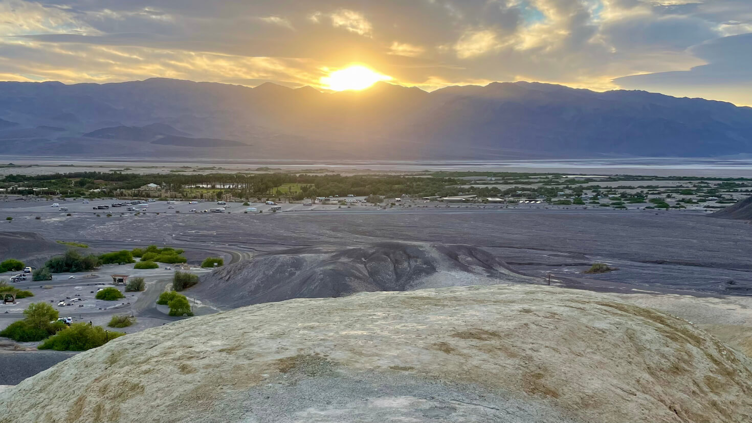
Sunset over Furnace Creek, Death Valley National Park
Furnace Creek was originally a mining settlement known as Greenland Ranch. Today it is the tourism hub of the magnificent Death Valley National Park. The National Park Service and concessionaires maintain a beautiful and sprawling complex here of hotels, a golf course, campgrounds, a visitor center, shops, a swimming pool, playgrounds, and a single-runway, civil aviation airport. The Park covers 3,000 square miles of southeastern Inyo County and the lowest point on the North American continent is just 15 miles south of Furnace Creek. It is known as Badwater Basin and sits at 282 feet below sea level. The summer heat is intense and the salty water is undrinkable, and yet it is home to an amazing number of tiny plants, animals, and aquatic insects.
A perfect starting point for this memorable experience is the Eastern Sierra Visitor Center just south of Lone Pine at the intersection of US-395 and CA-136. There’s a wonderful view of the highest summit in the contiguous United States, Mt. Whitney, rising to 14,505 feet. This is a gateway to the lowest point in the United States, Badwater Basin in Death Valley. These two points are just 84.6 miles apart in distance, yet worlds apart in climate, ecology and character. The drive to Furnace Creek from here is 103 miles and can be done in 1-hour and 48-minutes but take your time and see all the spectacular sights along the way.
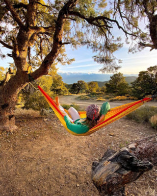
Resting in a hammock Photo: @cheeeeetah
Rest & Relaxation
The Eastern Sierra’s rugged landscape, its varied topography and diverse ecology, are magnets for outdoor enthusiasts and high-energy adventure seekers. It is also a lure for quiet contemplation, and soulful rejuvenation. Many visitors enjoy the solitude that the wide-open spaces offer for fishing, photography, birding, and plein-air painting—to name but a few. And everyone loves the hot springs that are a feature of this geologically active region.
Keough’s Hot Springs Resort
 Keough’s Hot Springs Resort was built in 1919 and much of the original wooden structure is still intact. It was a luxury getaway for the early Hollywood stars of the 1920s & 30s when it was a first-class health resort. The large warm water swimming pool and smaller hot soaking pool are the original ones built in 1919. A constant flow of hot, fresh mineral water fills the pools, making this a wonderful place to languish in these restorative waters. Enclosed on all four sides the pools are protected from the winter wind, but open to the sky above. An early winter’s evening is a relaxing and safe activity for the whole family to wind down and warm up after a day on the slopes. It’s also a great day outing for warm water play and a little sun tanning even on a chilly winter day. Relax. Read. Restore yourself. 100 years later it still delivers on that promise.
Drive from downtown Bishop drive south on US-395 for about 7.5-miles and turn right onto Keough Hot Springs Rd. The road terminates in the parking area for the resort. Pool hours are subject to change seasonally so check the resort’s website. It is always closed on Tuesdays for cleaning and maintenance.
Benton Hot Springs

Private tub at Benton Hot Springs
The Inn at Benton Hot Springs is about as beautifully rustic as it gets. The small town of Benton is one of the oldest existing towns in Mono County. The current Inn, built with local pumice materials in the 1940s, replaced an old 10-room hotel first built in 1904. In 1998 the structure was renovated, keeping much of its original structural integrity and historical character intact. Accommodations feature seven rooms at the Inn, a historic miner’s cabin, four houses with private hot tubs, and 12 private tub sites for day or overnight use. This marvelous, off-the-beaten-track resort remains true to its heritage and is kept in beautiful condition and in perfect harmony with its surroundings for those, “Who appreciate its uniqueness and value in this fast-changing world,” say the local owner-operators.
Drive north on US-6 from Bishop for 34 miles (30-minutes) to the little town on Benton. Turn left onto CA-120 W and drive for 3.8-miles where the resort will be on your right.
Bishop Visitor Center in the Bishop City Park
Bishop Visitor Center
Come in or call the Bishop Visitor Center at 690 N. Main Street, (760) 873-8405, to get more details, directions, maps and brochures about these great winter activities and many others in the area. Let the friendly, knowledgeable staff help you plan your visit to get the best experience and the most from your time.
As always – it is important to remember that winter in the Eastern Sierra is unpredictable and often chilly. Days can be warm and nights cold. Bring clothing to dress in layers. Bring the kids, the dogs, family and friends, binoculars and a camera, and winter activity gear.