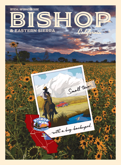
Rising abruptly on the western skyline from the 4,000-foot floor of the Owens Valley, the jagged eastern escarpment of the Sierra Nevada punches an airy 14,500-foot crest into the heavens. Lying along this austere fortress of granite and extending into the gently rolling, deeply forested foothills of the West Slope is one of the largest, contiguous expanses of roadless wilderness remaining in the lower 48. This lofty backdrop to the Eastside, as the region is colloquially known, incessantly beckons attempts at transcendence.
Access from the east utilizes trails, enhanced over time by European settler industrial and recreational activities, which follow trade paths long used by Indigenous peoples on both sides of the range. While grinding out a long ascent to a pass, one may not be inclined to describe these trails as “easy,” however, they are by far the most mellow corridors into the Sierra’s glacial lake-adorned paradise.
To the Nuumu tribe, the mountains themselves are an integral presence, not just in the physical space they inhabit, but within the traditions informing their culture. This land is infused with spirit voices and bedrock deities, energies and stories containing their explanations of existence. With a mind open to the idea of the natural world as a space, not to conquer, but to move harmoniously through, and a willingness to grate one’s comfort zone raw against the elements, you too can feel the intimacy and immediacy—the spirituality—of this primordial beauty.
Trail running is but one path. If you feel the call, here are five contemporary vision quests guaranteed to set your soul aglow, in the Range of Light.
THE EVOLUTION “LOOP”
In the early 2000s, “the Evo” was an annual alpine summer rite of passage for a tight-knit band of Eastside trail runners. The twin realities of referring to it as a loop, irrespective of the required car shuttle between two Bishop Creek drainage trailheads, and calling it a 100k, even though maps and GPS watches alike never yielded a number out of the 50s, was troublesome. However, the “Evolution 100k Loop” sounded much sexier than the “Evolution 55-Mile Horseshoe,” and therefore, had illegitimate staying power.
Eventually, ground truth dropped the 100k embellishment, but our endless, overzealous banter about closing the loop someday never yielded anything but empty promises. It was simply too daunting.
Then, in 2020, Bishop locals Todd Vogel and Angel Avila quietly put their money where our mouths had been. Just under 24 hours later, they legitimized calling this most classic of High Sierra ultrarunning adventures a loop.
Sufficiently inspired, 25 years after my first Evo, I followed their lead in 2022. It was every bit the full value Sierra experience I had always envisioned. Floating on a cloud of accomplishment, a Hardrocker friend sucker-punched my satisfaction with a simple query: “Do you have to run the loop in both directions to consider yourself truly evolved?”
Whether you lace up for the Standard, the Full, or the Mini, doing the Evolution is an experience not to be missed.
STANDARD EVO:
- Distance: 55 miles
- Elevation: 10,000 feet ascent / 9,600 feet descent
- Low Elevation: 8,050 feet (Piute Trail/JMT junction)
- High Elevation: 11,970 feet (Bishop Pass)
- Start Trailhead: 9,350 feet North Lake (Piute/Lamarck)
- Finish Trailhead: 9,820 feet South Lake (Bishop Pass)Passes: 11,425 feet Piute Pass > 11,955 feet Muir Pass > 11,970 feet Bishop Pass
- Crux: (counterclockwise) 7 mile / 3,300-foot climb out of LeConte Cyn to Bishop Pass (clockwise) 12.5 mile / 3,400-foot climb up Piute Creek drainage to Piute PassTips: The Evolution Creek crossing is hazardous in high flow. There is an alternate crossing further upstream in Evolution Meadow. Vehicle shuttle between trailheads is 12 miles/30 minutes.
- Map: Tom Harrison Maps – Bishop Pass
FULL EVO:
- Distance: 69 miles
- Elevation: 14,000 feet
- Link-up Beta (counterclockwise from South Lake): There is a good trail to Parchers Resort and an old access road to Willow Campground where you will cross pavement to the Tyee Lakes trailhead. Take this popular trail over 11,610-foot “Table Mountain Pass” and down along the eastern shore of Lake Sabrina to the Sabrina Basin trailhead, where you will head left up a short stretch of paved road to the marina and pick up an obscure trail along the western shore. At a stand of junipers, cut right up a steep, scrappy trail-less slope to a low saddle separating Sabrina from Grass Lake. This is the link-up crux. Descend gentler terrain to Grass Lake, eventually picking up a use trail that follows the outlet creek to North Lake.
- Tips: If full commitment is what you seek, run the link-up at the start. Otherwise, bailing out after completing the Standard Evo will be the likely result. Scouting the Parchers area, and especially the Lake Sabrina-to-Grass Lake section is recommended, particularly if you will be doing the link-up in the dark.
MINI EVO:
- Distance: 36 miles
- Elevation: 9,500 feet ascent / 9,000 feet descent
- Low Elevation: 8,750 feet LeConte Canyon
- High Elevation: 12,925 feet Lamarck Col
- Beta (counterclockwise from North Lake): This option cuts out the Piute and Evolution Valley sections, in favor of a more direct grind over Lamarck Col, and a descent through spectacular Darwin Canyon before intersecting the JMT below Evolution Lake.
- Cruxes + Tips: Increasing popularity of Lamarck Col has made the use trail much easier to follow, but there are tricky spots. A metal national park boundary sign at the indistinct col is your indicator of nailing the route-finding. After passing the lowest lake on Darwin Bench keep the creek on your right and the cliffs on your left. The trail intersects the JMT at 10,700 feet.
THE MONO DIVIDE LOOP
Cresting out on the 13,100-foot shoulder of Bear Creek Spire, a blocky talus ridgeline separating the Hilgard and Rock Creek drainages, my route concept co-conspirator was nowhere to be found. We had met recently at a local 10k, and, although we were destined to become close friends and regular adventure partners, we did not yet know each other’s backcountry habits.
Unable to keep up with his Sierra Bighorn quickness on talus or trail, he had been periodically waiting all afternoon. Unbeknownst to me, without a headlamp and with limited daylight remaining to make it out to the Little Lakes Valley trail by dark, he had opted to continue. The intensity of the beauty surrounding me from this lofty vantage point was quickly overshadowed by my mind leaping to worst-case scenarios.
Hours later, after miles of oscillation between anger, and just hoping he was there, my headlamp beam fell on what looked like a deserted truck. My heart sank – until a groggy head popped up from the bed. I never mentioned my frustration; the temporary buzzkill was no match for the magic of the day.
- Distance: 39.5 miles
- Elevation: 8,850 feet gain
- Low Elevation: 7,865 feet (footbridge crossing Mono Creek on JMT)
- High Elevation: 13,100 feet (NW Ridge of 13726’ Bear Creek Spire)
- Trailhead: 10,300 feet (Mosquito Flat / Little Lakes Valley)
- Passes: 12,025 feet Mono, 13,100 feet Bear Creek Spire’s NW Ridge
- Crux (counterclockwise): The 2,000-foot talus field ascent from Lake Italy, and subsequent 1,500-foot descent to 11,600-foot Dade Lake—a challenging but non-technical cross-country section.
- Tips: If you are concerned about getting caught out after nightfall in the cross-country section from Lake Italy to the Treasure Lakes, run the loop clockwise. Traverse Lake Italy’s northern shore to avoid a hidden, and nasty, section of talus on the flanks of Mt Julius Caesar. From Dade Lake, cruise the eastern half of the broad ridge separating the Gem Lakes from the Treasure Lakes, until you can easily drop down to the northern end of the Treasures, to avoid cliff bands and scrub pine bushwhacking.
- Map: Tom Harrison Maps – Mono Divide High Country
THE RAE LAKES LOOP – EASTSIDE STYLE
It took over two decades of backcountry running in the Sierra, and a route that plunges deep and low onto the West Slope, to encounter a black bear. Dropping down the South Fork of the Kings River below Paradise Valley, I came around a blind corner to see an adolescent Ursus americanus ambling up the trail. Without visibly acknowledging my presence, he immediately veered off-trail and up a steep slope, arcing back down to the path once adequately beyond me.
Whether a gesture of respect, or pure avoidance behavior, I immediately disrespected the peaceable passage by turning around to follow with my camera. After a few minutes, the bear paused, slowly turned his head, and stared at me with an exasperated look that said, “Seriously, dude?” I got the hint.
The Rae Lakes Loop, popular with both bears and backpackers, is a 42-mile route traditionally done from the Road’s End trailhead of Kings Canyon National Park on the west side. An Onion Valley start adds on a significant-but-sublime alpine helping of vert and mileage with a Kearsarge Pass crossing on both ends of the loop, but you then get to claim Eastside-style bragging rights.
- Distance: 51.5 miles
- Elevation: 10,925 feet gain
- Low Elevation: 5,100 feet (trail junction for Roads End)
- High Elevation: 11,980 feet (Glen Pass)
- Trailhead: 9,185 feet (Onion Valley)
- Passes: 11,845 feet Kearsarge X 2, 11,980 feet Glen
- Crux (counterclockwise): There is the potential for oppressive low elevation heat near Roads End, followed immediately by the long, grinding 6,800-foot ascent up Bubbs Creek to Kearsarge Pass.
- Tip: Counterclockwise is the way, the truth and the light!
- Map: Tom Harrison Maps – Kearsarge Pass-Rae Lakes Loop
THE FIVE PASSES LOOP (AKA THE KINGS-KERN DIVIDE DOUBLE DIP)
If the Rae Lakes Loop – Eastside Style is a master’s degree in Sierra backcountry ultrarunning, then this monster of a route that twice crosses the massive divide separating the mighty Kings and Kern River drainages, in addition to three crossings of the Sierra Crest itself, is a doctoral thesis defense.
Climbing out of Vidette Meadow on his return leg back over Kearsarge Pass, a friend of mine was once pinned at tree line near Bullfrog Lake by an intense thunderstorm roaring up the Bubbs Creek drainage. As blinding flashes blinked all around, the torrential rain and plummeting temps had him heading toward hypothermia too quickly to wait it out. Wondering all the while whether Zeus was about to deliver the afterworld, he raced the heavens over the crest and was gratefully granted safe passage.
Even in more typical splitter Sierra weather, this route is a beauty and a beast. Utilizing both the original and contemporary routes of the John Muir Trail, the loop crosses the Kings-Kern Divide at 13,160-foot Forester Pass, the highest point on the Pacific Crest Trail, then recrosses it to the east at 13,210-foot Junction Pass.
- Distance: 43 miles
- Elevation: 11,625 feet gain
- Low Elevation: 9,185 feet (Onion Valley)
- High Elevation: 13,210 feet (Junction Pass)
- Trailhead: 9,185 (Onion Valley)
- Passes: 11,845-foot Kearsarge X 2, 13,160-foot Forester, 12,035-foot Shepherd Pass, 13,210-foot Junction Pass
- Crux (counterclockwise): The 2,100-foot climb from just above Anvil Camp on the Shepherd Pass trail to Junction Pass. A discerning navigator will be able to largely remain on the faint remnants of the old JMT; regardless, this section will mostly feel like the horrendous talus and scree that it is.
- Tip: Carry ultralight traction devices, as there is often a lingering and hazardously runout snow tongue on Shepherd Pass. It’s a short crossing but hit it when firm and you will be grateful to have carried those extra ounces all day for a few minutes of use.
- Maps: Tom Harrison Maps – Kings Canyon High Country, Mt. Whitney High Country

THE YOSEMITE HIGH SIERRA CAMPS LOOP
The grandeur of crisply clean Sierra granite, in the form of glacially polished domes and cathedral spires in one of the country’s earliest national parks, awaits.
If any of the loops presented are user-friendly to the backcountry ultrarunning beginner, this is the one. There are certainly sectional exceptions, but the trails are predominately non-technical, allowing for more frequent and longer duration zones of rhythmic running. The high point of the loop is only 10,700 feet and the route spends a lot of time below 9,000 feet, certainly no insignificant reduction in oxygen availability to the sea-level dweller, but not as hypoxia-inducing as the other loops.
And, perhaps most importantly, it is the only route with a bailout option. At 32.5 miles (based on a clockwise start from the Lembert Dome parking lot in Tuolumne Meadows), you can pull the plug at the west end of Tenaya (Pywiack) Lake and opt out for a refreshing dip in the cool waters named after a chief of the Ahwahnechees, original inhabitants of Yosemite Valley.
- Distance: 49.2 miles
- Elevation: 8,160 feet gain
- Low Elevation:7,055 feet (Echo Valley, just west of Merced Lake)
- High Elevation: 10,705 feet (Vogelsang Pass)
- Trailhead: 8,590 feet (Tuolumne Meadows – Lembert Dome parking)
- Passes: 9,990-foot Tuolumne, 10,705-foot Vogelsang
- Crux (clockwise direction): The long, potentially hot, climb out of Echo Valley to Sunrise HSC
- Tip: Run this in late fall before the first significant snowfall to avoid the heat and hordes.
- Map: Tom Harrison Maps – Tuolumne Meadows & High Sierra Camp Loop